160.223.160.14 - IP Lookup: Free IP Address Lookup, Postal Code Lookup, IP Location Lookup, IP ASN, Public IP
Country:
Region:
City:
Location:
Time Zone:
Postal Code:
IP information under different IP Channel
ip-api
Country
Region
City
ASN
Time Zone
ISP
Blacklist
Proxy
Latitude
Longitude
Postal
Route
Luminati
Country
Region
bc
City
burnaby
ASN
Time Zone
America/Vancouver
ISP
FORTINET
Latitude
Longitude
Postal
IPinfo
Country
Region
City
ASN
Time Zone
ISP
Blacklist
Proxy
Latitude
Longitude
Postal
Route
IP2Location
160.223.160.14Country
Region
british columbia
City
burnaby
Time Zone
America/Vancouver
ISP
Language
User-Agent
Latitude
Longitude
Postal
db-ip
Country
Region
City
ASN
Time Zone
ISP
Blacklist
Proxy
Latitude
Longitude
Postal
Route
ipdata
Country
Region
City
ASN
Time Zone
ISP
Blacklist
Proxy
Latitude
Longitude
Postal
Route
Popular places and events near this IP address

Burnaby
City in British Columbia, Canada
Distance: Approx. 1023 meters
Latitude and longitude: 49.26666667,-122.96666667
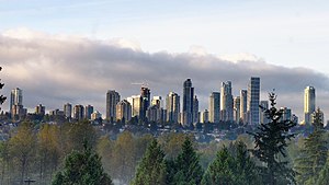
Burnaby is a city in the Lower Mainland region of British Columbia, Canada. Located in the centre of the Burrard Peninsula, it neighbours the City of Vancouver to the west, the District of North Vancouver across the confluence of the Burrard Inlet with its Indian Arm to the north, Port Moody and Coquitlam to the east, New Westminster and Surrey across the Fraser River to the southeast, and Richmond on Lulu Island to the southwest. It has a population of 249,125 as of the 2021 census.

Burnaby—Douglas
Federal electoral district of Canada
Distance: Approx. 1284 meters
Latitude and longitude: 49.262,-122.969
Burnaby—Douglas was a federal electoral district in the province of British Columbia, Canada, that was represented in the House of Commons of Canada from 1997 to 2012. It was named after the city of Burnaby, as well as Douglas Road and Tommy Douglas, an MP who represented the area in the 1960s.

Burnaby North
Provincial electoral district in British Columbia, Canada
Distance: Approx. 1531 meters
Latitude and longitude: 49.273,-122.971
Burnaby North is a provincial electoral district for the Legislative Assembly of British Columbia, Canada.

Burnaby North Secondary School
School in Burnaby, British Columbia, Canada
Distance: Approx. 1899 meters
Latitude and longitude: 49.27777778,-122.97194444
Burnaby North Secondary School is a secondary school in Burnaby, British Columbia, Canada. It encompasses two buildings at 751 Hammarskjold Drive in Burnaby. Nearly 1,800 students from grades 8 to 12 attend the school.
Lake City Way station
Metro Vancouver SkyTrain station
Distance: Approx. 1635 meters
Latitude and longitude: 49.25458,-122.93903
Lake City Way is an elevated station on the Millennium Line of Metro Vancouver's SkyTrain rapid transit system, located at the intersection of Lougheed Highway and Lake City Way in Burnaby, British Columbia, Canada. It opened in November 2003, after the initial 2002 opening of the Millennium Line. The station serves a nearby business park and the television studios for CHAN-DT (Global Television Network) and Global News: BC 1, a terrestrial and cable television news channel, respectively.

Sperling–Burnaby Lake station
Metro Vancouver SkyTrain station
Distance: Approx. 1145 meters
Latitude and longitude: 49.25914,-122.96391
Sperling–Burnaby Lake is an elevated station on the Millennium Line of Metro Vancouver's SkyTrain rapid transit system. The station is located on the southeast corner of the intersection at Sperling Avenue and Lougheed Highway in Burnaby, British Columbia, Canada. The Burnaby Lake Regional Park is located nearby, from which the name of the station is partially derived.
Bill Copeland Sports Centre
Multi-purpose arena in Burnaby, British Columbia
Distance: Approx. 1847 meters
Latitude and longitude: 49.25198,-122.96545
Bill Copeland Sports Centre is a 2,000-seat, multi-purpose arena in Burnaby, British Columbia. The arena is primarily used for ice hockey and lacrosse. Bill Copeland Sports Centre was the host venue for the 2019 World Ringette Championships and the 2013 Esso Cup.
Parkcrest
Neighourhood in Burnaby, British Columbia
Distance: Approx. 2042 meters
Latitude and longitude: 49.2726,-122.979
Parkcrest is a hillside neighbourhood in North Burnaby, British Columbia adjacent to Kensington Park which gave it its name. It has a long rectangular shape stretched north to south and is bounded by Springer Avenue to the west and Kensington Avenue to the east. To the north its border runs along Hastings Street, its southern border lies along the Lougheed Highway and Skytrain tracks.
Still Creek
Distance: Approx. 1881 meters
Latitude and longitude: 49.25,-122.95944444
Still Creek is a long stream flowing across Central Burnaby, British Columbia and into Burnaby Lake (which outflows into the Brunette River). Still Creek's path lies mainly through the industrial area which contributes to its high level of pollution, although through dedicated work of local volunteers the creek is slowly recovering. In 2006, the City of Burnaby approved a plan to reduce the amount of flooding in the Still Creek watershed (the low-lying area of Gilmore Avenue is heavily flooded every year) while improving fish and wildlife habitat.

Montecito, Burnaby
Neighourhood in Burnaby, British Columbia
Distance: Approx. 148 meters
Latitude and longitude: 49.265,-122.953
Montecito, for administrative and planning purposes also known as "Sperling-Broadway", is a neighbourhood in Burnaby, British Columbia, Canada. Montecito is located to the southwest of Burnaby Mountain, between Kensington Avenue to the west and Greystone Drive and Arden Avenue to the east. Halifax Street and the Lougheed Highway form its northern and southern boundaries respectively.
Westridge, British Columbia
Neighourhood in Burnaby, British Columbia
Distance: Approx. 1930 meters
Latitude and longitude: 49.28347222,-122.95630556
Westridge is a residential neighbourhood in Burnaby, British Columbia, Canada.
Sullivan Heights, Burnaby
Neighourhood in Burnaby, British Columbia
Distance: Approx. 1049 meters
Latitude and longitude: 49.267,-122.967
Sullivan Heights is a neighbourhood in Burnaby, just north of Lougheed highway, east of Government road and south of SFU (Simon Fraser University) campus. Bordering the city of Coquitlam and Port Moody, the area is served by the newly operational Millennium Line that connects the city of Coquitlam to other parts of greater Vancouver.
Weather in this IP's area
broken clouds
3 Celsius
3 Celsius
2 Celsius
4 Celsius
1032 hPa
89 %
1032 hPa
1022 hPa
10000 meters
1.03 m/s
260 degree
75 %


