Country:
Region:
City:
Latitude and Longitude:
Time Zone:
Postal Code:
IP information under different IP Channel
ip-api
Country
Region
City
ASN
Time Zone
ISP
Blacklist
Proxy
Latitude
Longitude
Postal
Route
Luminati
Country
ASN
Time Zone
America/Sao_Paulo
ISP
SITELBRA LTDA
Latitude
Longitude
Postal
IPinfo
Country
Region
City
ASN
Time Zone
ISP
Blacklist
Proxy
Latitude
Longitude
Postal
Route
db-ip
Country
Region
City
ASN
Time Zone
ISP
Blacklist
Proxy
Latitude
Longitude
Postal
Route
ipdata
Country
Region
City
ASN
Time Zone
ISP
Blacklist
Proxy
Latitude
Longitude
Postal
Route
Popular places and events near this IP address

Taguatinga, Federal District
Administrative region in Central-West, Brazil
Distance: Approx. 3116 meters
Latitude and longitude: -15.83333333,-48.05638889
Taguatinga is an administrative region in the Federal District in Brazil. It is bordered by Brasília to the north, Vicente Pires, Águas Claras, and Arniqueira to the east, Riacho Fundo and Riacho Fundo II to the south, Samambaia to the southwest, Ceilândia to the west, and Brazlândia to the northwest. Taguatinga has a population of 222,598, being the fourth largest administrative region by population.
Águas Claras, Federal District
Administrative region in Central-West, Brazil
Distance: Approx. 254 meters
Latitude and longitude: -15.84027778,-48.02777778
Águas Claras (Portuguese pronunciation: [ˈa.ɡuɐs ˈkla.ɾɐs]) is an administrative region in the Federal District in Brazil. It is bordered by Vicente Pires to the north, Guará and Park Way to the east, Arniqueira to the south, and Taguatinga to the west.

Riacho Fundo
Administrative region in Central-West, Brazil
Distance: Approx. 5163 meters
Latitude and longitude: -15.88333333,-48.0175
Riacho Fundo is an administrative region in the Federal District in Brazil. Riacho Fundo was founded on March 13, 1990, receiving the status of administrative region, according to Law 620, of December 15, 1993.

Vicente Pires
Administrative region in Central-West, Brazil
Distance: Approx. 3867 meters
Latitude and longitude: -15.80333333,-48.03
Vicente Pires (Portuguese pronunciation: [visentʃi piɾis]) is an administrative region in the Federal District in Brazil. It is bordered by Taguatinga to the west, Águas Claras to the south, Guará to the southeast, Brasília to the north, and Brazlândia to the northwest. According to a 2016 report, Vicente Pires has a population of 72,879.
Guará station
Federal District Metro station
Distance: Approx. 4927 meters
Latitude and longitude: -15.82658333,-47.98325
Guará (Station code: GUA) is a Federal District Metro station operating on the Orange and Green lines. It was opened on 10 May 2010 and added to the already operating section of the line, from Central to Terminal Samambaia and Terminal Ceilândia. It is located between Feira and Arniqueiras.
Arniqueiras station
Federal District Metro station
Distance: Approx. 1149 meters
Latitude and longitude: -15.83672222,-48.01705556
Arniqueiras (Station code: ARN) is a Federal District Metro brazilian station on Orange and Green lines. It was opened on 5 February 2002 and added to the already operating section of the line, from Central to Terminal Samambaia and Ceilândia Sul. It is located between Guará and Águas Claras.

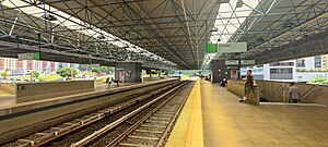
Águas Claras station
Federal District Metro station
Distance: Approx. 232 meters
Latitude and longitude: -15.84002778,-48.02819444
Águas Claras is a Federal District Metro Brazilian station on Orange and Green lines. It was opened on 31 March 2001 on the inaugural section of the line, from Central to Terminal Samambaia and Praça do Relógio. This is the westernmost joint station of Orange and Green lines.
Taguatinga Sul station
Federal District Metro station
Distance: Approx. 2172 meters
Latitude and longitude: -15.85186111,-48.04197222
Taguatinga Sul is a Federal District Metro brazilian station on Orange line. It was opened on 31 March 2001 on the inaugural section of the line, from Central to Terminal Samambaia. It is located between Águas Claras and Furnas.
Furnas station
Federal District Metro station
Distance: Approx. 4571 meters
Latitude and longitude: -15.865,-48.05986111
Furnas is a Federal District Metro brazilian station on Orange line. It opened on 31 March 2001 on the inaugural section of the line, from Central to Terminal Samambaia. It is located between Taguatinga Sul and Samambaia Sul.

Concessionárias station
Federal District Metro station
Distance: Approx. 1214 meters
Latitude and longitude: -15.83513889,-48.03863889
Concessionárias is a Federal District Metro station on the Green line. It was opened on 18 May 2004 on the already operating section of the line, from Central to Praça do Relógio. The adjacent stations are Águas Claras and Estrada Parque.

Estrada Parque station
Federal District Metro station
Distance: Approx. 1983 meters
Latitude and longitude: -15.83238889,-48.04527778
Estrada Parque is a Federal District Metro brazilian station on Green line. It was opened on 6 January 2019 on the already operating section of the line, from Central to Terminal Ceilândia. It is located between Concessionárias and Praça do Relógio.

Praça do Relógio station
Federal District Metro station
Distance: Approx. 3099 meters
Latitude and longitude: -15.83347222,-48.05625
Praça do Relógio (Station code: REL) is a Federal District Metro station operating on the Green line. It was opened on 31 March 2001 as the western terminus of the inaugural section of the line, from Central to Praça do Relógio. In November 2006, the line was extended to Ceilândia Sul as shuttle service, and on 23 April 2007, full service was opened.
Weather in this IP's area
broken clouds
18 Celsius
19 Celsius
18 Celsius
18 Celsius
1010 hPa
100 %
1010 hPa
884 hPa
10000 meters
1.03 m/s
330 degree
75 %
05:32:44
18:19:07

