Country:
Region:
City:
Latitude and Longitude:
Time Zone:
Postal Code:
IP information under different IP Channel
ip-api
Country
Region
City
ASN
Time Zone
ISP
Blacklist
Proxy
Latitude
Longitude
Postal
Route
Luminati
Country
ASN
Time Zone
Africa/Banjul
ISP
QCell
Latitude
Longitude
Postal
IPinfo
Country
Region
City
ASN
Time Zone
ISP
Blacklist
Proxy
Latitude
Longitude
Postal
Route
db-ip
Country
Region
City
ASN
Time Zone
ISP
Blacklist
Proxy
Latitude
Longitude
Postal
Route
ipdata
Country
Region
City
ASN
Time Zone
ISP
Blacklist
Proxy
Latitude
Longitude
Postal
Route
Popular places and events near this IP address

Serekunda
City in the Gambia
Distance: Approx. 3554 meters
Latitude and longitude: 13.445,-16.675
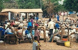
Serekunda or Serrekunda is the largest urban centre in The Gambia. It is situated close to the Atlantic coast, on the Gambia River, near the capital, Banjul. Serekunda and Banjul form an urban area known as the Kombos, with about half of the population of the Gambia.

Kanifing
Municipality in the Gambia
Distance: Approx. 3870 meters
Latitude and longitude: 13.4475,-16.6725
Kanifing is a municipality, local government area and district in the Gambia. It is part of the Greater Banjul Area, to the west of Banjul. It is governed by the Kanifing Municipal Council.

Sukuta
Place in Western Division, The Gambia The Smiling cost of west Africa
Distance: Approx. 2315 meters
Latitude and longitude: 13.41666667,-16.7
Sukuta is a town located in the Western Division of the Gambia. It had a population of 16,667 as of the 1993 census.
Nema Kunku
Village in the Kanifing Local Government Area, Gambia
Distance: Approx. 1181 meters
Latitude and longitude: 13.40361111,-16.68333333
Nema Kunku is a village in the Brikama Local Government Area, Gambia. As of the 2013 census, Nema Kunku had a population of 36,134. Nema Kunku is located near Serekunda, with most of tourism to the area being sparked by Serekunda and the capital, Banjul.

Lamin, Western Division
Place in Western Division, The Gambia
Distance: Approx. 4574 meters
Latitude and longitude: 13.38333333,-16.65
Lamin is the largest village in Kombo North Western Division of the Gambia. A village with three large clans, Bojang, Jammeh and Manneh, as the founders, and all the rest are considered "lountan" meaning "strangers" in Manidinko. There is a village leader, "AlKalo" who is from the lineage of the Bojang.

Abuko
Place in Western Division, The Gambia
Distance: Approx. 2697 meters
Latitude and longitude: 13.40416667,-16.65583333
Abuko is a town in the West Coast Division of the Gambia, five miles southwest of the capital Banjul. It is located in the district of Kombo North/Saint Mary to the north of Banjul International Airport and Abuko Nature Reserve.

Abuko Nature Reserve
Nature reserve in the Gambia
Distance: Approx. 4101 meters
Latitude and longitude: 13.39583333,-16.64555556
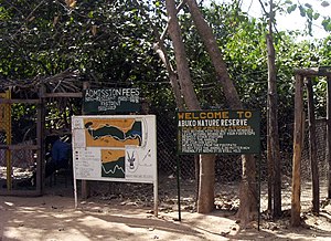
Abuko National Park is a nature reserve in the Gambia lying south of the town of Abuko. It is a popular tourist attraction and was the country's first designated wildlife reserve.
Banjulunding
Place in Western Division, Gambia
Distance: Approx. 4828 meters
Latitude and longitude: 13.37555556,-16.65694444
Banjulunding is a town in western Gambia. It is located in Kombo North/Saint Mary District in the Western Division. As of 2008, it has an estimated population of 8,029.
University of the Gambia
Public university based in Kanifing, The Gambia
Distance: Approx. 4942 meters
Latitude and longitude: 13.45722222,-16.68555556
The University of the Gambia (UTG) is an institution of higher education located in Sere Kunda, the largest city in the Gambia.
École Française de Banjul
Distance: Approx. 3841 meters
Latitude and longitude: 13.4478,-16.6791
École Française de Banjul is a French international school in Bakau, The Gambia, in the Banjul metropolitan area. It serves levels preschool through première; classes use the National Centre for Distance Education (CNED) beginning in sixième. It was established in 1984.
Latri Kunda
Distance: Approx. 4114 meters
Latitude and longitude: 13.45,-16.68333333
Latri Kunda (spelling variation: Latrikunda, name variant: Latri Kunda Yiringan Ya or Latrikunda Yiri Nganya) is part of the Kanifing District, and a suburb of Sere Kunda (or Serekunda) in The Gambia. The district is located in the center of Serekunda. In the 1993 census, Latri Kunda was listed as a separate town with 22,902 inhabitants.

Pipeline Mosque
Mosque in Serekunda, Gambia
Distance: Approx. 4989 meters
Latitude and longitude: 13.45773284,-16.68493762
The Pipeline Mosque is the main mosque of Serekunda, The Gambia.
Weather in this IP's area
clear sky
31 Celsius
32 Celsius
31 Celsius
31 Celsius
1010 hPa
45 %
1010 hPa
1008 hPa
10000 meters
2.57 m/s
350 degree
07:07:13
18:36:34
