Country:
Region:
City:
Latitude and Longitude:
Time Zone:
Postal Code:
IP information under different IP Channel
ip-api
Country
Region
City
ASN
Time Zone
ISP
Blacklist
Proxy
Latitude
Longitude
Postal
Route
Luminati
Country
ASN
Time Zone
Africa/Banjul
ISP
QCell
Latitude
Longitude
Postal
IPinfo
Country
Region
City
ASN
Time Zone
ISP
Blacklist
Proxy
Latitude
Longitude
Postal
Route
db-ip
Country
Region
City
ASN
Time Zone
ISP
Blacklist
Proxy
Latitude
Longitude
Postal
Route
ipdata
Country
Region
City
ASN
Time Zone
ISP
Blacklist
Proxy
Latitude
Longitude
Postal
Route
Popular places and events near this IP address

Yundum
Place in Banjul, The Gambia
Distance: Approx. 3406 meters
Latitude and longitude: 13.36666667,-16.65
Yundum is a small town in Gambia, south of the capital, Banjul. It is situated adjacent to the country's international airport. The only airport in Gambia is at Yundum, built in World War II. Post war it was used for passenger flights.
Banjul International Airport
International airport in Banjul, the capital of Gambia
Distance: Approx. 2387 meters
Latitude and longitude: 13.33796111,-16.65220556
Banjul International Airport, also known as Yundum International (IATA: BJL, ICAO: GBYD), is the international airport of Banjul, capital of Gambia, built during World War II. It is the country's only commercial airport.
Nema Kunku
Village in the Kanifing Local Government Area, Gambia
Distance: Approx. 6558 meters
Latitude and longitude: 13.40361111,-16.68333333
Nema Kunku is a village in the Brikama Local Government Area, Gambia. As of the 2013 census, Nema Kunku had a population of 36,134. Nema Kunku is located near Serekunda, with most of tourism to the area being sparked by Serekunda and the capital, Banjul.

Lamin, Western Division
Place in Western Division, The Gambia
Distance: Approx. 4873 meters
Latitude and longitude: 13.38333333,-16.65
Lamin is the largest village in Kombo North Western Division of the Gambia. A village with three large clans, Bojang, Jammeh and Manneh, as the founders, and all the rest are considered "lountan" meaning "strangers" in Manidinko. There is a village leader, "AlKalo" who is from the lineage of the Bojang.

Kombo North/Saint Mary
Distance: Approx. 2437 meters
Latitude and longitude: 13.36666667,-16.66666667
Kombo North/Saint Mary is one of the nine districts of the Gambia's Brikama Local Government Area (formerly known as the Western Division), which is located to the south of the Gambia River in the southwest of the country. Kombo North/Saint Mary is in the northwest of the LGA, between Kombo South and Kanifing LGA. It is the only district in the LGA with coasts on both the Atlantic Ocean and the Gambia River, and is the most populated district in the LGA, with 344,756 inhabitants at the 2013 Census. Villages in the district include Amdalai.

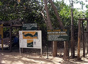
Abuko Nature Reserve
Nature reserve in the Gambia
Distance: Approx. 6323 meters
Latitude and longitude: 13.39583333,-16.64555556
Abuko National Park is a nature reserve in the Gambia lying south of the town of Abuko. It is a popular tourist attraction and was the country's first designated wildlife reserve.
Banjulunding
Place in Western Division, Gambia
Distance: Approx. 3751 meters
Latitude and longitude: 13.37555556,-16.65694444
Banjulunding is a town in western Gambia. It is located in Kombo North/Saint Mary District in the Western Division. As of 2008, it has an estimated population of 8,029.
Kabafita Forest Park
Distance: Approx. 5645 meters
Latitude and longitude: 13.3,-16.65
Kabafita Forest Park is a forest park in the Gambia. Established on January 1, 1954, it covers 243 hectares. The estimate terrain elevation above sea level is 38 metres.
Nymbai Forest Park
Distance: Approx. 5089 meters
Latitude and longitude: 13.3,-16.66944444
Nymbai Forest Park is a forest park in the Gambia. Established on January 1, 1954, it covers 202 hectares. It is located at an elevation of 28 meters above sea level.
Salagi Forest Park
Forest park in Gambia
Distance: Approx. 5471 meters
Latitude and longitude: 13.37666667,-16.71194444
Salagi Forest Park is a forest park in the Gambia. Established on January 1, 1954, it covers 262 hectares. It is located in the west of the country, at an altitude of 26 meters.
Busumbala
Place in Western Division, The Gambia
Distance: Approx. 1519 meters
Latitude and longitude: 13.33333333,-16.66666667
Busumbala , also known as Old-Busumbala, is a small town in western Gambia. It is located in Kombo North/Saint Mary District in the Western Division. As of 2009, it has an estimated population of 11,189.
Jambur Solar Power Station
Solar power station in the Gambia
Distance: Approx. 4770 meters
Latitude and longitude: 13.30638889,-16.69055556
The Jambur Solar Power Station (JSPS), is an operational 23 MW (31,000 hp) solar power plant in Gambia. The power station began commercial operations in March 2024. It is owned and was developed by the government of Gambia, with funding from the European Union, the European Investment Bank and the World Bank.
Weather in this IP's area
clear sky
28 Celsius
29 Celsius
28 Celsius
28 Celsius
1012 hPa
57 %
1012 hPa
1009 hPa
10000 meters
3.6 m/s
320 degree
07:07:06
18:36:39