Country:
 USA
USARegion:
City:
Latitude and Longitude:
Time Zone:
Postal Code:
IP information under different IP Channel
ip-api
Country
Region
City
ASN
Time Zone
ISP
Blacklist
Proxy
Latitude
Longitude
Postal
Route
IPinfo
Country
Region
City
ASN
Time Zone
ISP
Blacklist
Proxy
Latitude
Longitude
Postal
Route
MaxMind
Country
Region
City
ASN
Time Zone
ISP
Blacklist
Proxy
Latitude
Longitude
Postal
Route
Luminati
Country
USRegion
tx
City
dallas
ASN
Time Zone
America/Chicago
ISP
NTTDATA-SERVICES-AS1
Latitude
Longitude
Postal
db-ip
Country
Region
City
ASN
Time Zone
ISP
Blacklist
Proxy
Latitude
Longitude
Postal
Route
ipdata
Country
Region
City
ASN
Time Zone
ISP
Blacklist
Proxy
Latitude
Longitude
Postal
Route
Popular places and events near this IP address

The Colony, Texas
City in Texas, United States
Distance: Approx. 4452 meters
Latitude and longitude: 33.09083333,-96.88472222
The Colony is a city in Denton County, Texas, United States, and a suburb of Dallas. The population was 44,534 at the 2020 census.

Riders Field
Baseball stadium in Frisco, Texas, U.S.
Distance: Approx. 2155 meters
Latitude and longitude: 33.09833333,-96.82
Riders Field, formerly known as Dr Pepper/Seven Up Ballpark and Dr Pepper Ballpark, is a baseball park in Frisco, Texas, United States. The home of the Double-A Frisco RoughRiders of the Texas League, it opened on April 3, 2003, and can seat up to 10,216 people. Though primarily a venue for Minor League Baseball games, the facility also hosts high school and college baseball tournaments, and other public and private events throughout the year.

Stonebriar Community Church
Church in Texas, United States
Distance: Approx. 4397 meters
Latitude and longitude: 33.119051,-96.812327
Stonebriar Community Church is a nondenominational evangelical megachurch in Frisco, Texas, a northern suburb of Dallas, Texas.

Comerica Center
Sports stadium in Frisco, Texas, U.S.
Distance: Approx. 2387 meters
Latitude and longitude: 33.101026,-96.819624
Comerica Center (previously Deja Blue Arena and Dr Pepper Arena) is a multi-purpose arena in Frisco, Texas. It is the home of the Texas Legends of the NBA G League and the Frisco Fighters of the Indoor Football League, as well as the executive offices and practice facility of the National Hockey League's Dallas Stars. The arena is also used for concerts and other live entertainment events.

Stonebriar Centre
Shopping mall in Frisco, Texas
Distance: Approx. 2856 meters
Latitude and longitude: 33.099257,-96.811476
Stonebriar Centre, commonly referred to as Stonebriar Mall, is a super-regional mall located at the intersection of Preston Road (SH 289) and the Sam Rayburn Tollway (SH 121) in Frisco, Texas. The mall features Macy's, Nordstrom, Dillard's, JCPenney, and Dick's Sporting Goods, as well as a 24-screen AMC movie theater and a food court with a carousel.
Camey Spur, Texas
Town in Denton County, Texas, US
Distance: Approx. 1763 meters
Latitude and longitude: 33.08333333,-96.85611111
Camey Spur (Camey) was a small town in southeastern Denton County, Texas, located at what is now the intersection of State Highway 121 and W Spring Creek Pkwy. It was established around 1852 and named after Capt. William McKamy, as his family donated land for the construction of the Frisco Spur, part of the St.

Children's Medical Center Plano
Hospital in Texas, United States
Distance: Approx. 3479 meters
Latitude and longitude: 33.0784,-96.8011
Children's Medical Center Plano is a children's hospital located in Plano, Texas, USA. It provides pediatric healthcare for children from birth to age 21. As a branch of the Children's Health system, it offers care to families across north Texas and beyond in more than 25 specialties. The medical staff includes specialists from UT Southwestern.
Northwest Plano Park & Ride
Transit center in Plano, Texas, US
Distance: Approx. 1887 meters
Latitude and longitude: 33.0705,-96.8282
Northwest Plano Park & Ride is a bus-only park and ride station in Plano, Texas. The station is located on the western side of Dallas North Tollway in Plano's Legacy Park neighborhood. The station is operated by Dallas Area Rapid Transit and is the northernmost facility in the DART system.
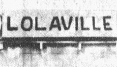
Lolaville, Texas
Unincorporated community in Texas, United States
Distance: Approx. 3263 meters
Latitude and longitude: 33.09722222,-96.80527778
Lolaville was an unincorporated community in Collin County, located in the U.S. state of Texas., near the present-day border between Plano and Frisco. It flourished in the early part of the 20th century but had all but disappeared by the late 1950s, as Texas State Highway 121 passed through the site of the community. After subsequent road expansion required the demolition of most of the houses, all that remained was a roadside fruit stand, for which Lola only charged a pittance of rent.

Arbor Hills Nature Preserve
Nature preserve
Distance: Approx. 4370 meters
Latitude and longitude: 33.0475,-96.8487
Arbor Hills Nature Preserve is a 200-acre park in Plano, Texas. It has several amenities including 3 miles of paved hiking trail, 3 miles of unpaved hiking trail, a 2.8 mile off-road bike trail, restrooms, a covered pavilion, and a playground. The pavilion can be reserved for special events.

Ford Center at The Star
Indoor stadium at the Dallas Cowboys headquarters
Distance: Approx. 2904 meters
Latitude and longitude: 33.1105,-96.8281
Ford Center at The Star is a 12,000-seat stadium located in Frisco, Texas. Its main use is as the Dallas Cowboys' practice facility. It is also used for Whataburger's Friday Night Stars, an event every Friday showcasing Frisco Independent School District high school varsity football.
Legacy West
Distance: Approx. 1433 meters
Latitude and longitude: 33.078,-96.825
Legacy West is a lifestyle center (open-air shopping mall) in Plano, Texas. Legacy West contains 415,000 sq ft of retail, restaurant and office space, a 55,000 sq ft food hall, over 1,300 residential units and a 303-room Renaissance Hotel. It is bordered on the south by the curving Legacy Drive and Headquarters Drive, on the north by the Sam Rayburn Tollway, on the east by the Dallas North Tollway, and on the west by the exit to Headquarters Drive from Sam Rayburn Tollway.
Weather in this IP's area
clear sky
20 Celsius
19 Celsius
18 Celsius
21 Celsius
1025 hPa
45 %
1025 hPa
1001 hPa
10000 meters
4.02 m/s
8.05 m/s
174 degree
10 %
07:34:12
18:50:14