16.14.240.86 - IP Lookup: Free IP Address Lookup, Postal Code Lookup, IP Location Lookup, IP ASN, Public IP
Country:
 USA
USARegion:
City:
Location:
Time Zone:
Postal Code:
ISP:
ASN:
language:
User-Agent:
Proxy IP:
Blacklist:
IP information under different IP Channel
ip-api
Country
Region
City
ASN
Time Zone
ISP
Blacklist
Proxy
Latitude
Longitude
Postal
Route
db-ip
Country
Region
City
ASN
Time Zone
ISP
Blacklist
Proxy
Latitude
Longitude
Postal
Route
IPinfo
Country
Region
City
ASN
Time Zone
ISP
Blacklist
Proxy
Latitude
Longitude
Postal
Route
IP2Location
16.14.240.86Country
usRegion
texas
City
beeville
Time Zone
America/Chicago
ISP
Language
User-Agent
Latitude
Longitude
Postal
ipdata
Country
Region
City
ASN
Time Zone
ISP
Blacklist
Proxy
Latitude
Longitude
Postal
Route
Popular places and events near this IP address

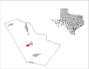
Bee County, Texas
County in Texas, United States
Distance: Approx. 2245 meters
Latitude and longitude: 28.42,-97.74
Bee County is a county located in the U.S. state of Texas. It is in South Texas and its county seat is Beeville. As of the 2020 census, its population was 31,047.

Beeville, Texas
City in and county seat of Bee County, Texas, United States
Distance: Approx. 545 meters
Latitude and longitude: 28.40555556,-97.75083333
Beeville is a city in Bee County, Texas, United States. Its population of 13,543 at the 2020 census makes it the 207th-largest city in Texas. It is the county seat of Bee County and home to the main campus of Coastal Bend College.
Blue Berry Hill, Texas
Census-designated place in Texas, United States
Distance: Approx. 3531 meters
Latitude and longitude: 28.38916667,-97.78166667
Blueberry Hill is a census-designated place (CDP) in Bee County, Texas, United States. The population was 844 at the 2020 census. It is located just outside Beeville and has no services of its own.

Beeville Independent School District
School district in Texas, United States
Distance: Approx. 191 meters
Latitude and longitude: 28.402886,-97.748679
Beeville Independent School District is a public school district based in Beeville, Texas (USA). Beeville serves central Bee County, including the city of Beeville and the unincorporated community of Blue Berry Hill.

Coastal Bend College
Community college in Texas, US
Distance: Approx. 3917 meters
Latitude and longitude: 28.4356,-97.7567
Coastal Bend College (CBC), formerly Bee County College, is a public community college that has its main campus in Beeville, Texas, and branch campuses in Alice, Kingsville, and Pleasanton, Texas. As defined by the Texas Legislature, the official service area of CBC is: All of Bee, Brooks, Duval, Jim Wells, Karnes, Live Oak, and McMullen Counties, The Pleasanton Independent School District, located in Atascosa County, and The Kingsville, Ricardo, and Santa Gertrudis school districts, located within Kleberg County. The school enrolled 4,105 students in academic, workforce education, and continuing education classes during the fall of 2021.
Joe Hunter Field
Baseball field located in Beeville, Texas
Distance: Approx. 4214 meters
Latitude and longitude: 28.4387,-97.75416
Joe Hunter Field is a baseball field located in Beeville, TX on the campus of Coastal Bend College formerly known as Bee County Junior College, home to the Cougars.
KIBL
Radio station in Beeville, Texas
Distance: Approx. 2618 meters
Latitude and longitude: 28.38555556,-97.72833333
KIBL (1490 AM) is a radio station broadcasting a country music format. Licensed to Beeville, Texas, United States, the station serves the Corpus Christi area. The station is currently owned by David Martin Phillip, through licensee Rufus Resources, LLC. On April 20, 2019, KIBL flipped from Spanish Christian programming to the country "No Bull Radio Network" owned by Rufus Resources.
Garza West Unit
Correctional transfer unit in Texas, US
Distance: Approx. 8383 meters
Latitude and longitude: 28.37777778,-97.66694444
Garza West Unit is a correctional transfer unit on the grounds of Chase Field Industrial Complex in unincorporated Bee County, Texas, near the city of Beeville. It is co-located with the Garza East Unit. The facility is operated by the Correctional Institutions Division of the Texas Department of Criminal Justice, administered as within Region IV. The facility is classified as a Transfer Facility that houses adult male inmates convicted of felonies and state jail felonies.
A. C. Jones High School (Beeville, Texas)
Public school in Texas, United States
Distance: Approx. 2084 meters
Latitude and longitude: 28.4195,-97.7528
A. C. Jones High School is a public high school located in Beeville, Texas, United States and classified as a 4A school by the University Interscholastic League (UIL). It is part of the Beeville Independent School District located in central Bee County. As the only comprehensive high school of its district, its boundary includes Beeville and Blue Berry Hill.
KRXB
Radio station in Beeville, Texas
Distance: Approx. 230 meters
Latitude and longitude: 28.4032,-97.7477
KRXB (107.1 FM) is a radio station licensed to Beeville, Texas. The station broadcasts a tejano format and is owned by Scarlet Begonia Productions, Inc.
McConnell Unit
Distance: Approx. 4444 meters
Latitude and longitude: 28.3723,-97.717
William G. McConnell Unit (ML) is a Texas state prison located in unincorporated Bee County, Texas, along Texas State Highway 181, 1 mile (1.6 km) east of the city limits of Beeville. It is a part of the Texas Department of Criminal Justice (TDCJ). The unit, in proximity to Corpus Christi, was named after William G. "Bill" McConnell, the former chief of police of Beeville; he died in 1987.
Bee County Courthouse
United States historic place
Distance: Approx. 26 meters
Latitude and longitude: 28.40111111,-97.74805556
The Bee County Courthouse, at 105 W. Corpus Christi St. in Beeville, Texas, United States, was built in 1912. It was listed on the National Register of Historic Places in 2001.
Weather in this IP's area
overcast clouds
20 Celsius
20 Celsius
20 Celsius
20 Celsius
1017 hPa
64 %
1017 hPa
1008 hPa
10000 meters
3.09 m/s
80 degree
100 %