159.255.148.88 - IP Lookup: Free IP Address Lookup, Postal Code Lookup, IP Location Lookup, IP ASN, Public IP
Country:
Region:
City:
Location:
Time Zone:
Postal Code:
IP information under different IP Channel
ip-api
Country
Region
City
ASN
Time Zone
ISP
Blacklist
Proxy
Latitude
Longitude
Postal
Route
Luminati
Country
ASN
Time Zone
Europe/Zagreb
ISP
EOLO Hrvatska d.d.
Latitude
Longitude
Postal
IPinfo
Country
Region
City
ASN
Time Zone
ISP
Blacklist
Proxy
Latitude
Longitude
Postal
Route
IP2Location
159.255.148.88Country
Region
primorsko-goranska zupanija
City
rijeka
Time Zone
Europe/Zagreb
ISP
Language
User-Agent
Latitude
Longitude
Postal
db-ip
Country
Region
City
ASN
Time Zone
ISP
Blacklist
Proxy
Latitude
Longitude
Postal
Route
ipdata
Country
Region
City
ASN
Time Zone
ISP
Blacklist
Proxy
Latitude
Longitude
Postal
Route
Popular places and events near this IP address

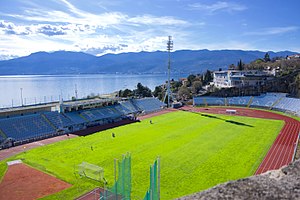
Stadion Kantrida
Croatian football stadium
Distance: Approx. 2252 meters
Latitude and longitude: 45.339202,14.380959
Kantrida Stadium (Croatian: Stadion Kantrida) is a football stadium in the Croatian city of Rijeka. It is named after the Kantrida neighbourhood in which it is located, in the western part of the city. It has served as the home of the HNK Rijeka football club for most years since at least 1918.

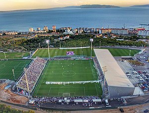
Stadion Rujevica
Stadium in Rijeka, Croatia
Distance: Approx. 765 meters
Latitude and longitude: 45.34788889,14.40219444
Stadion Rujevica (English: Rujevica Stadium), officially known as Stadion HNK Rijeka (English: HNK Rijeka Stadium), is a stadium in the city of Rijeka, Croatia. The stadium is commonly referred to as Rujevica after its location. From August 2015, the stadium is a temporary home ground for HNK Rijeka during construction of the new Stadion Kantrida.

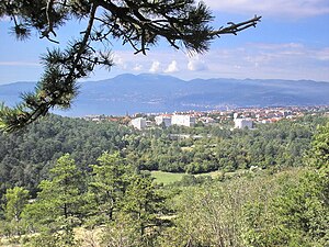
Drenova, Rijeka
Local board in Primorje-Gorski Kotar County, Croatia
Distance: Approx. 2058 meters
Latitude and longitude: 45.35333333,14.43111111
Drenova is a neighbourhood and a local board of the city of Rijeka, Croatia perched on a plateau above the city. Historically there were two parts: Gornja (Upper) Drenova and Donja (Lower) Drenova, nowadays united in one. Drenova has the largest cemetery and park area of the city.

Corpus separatum (Fiume)
City of Fiume under the Kingdom of Hungary (1779–1918)
Distance: Approx. 2179 meters
Latitude and longitude: 45.33333333,14.43333333
Corpus separatum, a Latin term meaning "separated body", refers to the status of the City of Fiume (modern Rijeka, Croatia) while given a special legal and political status different from its environment under the rule of the Kingdom of Hungary. Formally known as City of Fiume and its District (Hungarian: Fiume város és kerülete), it was instituted by Empress Maria Theresa in 1779, determining the semi-autonomous status of Fiume within the Habsburg monarchy until the fall of the Austro-Hungarian Empire in 1918.
Port of Rijeka
Port in Croatia
Distance: Approx. 1528 meters
Latitude and longitude: 45.332358,14.421358
The Port of Rijeka (Croatian: Luka Rijeka, IPA: [lǔːka rijěːka]) is a seaport in Rijeka, Croatia, located on the shore of the Kvarner Gulf in the Adriatic Sea. The first records of the port date to 1281. It was the main port of the Kingdom of Hungary in the 19th century and the beginning of the 20th century, of Yugoslavia between World War II and 1991, and of Croatia after its independence.

Province of Fiume
Italian province (1924–1947)
Distance: Approx. 2179 meters
Latitude and longitude: 45.33333333,14.43333333
The Province of Fiume (or Province of Carnaro) was a province of the Kingdom of Italy from 1924 to 1943, then under control of the Italian Social Republic and German Wehrmacht from 1943 to 1945. Its capital was the city of Fiume. It took the other name after the Gulf of Carnaro (Golfo del Carnaro).
HNK Rijeka Academy
Youth academy of Croatian football club Rijeka
Distance: Approx. 761 meters
Latitude and longitude: 45.34788889,14.40225
HNK Rijeka Academy is the youth academy of HNK Rijeka. There are a total of eleven age categories within the academy, the oldest being the Juniori (under-19) and youngest the Morčići (under-8). Rijeka's football academy was officially founded in 1972.

Italian Secondary School, Rijeka
Secondary school in Rijeka, Croatia
Distance: Approx. 2859 meters
Latitude and longitude: 45.32869444,14.43944444
Italian Secondary School in Rijeka (Croatian: Srednja talijanska škola Rijeka; Italian: Scuola media superiore italiana di Fiume) is a public high school for the Italian ethnic minority in the city of Rijeka, Croatia. The school was established in 1888 and has been in operation continuously since then. The school building is protected as a cultural heritage site.

Centar Zamet
Mixed-use sports hall in Rijeka, Croatia
Distance: Approx. 2003 meters
Latitude and longitude: 45.3443851,14.3836658
Centar Zamet (English: Centre Zamet), also rendered in English as Zamet Sports Centre, is a mixed-use sports hall in the Zamet neighbourhood of Rijeka, Croatia, that hosts sporting, cultural, business and entertainment events. The hall was built in Zamet in 2009. The size of the hall is 16,830 square metres (181,200 sq ft) and the surface of the outer space is 88,075 square metres (948,030 sq ft).

Rijeka railway station
Railway station in Croatia
Distance: Approx. 2198 meters
Latitude and longitude: 45.33027778,14.43055556
The Rijeka railway station (Croatian: Željeznički kolodvor Rijeka) opened in 1873 and is close to the port of Rijeka. It is operated by Croatian Railways (HŽ).
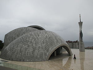
Rijeka Mosque
Mosque in Rijeka, Croatia
Distance: Approx. 971 meters
Latitude and longitude: 45.3458,14.3974
Rijeka Mosque (Croatian and Bosnian: Džamija u Rijeci) is a mosque in Rijeka, Croatia built between 2009 and 2013. The project of the mosque and the cultural center was originally developed by Dušan Džamonja in cooperation with Branko Vučinović and Darko Vlahović. The entire project costed 76 million Croatian kuna with significant contribution by the state of Qatar.

Rijeka Orthodox Synagogue
Orthodox synagogue in Rijeka, Croatia
Distance: Approx. 2377 meters
Latitude and longitude: 45.331057,14.434284
The Rijeka Orthodox Synagogue is an Orthodox Jewish synagogue, located on Ivan Filipović Street, formerly Galvani Street (opposite the Faculty of Economics), in Rijeka in Croatia. The synagogue was built in a Rationalist style in 1931 (when Rijeka was part of Italy). It is one of the very few synagogues in Croatian territory to have survived the destruction of the Nazi period.
Weather in this IP's area
clear sky
7 Celsius
6 Celsius
7 Celsius
10 Celsius
1017 hPa
37 %
1017 hPa
974 hPa
10000 meters
2.57 m/s
