159.221.246.177 - IP Lookup: Free IP Address Lookup, Postal Code Lookup, IP Location Lookup, IP ASN, Public IP
Country:
Region:
City:
Location:
Time Zone:
Postal Code:
IP information under different IP Channel
ip-api
Country
Region
City
ASN
Time Zone
ISP
Blacklist
Proxy
Latitude
Longitude
Postal
Route
Luminati
Country
Region
ma
City
uxbridge
ASN
Time Zone
America/New_York
ISP
FMGLOBAL
Latitude
Longitude
Postal
IPinfo
Country
Region
City
ASN
Time Zone
ISP
Blacklist
Proxy
Latitude
Longitude
Postal
Route
IP2Location
159.221.246.177Country
Region
rhode island
City
johnston
Time Zone
America/New_York
ISP
Language
User-Agent
Latitude
Longitude
Postal
db-ip
Country
Region
City
ASN
Time Zone
ISP
Blacklist
Proxy
Latitude
Longitude
Postal
Route
ipdata
Country
Region
City
ASN
Time Zone
ISP
Blacklist
Proxy
Latitude
Longitude
Postal
Route
Popular places and events near this IP address

Johnston, Rhode Island
Town in Rhode Island, United States
Distance: Approx. 1129 meters
Latitude and longitude: 41.82666667,-71.49472222
Johnston is a town in Providence County, Rhode Island, United States. The population was 29,568 at the 2020 census. Johnston is the site of the Clemence Irons House (1691), a stone-ender museum, and the only landfill in Rhode Island.

Clemence–Irons House
Historic house in Rhode Island, United States
Distance: Approx. 2697 meters
Latitude and longitude: 41.83916667,-71.48444444
The Clemence–Irons House (also known as the Edward Manton House) is a historic house located in Johnston, Rhode Island. It was built by Richard Clemence in 1691 and is a rare surviving example of a "stone ender", a building type first developed in the western part of England and common in colonial Rhode Island. The house is listed on the National Register of Historic Places, and is a historic house museum owned and operated by Historic New England.
Johnston Senior High School
Public school in Johnston, Rhode Island, United States
Distance: Approx. 1304 meters
Latitude and longitude: 41.83224,-71.50125
Johnston Senior High School (JHS) is a public high school located in Johnston, Rhode Island, United States. It is part of the Johnston Public School System and has approximately 900 students in grades 9 through 12. The school colors are Columbia blue and white and the school mascot is the Panther.

Thomas H. Hughes House
Historic house in Rhode Island, United States
Distance: Approx. 1646 meters
Latitude and longitude: 41.80777778,-71.4975
The Thomas H. Hughes House is a historic house in Johnston, Rhode Island. The 1+1⁄2-story wood-frame house was built c. 1845 by Zacharias French, and exhibits simple but well-proportioned Greek Revival style.

Mathewson Farm
United States historic place
Distance: Approx. 2857 meters
Latitude and longitude: 41.84661,-71.50231
The Mathewson Farm is an historic farm on 544 Greenville Avenue in Johnston, Rhode Island. It is an agricultural remnant of the formerly rural village of Belknap. The centerpiece of the farm complex is a late 18th-century farmhouse with vernacular Federal styling.

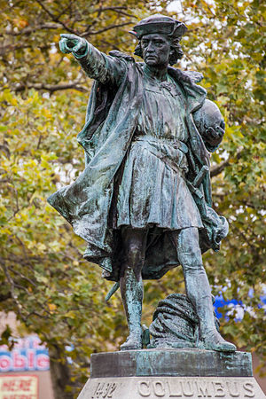
Statue of Christopher Columbus (Johnston, Rhode Island)
Sculpture by Frédéric Auguste Bartholdi
Distance: Approx. 666 meters
Latitude and longitude: 41.82702222,-71.50725
Columbus is a historic statue in Johnston, Rhode Island. The statue is a bronze cast of a sterling silver statue which was created by Rhode Island's Gorham Manufacturing Company for the 1892 World's Columbian Exposition in Chicago. The original silver statue was not meant for permanent exhibition, but rather as a demonstration of the skills of the Gorham Company, and was later melted down.

Belknap, Rhode Island
Village in Johnston, Rhode Island, U.S.
Distance: Approx. 3002 meters
Latitude and longitude: 41.848066,-71.505486
Belknap is a village within the city of Johnston in Rhode Island. On April 18, 1759, the citizens of Johnston held the first Town Meeting at Benjamin Belknap's house on Greenville Avenue in Belknap, and Abraham Belknap was appointed as the town's first Town Sergeant at the meeting. In 1771 the Baptist Meeting House in Belknap opened, and is believed to be the first place of worship in Johnston.

Belknap School
Historical building in Johnston, Rhode Island
Distance: Approx. 2938 meters
Latitude and longitude: 41.8471,-71.5
Belknap School (also known as the District No. 8 School House) is a historic former school house at 509 Greenville Avenue in the Belknap village of Johnston, Rhode Island. The first school on the site was built in 1790 and was the first school in the town when it was founded.

Lymansville Company Mill
United States historic place
Distance: Approx. 3235 meters
Latitude and longitude: 41.83916667,-71.47555556
The Lymansville Company Mill is a historic industrial complex at 184 Woonasquatucket Avenue in North Providence, Rhode Island. The oldest portion of the complex, a three-story brick building which originally a textile spinning and carding building, was built in 1884. The mill was significantly expanded in subsequent years, with its last addition taking place in 1951.

Hughesdale, Rhode Island
Neighborhood in Johnston, Rhode Island, US
Distance: Approx. 1707 meters
Latitude and longitude: 41.80861111,-71.49416667
Hughesdale is a neighborhood in the town of Johnston, Rhode Island. Hughesdale is a primarily residential neighborhood in the southeast corner of the town, centered near Central Avenue and Atwood Avenue. It is situated near the villages of Simmonsville and Thornton.

Central Landfill
Distance: Approx. 3006 meters
Latitude and longitude: 41.807,-71.537
The Central Landfill is a 154-acre (62 ha) waste disposal site in Johnston, Rhode Island. It is the state's only landfill and receives more than 90% of the state's solid waste. It has been on the Environmental Protection Agency's Superfund National Priorities List since 1986.

Ice hockey in Rhode Island
Distance: Approx. 1129 meters
Latitude and longitude: 41.82666667,-71.49472222
Rhode Island is one of the traditional centers of ice hockey in the United States. Located in New England, the font of American ice hockey, teams from Rhode Island have played organized hockey as far back as the late-19th century and many residents have played at the highest levels of the sport.
Weather in this IP's area
clear sky
-4 Celsius
-6 Celsius
-5 Celsius
-2 Celsius
1017 hPa
79 %
1017 hPa
1006 hPa
10000 meters
1.54 m/s
270 degree