159.20.125.52 - IP Lookup: Free IP Address Lookup, Postal Code Lookup, IP Location Lookup, IP ASN, Public IP
Country:
Region:
City:
Location:
Time Zone:
Postal Code:
IP information under different IP Channel
ip-api
Country
Region
City
ASN
Time Zone
ISP
Blacklist
Proxy
Latitude
Longitude
Postal
Route
Luminati
Country
Region
an
City
lanjaron
ASN
Time Zone
Europe/Madrid
ISP
Jetnet Wimax S.A
Latitude
Longitude
Postal
IPinfo
Country
Region
City
ASN
Time Zone
ISP
Blacklist
Proxy
Latitude
Longitude
Postal
Route
IP2Location
159.20.125.52Country
Region
andalucia
City
lanjaron
Time Zone
Europe/Madrid
ISP
Language
User-Agent
Latitude
Longitude
Postal
db-ip
Country
Region
City
ASN
Time Zone
ISP
Blacklist
Proxy
Latitude
Longitude
Postal
Route
ipdata
Country
Region
City
ASN
Time Zone
ISP
Blacklist
Proxy
Latitude
Longitude
Postal
Route
Popular places and events near this IP address

Órgiva
Municipality in Andalusia, Spain
Distance: Approx. 6152 meters
Latitude and longitude: 36.9,-3.41666667
Órgiva (pronounced [ˈoɾxiβa]) is a Spanish town municipality in comarca of Alpujarra Granadina (which is located within the larger Alpujarras region) in the province of Granada, Andalusia. It has a population of around 6,000 and lies in the Alpujarra valley between the Sierra de Lújar and Sierra Nevada.

Cáñar
Municipality in Andalusia, Spain
Distance: Approx. 5800 meters
Latitude and longitude: 36.91666667,-3.41666667
Cáñar is a small village in the Alpujarras comarca of the province of Granada in Spain. It is located a few kilometres north of the road from Órgiva to Pampaneira and the high Alpujarras. The GR 7 long-distance footpath, following the ancient highway through the Alpujarras, runs through the village.

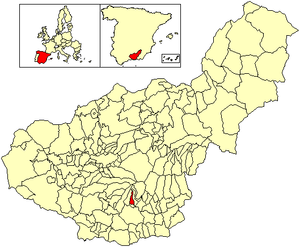
Lanjarón
Municipality in Andalusia, Spain
Distance: Approx. 1362 meters
Latitude and longitude: 36.91666667,-3.46666667
Lanjarón (pronounced [laŋxaˈɾon]) is a municipality and town in the Alpujarras area in the province of Granada in Andalusia, Spain. Lanjarón has a ruined castle and chalybeate baths. This spa town is most famous, however, for its eponymous bottled water company, the first ever established in Spain, whose products are sold throughout the country.

Carataunas
Place in Granada, Spain
Distance: Approx. 7283 meters
Latitude and longitude: 36.91666667,-3.4
Carataunas is a municipality located in the province of Granada, Spain. According to the 2005 census (INE), it has a population of 198 inhabitants.

Lecrín
City in Granada, Spain
Distance: Approx. 6948 meters
Latitude and longitude: 36.9488889,-3.55000001
Lecrín is a municipality located in the province of Granada, Spain. According to the 2004 census (INE), the city has a population of 2269 inhabitants. Although the municipality was formed only in 1970, the six areas of which it is comprised have existed for much longer.

Nigüelas
Town in Granada, Spain
Distance: Approx. 7055 meters
Latitude and longitude: 36.96666667,-3.53333333
Nigüelas is a municipality located in the province of Granada, Spain. According to the 2012 census (INE), the town has a population of 1203. In September, there is the celebration of its famous a party around the village with different customs.

Soportújar
City in Granada, Spain
Distance: Approx. 7283 meters
Latitude and longitude: 36.91666667,-3.4
Soportújar is a municipality located in the province of Granada, Spain. According to the 2015 census (INE), the city has a population of 296 inhabitants.

Beneficio
Place in Andalusia, Spain
Distance: Approx. 4175 meters
Latitude and longitude: 36.92236111,-3.43513889
Beneficio is an intentional community in southern Spain. It consists of a plot co-owned by many residents in a river valley, outside of the Alpujarras village of Órgiva. Inhabitants live largely in various styles of light shelters such as tents, benders and tipis, although some more permanent structures have been built, including straw bale constructions.

Béznar Reservoir
Reservoir in Béznar and El Pinar
Distance: Approx. 6276 meters
Latitude and longitude: 36.92138889,-3.55222222
Béznar Reservoir is a reservoir in the province of Granada, Andalusia, Spain.
Rules Reservoir
Reservoir in Vélez de Benaudalla
Distance: Approx. 4693 meters
Latitude and longitude: 36.87638889,-3.48416667
Rules Reservoir is a reservoir in Vélez de Benaudalla, province of Granada, Andalusia, Spain.

Alpujarra Granadina
Comarca in Andalusia, Spain
Distance: Approx. 5539 meters
Latitude and longitude: 36.90027778,-3.42388889
Alpujarra Granadina is a Spanish comarca in the Province of Granada. Along with Alpujarra Almeriense, it forms the historical region of the Alpujarras.

El Pinar, Granada
Place in Andalusia, Spain
Distance: Approx. 6579 meters
Latitude and longitude: 36.91027778,-3.555
El Pinar is a municipality in the province of Granada, Spain. As of 2010, it has a population of 1011 inhabitants.
Weather in this IP's area
clear sky
14 Celsius
13 Celsius
13 Celsius
16 Celsius
1027 hPa
31 %
1027 hPa
954 hPa
10000 meters
1.84 m/s
2.35 m/s
147 degree