159.20.122.191 - IP Lookup: Free IP Address Lookup, Postal Code Lookup, IP Location Lookup, IP ASN, Public IP
Country:
Region:
City:
Location:
Time Zone:
Postal Code:
IP information under different IP Channel
ip-api
Country
Region
City
ASN
Time Zone
ISP
Blacklist
Proxy
Latitude
Longitude
Postal
Route
Luminati
Country
Region
an
City
moclin
ASN
Time Zone
Europe/Madrid
ISP
Jetnet Wimax S.A
Latitude
Longitude
Postal
IPinfo
Country
Region
City
ASN
Time Zone
ISP
Blacklist
Proxy
Latitude
Longitude
Postal
Route
IP2Location
159.20.122.191Country
Region
andalucia
City
orgiva
Time Zone
Europe/Madrid
ISP
Language
User-Agent
Latitude
Longitude
Postal
db-ip
Country
Region
City
ASN
Time Zone
ISP
Blacklist
Proxy
Latitude
Longitude
Postal
Route
ipdata
Country
Region
City
ASN
Time Zone
ISP
Blacklist
Proxy
Latitude
Longitude
Postal
Route
Popular places and events near this IP address

Órgiva
Municipality in Andalusia, Spain
Distance: Approx. 698 meters
Latitude and longitude: 36.9,-3.41666667
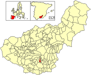
Órgiva (pronounced [ˈoɾxiβa]) is a Spanish town municipality in comarca of Alpujarra Granadina (which is located within the larger Alpujarras region) in the province of Granada, Andalusia. It has a population of around 6,000 and lies in the Alpujarra valley between the Sierra de Lújar and Sierra Nevada.

Poqueira
River in Spain
Distance: Approx. 2114 meters
Latitude and longitude: 36.8872,-3.4099
The Poqueira is a river in La Alpujarra region in the province of Granada, in Spain. It is formed by the confluence of streams that rise near the summit of Mulhacén, the highest peak of the Sierra Nevada mountains. The river cuts through a dramatic gorge, then joins the Río Trevélez shortly before flowing into the Río Guadalfeo.

Trevélez (river)
River in the province of Granada, Spain
Distance: Approx. 4988 meters
Latitude and longitude: 36.9011,-3.3678
The Trevélez River is a river in the province of Granada, Spain. It flows through the town of Trevélez in the western part of the Alpujarras region. The Trevélez river rises in the Sierra Nevada to the north of the town, and flows south and west from Trevélez, through a narrow gorge to the south of Busquístar and the La Tahá villages, eventually converging with the Rio Poqueira shortly before flowing into the Río Guadalfeo.

Capileira
Municipality in Andalusia, Spain
Distance: Approx. 8425 meters
Latitude and longitude: 36.95,-3.35
Capileira is the highest and most northerly of the three villages in the gorge of the Poqueira river in the La Alpujarra district of the province of Granada, in Spain. It is located at latitude 36° 57' N and longitude 3° 21' W, about 1 km north of Bubión. Its altitude is officially recorded as 1436 metres, though there is a considerable altitude difference between the oldest part of the village, which is at the lower, southern end, and the highest part, where tourist-oriented development is currently concentrated.

Cáñar
Municipality in Andalusia, Spain
Distance: Approx. 1690 meters
Latitude and longitude: 36.91666667,-3.41666667
Cáñar is a small village in the Alpujarras comarca of the province of Granada in Spain. It is located a few kilometres north of the road from Órgiva to Pampaneira and the high Alpujarras. The GR 7 long-distance footpath, following the ancient highway through the Alpujarras, runs through the village.

Lanjarón
Municipality in Andalusia, Spain
Distance: Approx. 4124 meters
Latitude and longitude: 36.91666667,-3.46666667
Lanjarón (pronounced [laŋxaˈɾon]) is a municipality and town in the Alpujarras area in the province of Granada in Andalusia, Spain. Lanjarón has a ruined castle and chalybeate baths. This spa town is most famous, however, for its eponymous bottled water company, the first ever established in Spain, whose products are sold throughout the country.

Carataunas
Place in Granada, Spain
Distance: Approx. 2634 meters
Latitude and longitude: 36.91666667,-3.4
Carataunas is a municipality located in the province of Granada, Spain. According to the 2005 census (INE), it has a population of 198 inhabitants.

Pampaneira
Village in Granada, Spain
Distance: Approx. 7406 meters
Latitude and longitude: 36.93333333,-3.35
Pampaneira is a village located in the province of Granada, Spain. According to the 2005 census (INE), the village has a population of 355 inhabitants. It is one of three mountain villages of the Barranco de Poqueira in the Alpujarras region.

Soportújar
City in Granada, Spain
Distance: Approx. 2634 meters
Latitude and longitude: 36.91666667,-3.4
Soportújar is a municipality located in the province of Granada, Spain. According to the 2015 census (INE), the city has a population of 296 inhabitants.

Beneficio
Place in Andalusia, Spain
Distance: Approx. 2420 meters
Latitude and longitude: 36.92236111,-3.43513889
Beneficio is an intentional community in southern Spain. It consists of a plot co-owned by many residents in a river valley, outside of the Alpujarras village of Órgiva. Inhabitants live largely in various styles of light shelters such as tents, benders and tipis, although some more permanent structures have been built, including straw bale constructions.
Rules Reservoir
Reservoir in Vélez de Benaudalla
Distance: Approx. 6116 meters
Latitude and longitude: 36.87638889,-3.48416667
Rules Reservoir is a reservoir in Vélez de Benaudalla, province of Granada, Andalusia, Spain.

Alpujarra Granadina
Comarca in Andalusia, Spain
Distance: Approx. 259 meters
Latitude and longitude: 36.90027778,-3.42388889
Alpujarra Granadina is a Spanish comarca in the Province of Granada. Along with Alpujarra Almeriense, it forms the historical region of the Alpujarras.
Weather in this IP's area
clear sky
7 Celsius
7 Celsius
7 Celsius
8 Celsius
1026 hPa
63 %
1026 hPa
970 hPa
10000 meters
1.05 m/s
1.42 m/s
83 degree