159.182.5.88 - IP Lookup: Free IP Address Lookup, Postal Code Lookup, IP Location Lookup, IP ASN, Public IP
Country:
Region:
City:
Location:
Time Zone:
Postal Code:
ISP:
ASN:
language:
User-Agent:
Proxy IP:
Blacklist:
IP information under different IP Channel
ip-api
Country
Region
City
ASN
Time Zone
ISP
Blacklist
Proxy
Latitude
Longitude
Postal
Route
db-ip
Country
Region
City
ASN
Time Zone
ISP
Blacklist
Proxy
Latitude
Longitude
Postal
Route
IPinfo
Country
Region
City
ASN
Time Zone
ISP
Blacklist
Proxy
Latitude
Longitude
Postal
Route
IP2Location
159.182.5.88Country
Region
iowa
City
iowa city
Time Zone
America/Chicago
ISP
Language
User-Agent
Latitude
Longitude
Postal
ipdata
Country
Region
City
ASN
Time Zone
ISP
Blacklist
Proxy
Latitude
Longitude
Postal
Route
Popular places and events near this IP address
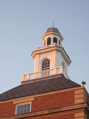
Iowa City High School
Public secondary school in Iowa City, Iowa, United States
Distance: Approx. 624 meters
Latitude and longitude: 41.66,-91.507
Iowa City High School is a public high school in Iowa City, Iowa and is part of the Iowa City Community School District. The present high school was completed as part of the Public Works Projects started by President Franklin D. Roosevelt to provide jobs. The first classes were held in the fall of 1939.
Regina High School (Iowa)
Private secondary school in Iowa City, Iowa, United States
Distance: Approx. 519 meters
Latitude and longitude: 41.66638889,-91.50444444
Regina Catholic Education Center is a PK–12 private, Roman Catholic co-educational school in Iowa City, Iowa, United States. It is located in the Roman Catholic Diocese of Davenport.

Oakland Cemetery (Iowa City, Iowa)
Cemetery in Iowa City, Iowa, US
Distance: Approx. 973 meters
Latitude and longitude: 41.67,-91.52
Oakland Cemetery is on the north side of Iowa City, Iowa, and has served as the main cemetery for Iowa City since 1843.

Hickory Hill Park
Distance: Approx. 819 meters
Latitude and longitude: 41.67235,-91.509975
Hickory Hill Park is a large natural area in northeast Iowa City, Iowa consisting of 190 acres (0.77 km2) of forest, abandoned fields, reconstructed prairie, wetlands, and parkland centered on Ralston Creek and its tributary drainages. It is owned and administered by the city, with help from Friends of Hickory Hill Park. The park is popular with day hikers, dog walkers, cross-country skiers, sledders, and picnickers.
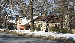
Muscatine Avenue Moffitt Cottage Historic District
Historic district in Iowa, US
Distance: Approx. 956 meters
Latitude and longitude: 41.65722222,-91.51527778
The Muscatine Avenue Moffitt Cottage Historic District is a National Register of Historic Places district that includes five stone cottages in Iowa City epitomizing the eccentric vernacular architectural style of Howard Moffitt. Moffitt constructed more than 100 houses in Iowa City and Coralville, Iowa, and a few in Citrus City, Texas. These small houses represent one of the regional 20th-century vernacular architectural styles in the United States.
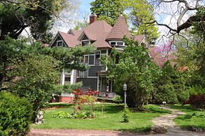
Woodlawn Historic District (Iowa City, Iowa)
Historic district in Iowa, United States
Distance: Approx. 868 meters
Latitude and longitude: 41.66111111,-91.51944444
The Woodlawn Historic District is a nationally recognized historic district located in Iowa City, Iowa, United States. It was listed on the National Register of Historic Places in 1979. At the time of its nomination it consisted of 14 resources, all of which are contributing buildings.
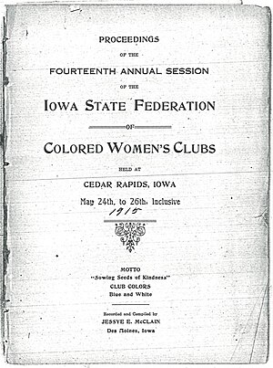
Iowa Federation of Colored Women's Clubs
United States historic place
Distance: Approx. 977 meters
Latitude and longitude: 41.66138889,-91.52111111
The Iowa Federation of Colored Women's Clubs (IFCWC) was an umbrella organization serving African-American women's clubs in Iowa. The motto of IFCWC was "Sowing Seeds of Kindness", and the organization was affiliated with the National Association of Colored Women. The club produced a journal called the Iowa Colored Woman.

Isaac A. Wetherby House
Historic house in Iowa, United States
Distance: Approx. 1114 meters
Latitude and longitude: 41.66833333,-91.52302778
The Isaac A. Wetherby House is a historic building located in Iowa City, Iowa, United States. This house was built in two parts. The original two story frame section was built in 1854 by Patrick Doyle, an Irish immigrant and teamster.

Cavanaugh-Zetek House
Historic house in Iowa, United States
Distance: Approx. 789 meters
Latitude and longitude: 41.66919444,-91.51805556
The Cavanaugh-Zetek House (also known as the Cavanuagh House) is a historic house located at 704 Reno Street in Iowa City, Iowa.

Oakes-Wood House
Historic house in Iowa, United States
Distance: Approx. 1103 meters
Latitude and longitude: 41.65697222,-91.51816667
The Oakes-Wood House, also known as the Grant Wood House, is a historic building located in Iowa City, Iowa, United States. Nicholas Oakes, who established one of the first brickyards in town, built this house in 1858. The two-story brick Italianate structure features a T-shape floor plan, low gable roof, bracketed eaves, and three brick chimneys.

Rose Hill (Iowa City, Iowa)
Historic house in Iowa, United States
Distance: Approx. 377 meters
Latitude and longitude: 41.6655,-91.51488889
Rose Hill, also known as the Irish-Goetz House, is a historic building located in Iowa City, Iowa, United States. It was built as a farmhouse in 1849 by Frederick Irish, an early settler in this community. His descendants would own this house until 1964.
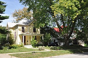
East College Street Historic District
Historic district in Iowa, United States
Distance: Approx. 1014 meters
Latitude and longitude: 41.65888889,-91.51944444
The East College Street Historic District is a nationally recognized historic district located in Iowa City, Iowa, United States. It was listed on the National Register of Historic Places in 1997. At the time of its nomination it consisted of 27 resources, which included 21 contributing buildings and six non-contributing buildings.
Weather in this IP's area
clear sky
-4 Celsius
-10 Celsius
-4 Celsius
-3 Celsius
1029 hPa
52 %
1029 hPa
1000 hPa
10000 meters
5.14 m/s
310 degree