Country:
 Turkey
Region:
City:
Latitude and Longitude:
Time Zone:
Postal Code:
IP information under different IP Channel
ip-api
Country
Region
City
ASN
Time Zone
ISP
Blacklist
Proxy
Latitude
Longitude
Postal
Route
IPinfo
Country
Region
City
ASN
Time Zone
ISP
Blacklist
Proxy
Latitude
Longitude
Postal
Route
MaxMind
Country
Region
City
ASN
Time Zone
ISP
Blacklist
Proxy
Latitude
Longitude
Postal
Route
Luminati
Country
TRRegion
16
City
osmangazi
ASN
Time Zone
Europe/Istanbul
ISP
TurkNet Iletisim Hizmetleri A.S.
Latitude
Longitude
Postal
db-ip
Country
Region
City
ASN
Time Zone
ISP
Blacklist
Proxy
Latitude
Longitude
Postal
Route
ipdata
Country
Region
City
ASN
Time Zone
ISP
Blacklist
Proxy
Latitude
Longitude
Postal
Route
Popular places and events near this IP address
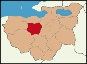
Nilüfer, Bursa
District of Bursa Province, Turkey
Distance: Approx. 2596 meters
Latitude and longitude: 40.28333333,28.95
Nilüfer (Turkish: [nilyˈfæɾ]) is a municipality and district of Bursa Province, Turkey. Its area is 552 km2, and its population is 536,365 (2022). Established in 1987, it is one of the seventeen districts of Bursa Province.
Bursa Anadolu Lisesi
Public school in Bursa, Turkey
Distance: Approx. 7393 meters
Latitude and longitude: 40.2104,29.0184
Bursa Anatolian High School (Turkish: Bursa Anadolu Lisesi; BAL), is a public boarding secondary school in Bursa, Turkey. BAL is one of the most prominent high schools in the West Anatolian area. It was established in 1970 as Education College (Maarif Koleji) and later was renamed as Bursa Anatolian High School becoming the first Anatolian High School in Bursa Province.

Centennial Atatürk Stadium
Stadium in Bursa, Turkey
Distance: Approx. 6925 meters
Latitude and longitude: 40.21083333,29.00944444
The Centennial Atatürk Stadium (Turkish: Yüzüncü Yıl Atatürk Stadyumu) is an association football stadium in Bursa, Turkey. It has a capacity of 43,361 spectators and is home to Bursaspor of the TFF Second League, replacing the Bursa Atatürk Stadium. The stadium is called the Bursa Metropolitan Municipality Stadium (Turkish: Bursa Büyükşehir Belediye Stadyumu) in UEFA competitions.

Hüdavendigar Mosque
Mosque in Bursa, Turkey
Distance: Approx. 8256 meters
Latitude and longitude: 40.20222222,29.02083333
Hüdavendigar Mosque or Murat I, the Hüdavendigar Mosque (Turkish: Hüdavendigar Camii or 1. Murat Hüdavendigar Camii) is a historic mosque in Bursa, Turkey, that is part of the large complex (külliye) built by the Ottoman Sultan, Murad I, between 1365–1385 and is also named after the same sultan. It went under extensive renovation following the 1855 Bursa earthquake.

Minareliçavuş Spor Tesisleri
Sports facility
Distance: Approx. 3906 meters
Latitude and longitude: 40.23396,28.94211
Minareliçavuş Spor Tesisleri, opened in 2014, is a sports facility for football matches in Bursa, Turkey. Situated inside the Nilüfer Industrial Zone (Turkish: Nilüfer Organize Sanayi Bölgesi, NOSAB) at Minareliçavuş neighborhood of Nilüfer district in Bursa, the sports facility was built by Bursa Metropolitan Municipality and opened on January 4, 2014. It consists of two football fields with dimensions of 72 m × 105 m (236 ft × 344 ft) in FIFA standards, one of with grass ground and the other with artificial turf.

Abdal Bridge (Bursa)
Bridge in Turkey
Distance: Approx. 6588 meters
Latitude and longitude: 40.21625,29.01283333
The Abdal Bridge (Turkish: Abdal Köprüsü) is a stone arch bridge in Bursa, Turkey. It was constructed in 1669 to carry the road to Mudanya across the Nilüfer River. Today it connects the Acemler and Hürriyet quarters of Bursa.
Ahmetbey, Osmangazi
Village in Turkey
Distance: Approx. 4143 meters
Latitude and longitude: 40.2934,28.9959
Ahmetbey is a neighbourhood in the municipality and district of Osmangazi, Bursa Province in Turkey. Its population is 531 (2022).
Aksungur, Osmangazi
Village in Turkey
Distance: Approx. 3435 meters
Latitude and longitude: 40.2935,28.977
Aksungur is a neighbourhood in the municipality and district of Osmangazi, Bursa Province in Turkey. Its population is 374 (2022).
Çağrışan, Mudanya
Village in Turkey
Distance: Approx. 4926 meters
Latitude and longitude: 40.3,28.93333333
Çağrışan is a neighbourhood in the municipality and district of Mudanya, Bursa Province in Turkey. Its population is 3,884 (2022).
Göynüklü, Mudanya
Village in Turkey
Distance: Approx. 6893 meters
Latitude and longitude: 40.325,28.955
Göynüklü is a neighbourhood in the municipality and district of Mudanya, Bursa Province in Turkey. Its population is 1,571 (2022).
Mürsel, Mudanya
Village in Turkey
Distance: Approx. 7617 meters
Latitude and longitude: 40.30611111,28.89611111
Mürsel (also: Mürselköy) is a neighbourhood in the municipality and district of Mudanya, Bursa Province in Turkey. Its population is 2,131 (2022).
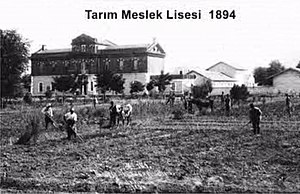
Bursa Agriculture Vocational High School
Vocational school in Turkey
Distance: Approx. 4821 meters
Latitude and longitude: 40.22787,28.99838
Bursa Agriculture Vocational High School (Turkish: Tarım Meslek Lisesi - Bursa), also known as Hamidiye Vocational and Technical Anatolian High School ("Hamidiye Mesleki ve Teknik Anadolu Lisesi") is a vocational high school for agriculture in Bursa, Turkey. It was established during the Ottoman Empire in 1891.
Weather in this IP's area
clear sky
12 Celsius
10 Celsius
12 Celsius
12 Celsius
1024 hPa
58 %
1024 hPa
1006 hPa
10000 meters
2.77 m/s
5.32 m/s
47 degree
2 %
07:18:03
18:20:05