Country:
 Turkey
Region:
City:
Latitude and Longitude:
Time Zone:
Postal Code:
IP information under different IP Channel
ip-api
Country
Region
City
ASN
Time Zone
ISP
Blacklist
Proxy
Latitude
Longitude
Postal
Route
IPinfo
Country
Region
City
ASN
Time Zone
ISP
Blacklist
Proxy
Latitude
Longitude
Postal
Route
MaxMind
Country
Region
City
ASN
Time Zone
ISP
Blacklist
Proxy
Latitude
Longitude
Postal
Route
Luminati
Country
TRRegion
34
City
istanbul
ASN
Time Zone
Europe/Istanbul
ISP
TurkNet Iletisim Hizmetleri A.S.
Latitude
Longitude
Postal
db-ip
Country
Region
City
ASN
Time Zone
ISP
Blacklist
Proxy
Latitude
Longitude
Postal
Route
ipdata
Country
Region
City
ASN
Time Zone
ISP
Blacklist
Proxy
Latitude
Longitude
Postal
Route
Popular places and events near this IP address

Esenler
District and municipality in Istanbul, Turkey
Distance: Approx. 993 meters
Latitude and longitude: 41.03388889,28.89027778
Esenler is a municipality and district of Istanbul Province, Turkey. Its area is 43 km2, and its population is 445,421 (2022). It is on its European side.

Güngören
District and municipality in Istanbul, Turkey
Distance: Approx. 1244 meters
Latitude and longitude: 41.0225,28.87166667
Güngören is a municipality and district of Istanbul Province, Turkey. Its area is 7 km2, making it the smallest district of Turkey in terms of land area. Its population is 282,692 (2022), down from a peak of 318,545 in 2007.
Güngören M.Yahya Baş Stadium
Distance: Approx. 550 meters
Latitude and longitude: 41.023775,28.87981389
Güngören M. Yahya Baş Stadyumu is a multi-purpose stadium in the Güngören district of Istanbul, Turkey. It is currently used mostly for football matches and is the home stadium of İstanbul Güngörenspor. The stadium holds 7,500 people.
Battle of Katasyrtai
Battle between Byzantines and Bulgarians
Distance: Approx. 663 meters
Latitude and longitude: 41.030556,28.890278
The battle of Katasyrtai (Kατασυρται) occurred in the fall of 917, shortly after the striking Bulgarian triumph at Achelous near the village of the same name close to the Byzantine capital Constantinople, (now Istanbul). The result was a Bulgarian victory.

Esenler Coach Terminal
Largest bus terminal in Istanbul, Turkey
Distance: Approx. 1732 meters
Latitude and longitude: 41.03987,28.89413
Esenler Coach Terminal (Turkish: Esenler Otogarı) is the central and largest bus terminus for intercity bus service in Istanbul, Turkey. Although the terminus is located in Bayrampaşa district, it is named after Esenler district, which is closer. The multi-story terminal houses 450-500 permanent parking lots for buses and over 1,000 temporary ones.

Otogar (Istanbul Metro)
Station of the Istanbul Metro
Distance: Approx. 1644 meters
Latitude and longitude: 41.0389,28.8944
Otogar is a rapid transit station on the M1 line of the Istanbul Metro. It is located in southwestern Bayrampaşa in the center of the Esenler Bus Terminal. Otogar was opened on 31 January 1994 as part of the M1's extension to Zeytinburnu.
Terazidere (Istanbul Metro)
Station of the Istanbul Metro
Distance: Approx. 1136 meters
Latitude and longitude: 41.030325,28.897893
Terazidere is a rapid transit station on the M1 line of the Istanbul Metro located in southern Esenler. It was opened on 31 January 1994 as part of the Otogar-Zeytinburnu extension and is one of the five stations of this extension.

Davutpaşa—YTÜ (Istanbul Metro)
Station of the Istanbul Metro
Distance: Approx. 1328 meters
Latitude and longitude: 41.020517,28.900199
Davutpaşa—YTÜ is a rapid transit station on the M1 line of the Istanbul Metro located in southern Esenler, close to the entrance of Yıldız Technical University (Turkish: Yıldız Teknik Üniversitesi) or YTÜ. It was opened on 31 January 1994 as part of the Otogar-Zeytinburnu extension and is one of five stations of this extension.
Tozkoparan Olympic Swimming Pool
Swimming pool in Istanbul, Turkey
Distance: Approx. 1619 meters
Latitude and longitude: 41.01277778,28.895
Tozkoparan Olympic Swimming Pool (Turkish: Tozkoparan Olimpik Yüzme Havuzu) is an Olympic-size swimming pool in Istanbul, Turkey. The swimming pool is situated in Cevat Açıkalın Cad., Erdemli Sok. 4, at Tozkoparan neighborhood of Güngören district in Istanbul.
Menderes (Istanbul Metro)
Station of the Istanbul Metro
Distance: Approx. 2018 meters
Latitude and longitude: 41.042945,28.878918
Menderes is an underground rapid transit station on the M1B line of the Istanbul Metro. It was opened on 14 June 2013 as part of the four new stations of the M1B extension to Kirazlı.

Üçyüzlü (Istanbul Metro)
Station of the Istanbul Metro
Distance: Approx. 1766 meters
Latitude and longitude: 41.036857,28.871078
Üçyüzlü is an underground rapid transit station on the M1B line of the Istanbul Metro. It was opened on 14 June 2013 as part of the four new stations of the M1B extension to Kirazlı.
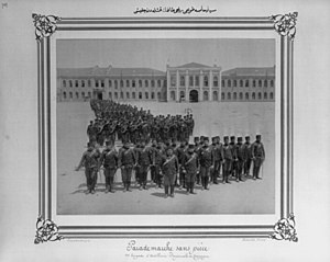
Davutpaşa Barracks
Distance: Approx. 276 meters
Latitude and longitude: 41.02583333,28.88916667
Davutpaşa Barracks (Turkish: Davutpaşa Kışlası) were Ottoman Army barracks built in the 1800s and located at Davutpaşa neighborhood of Esenler district on the European part of Istanbul, Turkey. The building was used later as a shelter for immigrants during the Balkan Wars and as a military hospital during World War I. Today, it serves as a campus of Yıldız Technical University after its redevelopment.
Weather in this IP's area
broken clouds
13 Celsius
13 Celsius
13 Celsius
14 Celsius
1025 hPa
70 %
1025 hPa
1016 hPa
10000 meters
5.36 m/s
360 degree
75 %
07:19:15
18:19:32