Country:
 Turkey
Region:
City:
Latitude and Longitude:
Time Zone:
Postal Code:
IP information under different IP Channel
ip-api
Country
Region
City
ASN
Time Zone
ISP
Blacklist
Proxy
Latitude
Longitude
Postal
Route
IPinfo
Country
Region
City
ASN
Time Zone
ISP
Blacklist
Proxy
Latitude
Longitude
Postal
Route
MaxMind
Country
Region
City
ASN
Time Zone
ISP
Blacklist
Proxy
Latitude
Longitude
Postal
Route
Luminati
Country
TRRegion
34
City
istanbul
ASN
Time Zone
Europe/Istanbul
ISP
TurkNet Iletisim Hizmetleri A.S.
Latitude
Longitude
Postal
db-ip
Country
Region
City
ASN
Time Zone
ISP
Blacklist
Proxy
Latitude
Longitude
Postal
Route
ipdata
Country
Region
City
ASN
Time Zone
ISP
Blacklist
Proxy
Latitude
Longitude
Postal
Route
Popular places and events near this IP address

Armenian Patriarchate of Constantinople
Autonomous See
Distance: Approx. 627 meters
Latitude and longitude: 41.0045,28.9612
The Armenian Patriarchate of Constantinople (Turkish: İstanbul Ermeni Patrikhanesi; Western Armenian: Պատրիարքութիւն Հայոց Կոստանդնուպոլսոյ, Badriark'ut'iun Hayots' Gosdantnubolsoy) is an autonomous see of the Armenian Apostolic Church. The seat of the Armenian Patriarchate of Constantinople is the Surp Asdvadzadzin Patriarchal Church (Holy Mother of God Patriarchal Church) in the Kumkapı neighborhood of Istanbul. Its head is the Armenian Patriarch of Constantinople (also known as Armenian Patriarch of Istanbul).

Harbour of Eleutherios
One of the harbours of Constantinople, built by Theodosius on the Sea of Marmara
Distance: Approx. 660 meters
Latitude and longitude: 41.00466667,28.95222222
The Harbour of Eleutherios (Medieval Greek: λιμήν Ἐλευθερίου), originally known as the Harbour of Theodosius (Latin: Portus Theodosiacus, Ancient Greek: λιμήν Θεοδοσίου) was one of the ports of ancient Constantinople, the capital of the Byzantine Empire, located beneath the modern Yenikapi neighbourhood of Istanbul, Turkey. It was built at the mouth of the Lycus watercourse that ran through the city to the Propontis (the Sea of Marmara). The harbour was built in the late 4th century, during the reign of Theodosius I, and was the city's major point of trade in Late Antiquity.

Kumkapı
Place in Istanbul, Turkey
Distance: Approx. 821 meters
Latitude and longitude: 41,28.96666667
Kumkapı (meaning "sand gate" in Turkish) is a quarter in Fatih district of Istanbul. It is located along the northern shore of Marmara Sea. Up to recent times, Kumkapı is the center of the Armenian community of the city, boasting a school and several churches.

Bodrum Mosque
Mosque in Istanbul, Turkey
Distance: Approx. 976 meters
Latitude and longitude: 41.00861111,28.95555556
Bodrum Mosque (Turkish: Bodrum Camii, or Mesih Paşa Camii named after its converter) in Istanbul, Turkey, is a former Eastern Orthodox church converted into a mosque by the Ottomans. The church was known under the Greek name of Myrelaion (Greek: Eκκλησία του Μυρελαίου).

Yenikapı
Distance: Approx. 580 meters
Latitude and longitude: 41,28.95
Yenikapı (Turkish pronunciation: ['jenikapɯ]) is a port and a quarter in Istanbul, Turkey, in the metropolitan district of Fatih on the European side of the Bosphorus, and along the southern shore of the city's historically central peninsula. Yenikapı is notable for the ongoing excavations on its Byzantine port, first discovered in 2004. Yenikapı’s archeological investigations have become one of the largest in Europe, due to the size and number of the shipwrecks found since the initial discovery, and the large number of associated artefacts.

Tayyare Apartments
Distance: Approx. 1096 meters
Latitude and longitude: 41.00972222,28.95777778
The Tayyare Apartments (initially Ottoman Turkish: Harikzedegân Apartmanları or later Turkish: Tayyare Apartmanları) are a complex of four buildings designed by Turkish architect Mimar Kemaleddin, completed in 1922 and located in the old city of Istanbul, Turkey. The apartments were originally built as public housing for the victims of a great fire, converted later into hotel premises. Formerly Ramada Hotel and then Merit Antique Hotel, the complex is currently a five star hotel of the Crowne Plaza Hotels & Resorts chain named Crowne Plaza Istanbul Old City.
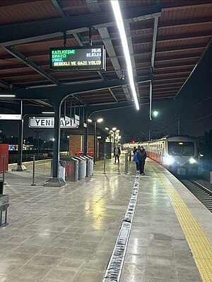
Yenikapı railway station
Closed train stop in Istanbul
Distance: Approx. 652 meters
Latitude and longitude: 41.00472222,28.9525
Yenikapı was an indefinitely closed railway station on the İstanbul-Halkalı Line in the Yenikapı neighborhood of Istanbul, Turkey. The station was built in 1872 by the Oriental Railway which was then taken over by the Turkish State Railways in 1937 and electrified in 1955. The station is situated near the south end of the busy Gazi Mustafa Kemal Paşa Boulevard and one block north of Kennedy St, two major inner-city roadways and is 4.8 km (3.0 mi) west of Sirkeci Terminal.

Yenikapı Transfer Center
Station of the Istanbul Metro
Distance: Approx. 748 meters
Latitude and longitude: 41.0053,28.9516
Yenikapı Transfer Center (Turkish: Yenikapı Aktarma Merkezi), referred to as Yenikapı, is an underground transportation complex in Istanbul. It is located in south-central Fatih in the neighborhood of Yenikapı, hence the name of the hub. The complex is right next to the Yenikapı railway station serving the T6 light rail line and a short walk away from the Yenikapı Ferry Terminal and İDO ferry service.
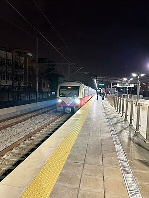
Kumkapı railway station
Distance: Approx. 651 meters
Latitude and longitude: 41.0033,28.9632
Kumkapı is an railway station on the İstanbul-Halkalı Line in Istanbul. The station is located in southeastern Fatih along Kennedy Boulevard and is 3.8 km (2.4 mi) away from Sirkeci Terminal. The station was built in 1872 by the Rumelia Railway as part of the extension of their mainline into İstanbul's city center.

Laleli, Fatih
Neighbourhood of Istanbul, Turkey
Distance: Approx. 1065 meters
Latitude and longitude: 41.00944444,28.95777778
Laleli (meaning 'with tulips' in Turkish) is a neighbourhood of Fatih, Istanbul, Turkey, lying between Beyazıt and Aksaray. It is known for its large textile wholesaling business and is home to the Literature and Science Faculties of Istanbul University, designed by Sedad Hakkı Eldem and Emin Onat in the 1940s. It is served by a stop on the T1 tram line which runs along Ordu Caddesi.
Yenikapı Ferry Terminal
Distance: Approx. 238 meters
Latitude and longitude: 41.002,28.9564
The Yenikapı Ferry Terminal (Turkish: Yenikapı Feribot Terminali) or Yenikapı Pier (Turkish: Yenikapı İskelesi) is a ferry terminal in Fatih, Istanbul, located along Kennedy Avenue on the Marmara Sea. It is used by İDO as a hub and is the largest ferry terminal in Istanbul. İDO operates several ferry routes from Yenikapı to destinations within Istanbul as well as across the Marmara Sea.

Surp Asdvadzadzin Patriarchal Church
Distance: Approx. 630 meters
Latitude and longitude: 41.00472222,28.96083333
Surp Asdvadzadzin Patriarchal Church, also known as the Holy Mother of God Patriarchal Church, (Armenian: Սուրբ Աստուածածին Աթոռանիստ Մայր Տաճար, Turkish: Aziz Meryem Ana Patriklik Kilisesi) is an Armenian Apostolic church located in Kumkapı quarter of Fatih district in old Istanbul, Turkey. It is the church of the Armenian Patriarchate of Constantinople, which has its offices directly across the church in the same street.
Weather in this IP's area
broken clouds
25 Celsius
25 Celsius
22 Celsius
25 Celsius
1015 hPa
70 %
1015 hPa
1015 hPa
10000 meters
6.71 m/s
360 degree
75 %
06:38:06
19:25:49