158.41.181.48 - IP Lookup: Free IP Address Lookup, Postal Code Lookup, IP Location Lookup, IP ASN, Public IP
Country:
Region:
City:
Location:
Time Zone:
Postal Code:
IP information under different IP Channel
ip-api
Country
Region
City
ASN
Time Zone
ISP
Blacklist
Proxy
Latitude
Longitude
Postal
Route
Luminati
Country
Region
tx
City
godley
ASN
Time Zone
America/Chicago
ISP
UNITED-BROADBAND
Latitude
Longitude
Postal
IPinfo
Country
Region
City
ASN
Time Zone
ISP
Blacklist
Proxy
Latitude
Longitude
Postal
Route
IP2Location
158.41.181.48Country
Region
texas
City
cleburne
Time Zone
America/Chicago
ISP
Language
User-Agent
Latitude
Longitude
Postal
db-ip
Country
Region
City
ASN
Time Zone
ISP
Blacklist
Proxy
Latitude
Longitude
Postal
Route
ipdata
Country
Region
City
ASN
Time Zone
ISP
Blacklist
Proxy
Latitude
Longitude
Postal
Route
Popular places and events near this IP address

Johnson County, Texas
County in Texas, United States
Distance: Approx. 4394 meters
Latitude and longitude: 32.38,-97.36
Johnson County is a county located in the U.S. state of Texas. As of the 2020 census, its population was 179,927. Its county seat is Cleburne.

Cleburne, Texas
City in Texas, United States
Distance: Approx. 2219 meters
Latitude and longitude: 32.35555556,-97.40833333
Cleburne ( KLEE-burn) is a city in and the county seat of Johnson County, Texas, United States. As of the 2020 census, its population was 31,352. The city is named in honor of Patrick Cleburne, a Confederate general.

Keene, Texas
City in Texas, United States
Distance: Approx. 6093 meters
Latitude and longitude: 32.38888889,-97.34416667
Keene is a city in Johnson County, Texas, United States. The population was 6,387 in 2020.

Cleburne Intermodal Transportation Depot
Amtrak train station in Cleburne, Texas
Distance: Approx. 483 meters
Latitude and longitude: 32.34972222,-97.38222222
The Cleburne Intermodal Transportation Depot is an Amtrak train station in Cleburne, Texas, United States.
Cleburne High School
School
Distance: Approx. 3781 meters
Latitude and longitude: 32.3472,-97.4269
Cleburne High School is a public high school located in the city of Cleburne, Texas. The school is in the Cleburne Independent School District.

Johnson County Courthouse (Texas)
United States historic place
Distance: Approx. 70 meters
Latitude and longitude: 32.34722222,-97.38611111
Johnson County, Texas, has had many courthouses since it was formed.

Gorman's Park
Baseball park in Cleburne, Texas, US
Distance: Approx. 785 meters
Latitude and longitude: 32.34055556,-97.38694444
Gorman's Park was a baseball park located in Cleburne, Texas and was the home of the Texas League Cleburne Railroaders in 1906. Controversially, the Railroaders won the Texas League pennant over Fort Worth. Fort Worth won the first half while Cleburne won the second half.
Hill College
Community college in Hillsboro, Texas, U.S.
Distance: Approx. 5146 meters
Latitude and longitude: 32.32799,-97.43625
Hill College is a public community college in Hillsboro, Texas. It opened its doors in 1923, one year before North Central Texas College, which is the oldest continuously-operating community college in Texas because Hill College was closed during the 1950s.
Cleburne Regional Airport
Airport
Distance: Approx. 4493 meters
Latitude and longitude: 32.35388889,-97.43388889
Cleburne Regional Airport (ICAO: KCPT, FAA LID: CPT, formerly F18) is a city-owned, public-use airport located two nautical miles (4 km) northwest of the central business district of Cleburne, a city in Johnson County, Texas, United States. Formerly known as Cleburne Municipal Airport, it is included in the National Plan of Integrated Airport Systems for 2011–2015, which categorized it as a general aviation facility. Although most U.S. airports use the same three-letter location identifier for the FAA and IATA, this airport is assigned CPT by the FAA but has no designation from the IATA (which assigned CPT to Cape Town International Airport in South Africa).
La Moderna Field
Baseball park in Cleburne, Texas, US
Distance: Approx. 3858 meters
Latitude and longitude: 32.37441667,-97.41269444
La Moderna Field (formerly known as "The Depot at Cleburne Station") is a baseball park located in Cleburne, Texas, United States, that opened on May 18, 2017. Seating at the ballpark has over 1,750 fixed seats, bleachers, grass berm seating, and several group seating areas. The Cleburne Railroaders baseball team of the independent American Association plays its home games at the stadium.

Confederate Memorial Arch (Cleburne, Texas)
Monument in Cleburne, Texas
Distance: Approx. 1326 meters
Latitude and longitude: 32.34598,-97.37273
The Confederate Memorial Arch is a monument located in Cleburne, Texas in memory of the Confederacy The arch stands on the edge of the Cleburne Memorial Cemetery.

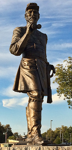
Statue of Patrick Cleburne
Distance: Approx. 289 meters
Latitude and longitude: 32.34608,-97.38919
A Statue of Patrick Cleburne stands in Cleburne, Texas. The statue honoring Confederate General Patrick Cleburne, the town's namesake, was installed in 2015.
Weather in this IP's area
overcast clouds
12 Celsius
12 Celsius
11 Celsius
13 Celsius
1017 hPa
97 %
1017 hPa
990 hPa
10000 meters
4.02 m/s
5.81 m/s
349 degree
100 %