158.255.95.243 - IP Lookup: Free IP Address Lookup, Postal Code Lookup, IP Location Lookup, IP ASN, Public IP
Country:
Region:
City:
Location:
Time Zone:
Postal Code:
IP information under different IP Channel
ip-api
Country
Region
City
ASN
Time Zone
ISP
Blacklist
Proxy
Latitude
Longitude
Postal
Route
Luminati
Country
Region
06
City
dys
ASN
Time Zone
Europe/Warsaw
ISP
Vectra S.A.
Latitude
Longitude
Postal
IPinfo
Country
Region
City
ASN
Time Zone
ISP
Blacklist
Proxy
Latitude
Longitude
Postal
Route
IP2Location
158.255.95.243Country
Region
lubelskie
City
lublin
Time Zone
Europe/Warsaw
ISP
Language
User-Agent
Latitude
Longitude
Postal
db-ip
Country
Region
City
ASN
Time Zone
ISP
Blacklist
Proxy
Latitude
Longitude
Postal
Route
ipdata
Country
Region
City
ASN
Time Zone
ISP
Blacklist
Proxy
Latitude
Longitude
Postal
Route
Popular places and events near this IP address
Lublin
City in Lublin Voivodeship, Poland
Distance: Approx. 2 meters
Latitude and longitude: 51.25,22.56666667
Lublin is the ninth-largest city in Poland and the second-largest city of historical Lesser Poland. It is the capital and the centre of Lublin Voivodeship with a population of 336,339 (December 2021). Lublin is the largest Polish city east of the Vistula River, located 153 km (95 mi) southeast of Warsaw.

Lublin County
County in Lublin Voivodeship, Poland
Distance: Approx. 330 meters
Latitude and longitude: 51.24805556,22.57027778
Lublin County (Polish: Powiat Lubelski) is a unit of territorial administration and local government (powiat) in Lublin Voivodeship, eastern Poland. It was established on January 1, 1999, as a result of the Polish local government reforms passed in 1998. Its administrative seat is the city of Lublin, although the city is not part of the county (it constitutes a separate city county).

Lublin Holocaust Memorial
Monument in Lublin, Poland
Distance: Approx. 432 meters
Latitude and longitude: 51.24950569,22.56054361
The Holocaust Memorial in Lublin (Polish: Pomnik ku czci masowej eksterminacji ludności żydowskiej, Pomnik ofiar getta) commemorates the Jewish inhabitants of the city who were killed during the Holocaust. It was unveiled in 1963.

Lublin Castle
Building in Lublin, Poland
Distance: Approx. 390 meters
Latitude and longitude: 51.25055556,22.57222222
The Lublin Castle (Polish: Zamek Lubelski) is a medieval castle in Lublin, Poland, adjacent to the Old Town district and close to the city center. It is one of the oldest preserved royal residencies in Poland, initially established by High Duke Casimir II the Just. Its contemporary Gothic Revival appearance is largely due to a reconstruction undertaken in the 19th century.
Maharam's Synagogue
Former synagogue in Lublin, Poland
Distance: Approx. 411 meters
Latitude and longitude: 51.25305556,22.57
The Maharam's Synagogue was a former Orthodox Jewish congregation and synagogue, that was part of synagogical complex in Podzamcze, located at 3 Jateczna Street, in Lublin, in the Lublin Voivodeship of Poland. Designed in the Renaissance style and completed in the late 16th or early 17th centuries, the synagogue served as a house of prayer, with several interruptions due to desecration and partial destruction, until World War II when it was destroyed by Nazis in 1942.
Church of St. Josaphat, Lublin
Distance: Approx. 292 meters
Latitude and longitude: 51.24805556,22.56388889
Church of St. Josaphat in Lublin was built by Greek merchants in 1786 upon the consent of king Stanisław August Poniatowski. In the second half of the 19th century the temple which was originally dependent on the patriarch of Constantinople was taken over by the Russian Orthodox Church and in 1922 it became the property of the Roman Catholic Church.

National Museum, Lublin
Museum in Lublin, Poland
Distance: Approx. 390 meters
Latitude and longitude: 51.25055556,22.57222222
The National Museum in Lublin (Polish: Muzeum Narodowe w Lublinie) is one of the oldest and largest museums in Eastern Poland, located in Lublin. It was created in 1914, and received its own building in 1923.
Grodzka Gate – NN Theatre
Distance: Approx. 219 meters
Latitude and longitude: 51.24944444,22.56972222
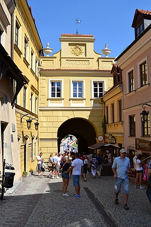
The "Grodzka Gate – NN Theatre" Centre (Polish: Ośrodek "Brama Grodzka — Teatr NN") is a cultural institution based in Lublin. It is housed in the Grodzka Gate also known as the Jewish Gate that historically used to be a passage from the Christian to the Jewish part of the city. In its activities the Center focuses on issues of cultural heritage.

St. Joseph's Church, Lublin
17th-century Roman Catholic church in Lublin, Poland
Distance: Approx. 113 meters
Latitude and longitude: 51.2494,22.5654
St. Joseph's Church is a 17th-century Roman Catholic church in Lublin. The building's construction was founded by Katarzyna from Kretków Sanguszkowa.

St. John the Baptist Cathedral, Lublin
Church in Lublin, Poland
Distance: Approx. 378 meters
Latitude and longitude: 51.2468,22.5685
The Cathedral of Saint John the Baptist (Polish: Archikatedra św. Jana Chrzciciela ) or simply Lublin Cathedral in Lublin, Poland is the cathedral church of the Roman Catholic Archdiocese of Lublin. It was built between 1592 and 1617 as a church of the Society of Jesus.

Maharshal's Synagogue
Destroyed synagogue in Lublin, Poland
Distance: Approx. 404 meters
Latitude and longitude: 51.25111111,22.57222222
The Maharshal's Synagogue (Polish: Synagoga Maharszala), also known as the Great Lublin Synagogue (Yiddish: מהרשל־שול), was a former Orthodox Jewish congregation and synagogue, that was located on the northern slope of castle hill at the now nonexistent 3 Jateczna Street, in Lublin, in the Lublin Voivodeship of Poland. The synagogue served as a house of prayer until World War II when it was destroyed by Nazis in 1942. It was the largest synagogue in Lublin, and was the oldest known building in Poland with a four-pillar bema.
Kraków Gate (Lublin)
City gate in Lublin, Poland
Distance: Approx. 268 meters
Latitude and longitude: 51.2476,22.56646
Kraków Gate is a gothic city gate in Lublin, Poland. It was built in the 14th century during the reign of Casimir the Great. It is a protected monument in Poland.
Weather in this IP's area
light shower snow
-3 Celsius
-10 Celsius
-3 Celsius
-2 Celsius
1015 hPa
86 %
1015 hPa
991 hPa
10000 meters
6.69 m/s
260 degree
75 %


