Country:
 USA
USARegion:
City:
Latitude and Longitude:
Time Zone:
Postal Code:
IP information under different IP Channel
ip-api
Country
Region
City
ASN
Time Zone
ISP
Blacklist
Proxy
Latitude
Longitude
Postal
Route
IPinfo
Country
Region
City
ASN
Time Zone
ISP
Blacklist
Proxy
Latitude
Longitude
Postal
Route
MaxMind
Country
Region
City
ASN
Time Zone
ISP
Blacklist
Proxy
Latitude
Longitude
Postal
Route
Luminati
Country
USASN
Time Zone
America/Chicago
ISP
ASN-CXA-ALL-CCI-22773-RDC
Latitude
Longitude
Postal
db-ip
Country
Region
City
ASN
Time Zone
ISP
Blacklist
Proxy
Latitude
Longitude
Postal
Route
ipdata
Country
Region
City
ASN
Time Zone
ISP
Blacklist
Proxy
Latitude
Longitude
Postal
Route
Popular places and events near this IP address

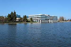
Redwood Shores, California
Place in California, United States
Distance: Approx. 1241 meters
Latitude and longitude: 37.5318804,-122.2480219
Redwood Shores is a waterfront community in Redwood City, California, along the western shore of San Francisco Bay on the San Francisco Peninsula in San Mateo County. Redwood Shores is the home of several major technology companies, including Oracle Corporation (which relocated its headquarters in 2020), Electronic Arts, Nintendo, Zuora, Qualys, Crystal Dynamics and Shutterfly.

Hiller Aviation Museum
Aviation museum in San Carlos, California
Distance: Approx. 2183 meters
Latitude and longitude: 37.5124,-122.2531
The Hiller Aviation Museum is an aviation museum located at the San Carlos Airport in San Carlos, California focused on Northern California aviation history, Hiller Aircraft and helicopter history.
Model N (company)
American software company
Distance: Approx. 770 meters
Latitude and longitude: 37.537,-122.2584
Model N, Inc. is an American software company founded in 1999 and headquartered in San Mateo, California. The company offers revenue management software technology and life sciences companies.

Marine World/Africa USA
Zoo in California, United States
Distance: Approx. 506 meters
Latitude and longitude: 37.53333333,-122.26666667
Marine World/Africa USA was an animal theme park located in the Redwood Shores area of Redwood City, California. The park was named Marine World when it first opened in 1968, before merging with a land-animal park called Africa USA in 1972. In 1986, the park relocated to Vallejo, California, and is now known as Six Flags Discovery Kingdom.

Belmont station (Caltrain)
Train station in Belmont, California, U.S.
Distance: Approx. 1640 meters
Latitude and longitude: 37.52138889,-122.27638889
Belmont station is a Caltrain station in Belmont, California that replaced the Southern Pacific Railroad station nearby. It is served by local and limited service trains. The modern elevated station was constructed in 1997 as part of a grade separation project.
Davey Glen Park
Distance: Approx. 2228 meters
Latitude and longitude: 37.524862,-122.286134
Davey Glen Park is a 1-acre (4,000 m2) piece of parkland set aside by the city of Belmont, California, in 2000 as part of an upscale housing development nearby. Donation of land for parks or in-lieu fees are required by the city for such development. In this case, The developer donated land valued at approximately $450,000 to the City of Belmont Parks Department in 2000 for use as a park.

Ray of Light (sculpture)
Distance: Approx. 249 meters
Latitude and longitude: 37.53074,-122.25918
Ray of Light, is a public artwork by artist Barton Rubenstein, located on the north side of the Redwood Shores Library, in Redwood City, California, United States. The sculpture, constructed from stainless steel, was commissioned as part of the G. R. Cress Bird Bath Project.
Rocketship Education
Charter schools school
Distance: Approx. 1244 meters
Latitude and longitude: 37.5200564,-122.2577127
Rocketship Public Schools (RPS) is a non-profit charter school network headquartered in Redwood City, California.
Peninsula Athletic League
High school athletic conference in California
Distance: Approx. 554 meters
Latitude and longitude: 37.5258,-122.2631
Peninsula Athletic League (PAL) is a high school athletic conference in California, part of the CIF Central Coast Section of the California Interscholastic Federation. It comprises 17 high schools generally around San Mateo County, California. There are also nine smaller schools, designated supplemental members, of which four are located in Santa Clara County.

Design Tech High School
Public charter high school in Redwood City, California, United States
Distance: Approx. 276 meters
Latitude and longitude: 37.5326,-122.264
Design Tech High School, commonly referred to as d.tech, is a public charter high school in the San Francisco Bay Area. The school is located on the Oracle Corporation campus in Redwood City, California, and is part of the San Mateo Union High School District. Founded in 2014, the school has roughly 562 students (as of Spring 2022) and focuses on implementing technology, self-direction, and the process of design thinking into its curriculum.
Agiloft
Distance: Approx. 863 meters
Latitude and longitude: 37.523472,-122.258472
Agiloft, Inc. is a technology company specializing in contract lifecycle management and business process management software in Redwood City, California. It was originally founded in October 1990 as Integral Solutions Corporation by Colin Earl.
Belmont Creek
Creek in California
Distance: Approx. 709 meters
Latitude and longitude: 37.5289,-122.2697
Belmont Creek is a creek in San Mateo County, California. The creek rises in Belmont and flows east under the Bayshore Freeway entering the Belmont Slough in Redwood Shores.
Weather in this IP's area
broken clouds
18 Celsius
18 Celsius
16 Celsius
20 Celsius
1011 hPa
81 %
1011 hPa
1011 hPa
10000 meters
8.23 m/s
290 degree
75 %
06:54:01
19:12:03