Country:
Region:
City:
Latitude and Longitude:
Time Zone:
Postal Code:
IP information under different IP Channel
ip-api
Country
Region
City
ASN
Time Zone
ISP
Blacklist
Proxy
Latitude
Longitude
Postal
Route
Luminati
Country
Region
ma
City
tewksbury
ASN
Time Zone
America/New_York
ISP
KRONOS-MA
Latitude
Longitude
Postal
IPinfo
Country
Region
City
ASN
Time Zone
ISP
Blacklist
Proxy
Latitude
Longitude
Postal
Route
db-ip
Country
Region
City
ASN
Time Zone
ISP
Blacklist
Proxy
Latitude
Longitude
Postal
Route
ipdata
Country
Region
City
ASN
Time Zone
ISP
Blacklist
Proxy
Latitude
Longitude
Postal
Route
Popular places and events near this IP address

Tewksbury, Massachusetts
Town in Massachusetts, United States
Distance: Approx. 894 meters
Latitude and longitude: 42.61055556,-71.23472222
Tewksbury is a town in Middlesex County, Massachusetts, United States. Its population was 31,342 as of the 2020 United States Census.

Tewksbury Hospital
Hospital in Massachusetts, United States
Distance: Approx. 1316 meters
Latitude and longitude: 42.60822183,-71.217628
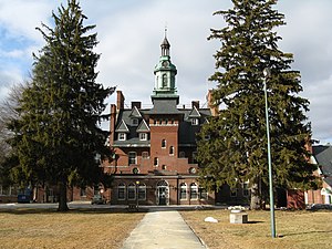
Tewksbury Hospital is a National Register of Historic Places-listed site located on an 800+ acre campus in Tewksbury, Massachusetts. The centerpiece of the hospital campus is the 1894 Richard Morris Building ("Old Administration Building"). The Massachusetts Department of Public Health currently operates a Joint Commission accredited, 370-bed facility at Tewksbury Hospital, providing both medical and psychiatric services to challenging adult patients with chronic conditions.

Tewksbury Memorial High School
Public school in Tewksbury, Massachusetts, United States
Distance: Approx. 687 meters
Latitude and longitude: 42.6025,-71.24027778
Tewksbury Memorial High School (also TMHS or Tewksbury High School) is a suburban public high school located at 320 Pleasant Street in Tewksbury, Massachusetts, United States. Serving grades 9–12, it is the only public high school in the town. Its total enrollment for the 2018–2019 school year was 916 students.

North Billerica, Massachusetts
Village of the town of Billerica, Massachusetts, US
Distance: Approx. 4821 meters
Latitude and longitude: 42.58333333,-71.28444444
North Billerica is an unincorporated village of the town of Billerica, Massachusetts, United States, one of the nine sections (hamlets) that make up the Town of Billerica. It is the home to Faulkner and Talbot mills and the North Billerica Train Depot. The Middlesex Canal was built through the village in 1783 and the Boston and Lowell Railroad was put through in the 1840s.
North Billerica station
Train station in Billerica, Massachusetts, US
Distance: Approx. 4178 meters
Latitude and longitude: 42.5935,-71.2813
North Billerica station is an MBTA Commuter Rail station in Billerica, Massachusetts. It serves the Lowell Line, and is located in the North Billerica village. The depot building, built in 1867, was renovated, expanded, and returned to station use in 1998.

Blanchard-Upton House
Historic house in Massachusetts, United States
Distance: Approx. 4816 meters
Latitude and longitude: 42.63138889,-71.18777778
The Blanchard-Upton House is a historic house in Andover, Massachusetts. It is a First Period 2.5-story saltbox, which is distinctive for having an integral leanto section rather than one that was added after other parts of the house. The exact date of its construction is not known: it was probably built by Thomas Blanchard, a cordwainer, sometime between 1699, when he bought the land, and 1740, when he died.

Billerica Mills Historic District
Historic district in Massachusetts, United States
Distance: Approx. 4632 meters
Latitude and longitude: 42.58972222,-71.28555556
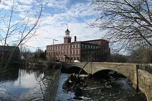
The Billerica Mills Historic District is a historic district between the Concord River, Treble Cove Terrace, Kohlrausch Avenue, Indian Road, Holt Ruggles, and Rogers Streets in the village of North Billerica, Massachusetts (part of the town of Billerica). The C.P. Talbot & Company mill building still stands in the center of the district. The buildings were planned and sited over decades, spanning from the mid-19th century until the 1920s.
Tew-Mac Airport
Airport in Tewksbury, Massachusetts
Distance: Approx. 2539 meters
Latitude and longitude: 42.59222222,-71.20444444
Tew Mac Airport (FAA LID: B09) was an airport in Tewksbury, Massachusetts. It was closed in 1997. The airport was located off Route 38 in Tewksbury, MA near the border with Wilmington.

Stoklosa Alumni Field
Baseball field in Lowell, Massachusetts
Distance: Approx. 4872 meters
Latitude and longitude: 42.6309,-71.2775
Stoklosa Alumni Field is a baseball field in Lowell, Massachusetts, United States. Originally opened on May 1, 1902, it was rebuilt in 1996 as a temporary home of the Lowell Spinners. The Spinners played at the field for the 1996 and 1997 seasons before moving to Edward A. LeLacheur Park on UMass Lowell's east campus.
Salter School
School in Boston, Massachusetts, US
Distance: Approx. 4598 meters
Latitude and longitude: 42.61161111,-71.28672222
Salter School is a for-profit vocational school in Malden. It is operated as a component of the Premier Education Group. Salter School grew from the Salter Secretarial School established in Massachusetts in 1937.

Iron Horse Park
Railroad repair facility in North Billerica, Massachusetts
Distance: Approx. 3609 meters
Latitude and longitude: 42.582925,-71.26669444
Iron Horse Park (formerly known as the Billerica Repair Shops) is the name of the former repair facilities of the Boston and Maine Railroad in North Billerica, Massachusetts.
The Public Health Museum in Massachusetts
Distance: Approx. 1352 meters
Latitude and longitude: 42.6109,-71.2196
The Public Health Museum in Massachusetts is a museum in Tewksbury, Massachusetts in the United States. It opened on September 30, 1994, the 100th anniversary year of the Old Administration building at the historic Tewksbury Hospital, where the museum is housed. The museum also offers a walking tour of the Tewksbury Hospital campus exploring its history, its architecture, the lives of its patients and staff, and its connection to public health.
Weather in this IP's area
clear sky
6 Celsius
4 Celsius
4 Celsius
8 Celsius
1013 hPa
74 %
1013 hPa
1009 hPa
10000 meters
2.57 m/s
200 degree
06:28:08
16:29:22
