Country:
Region:
City:
Latitude and Longitude:
Time Zone:
Postal Code:
IP information under different IP Channel
ip-api
Country
Region
City
ASN
Time Zone
ISP
Blacklist
Proxy
Latitude
Longitude
Postal
Route
Luminati
Country
ASN
Time Zone
Europe/Madrid
ISP
Lyntia Networks S.A.
Latitude
Longitude
Postal
IPinfo
Country
Region
City
ASN
Time Zone
ISP
Blacklist
Proxy
Latitude
Longitude
Postal
Route
db-ip
Country
Region
City
ASN
Time Zone
ISP
Blacklist
Proxy
Latitude
Longitude
Postal
Route
ipdata
Country
Region
City
ASN
Time Zone
ISP
Blacklist
Proxy
Latitude
Longitude
Postal
Route
Popular places and events near this IP address

Palacio de Deportes de la Comunidad de Madrid
Multipurpose venue in Madrid
Distance: Approx. 474 meters
Latitude and longitude: 40.42388889,-3.67166667
Palacio de Deportes de la Comunidad de Madrid (English: Sports Palace of the Regional Community of Madrid), officially WiZink Center since November 2016 for sponsorship reasons, is an indoor sporting arena located in Madrid, Spain. The former building, which was built in 1960, was destroyed by a fire in 2001. Architects Enrique Hermoso and Paloma Huidobro projected a High-Tech style new arena that was built at the same location between 2002 and 2005.

Salamanca (Madrid)
District in Community of Madrid, Spain
Distance: Approx. 395 meters
Latitude and longitude: 40.43,-3.67777778
Salamanca is one of the 21 districts that form the city of Madrid, Spain. Salamanca is located to the northeast of the historical center of Madrid. Salamanca lies east of the district of Chamberí, south of Chamartín, and north of Retiro.
Campo de O'Donnell
Distance: Approx. 609 meters
Latitude and longitude: 40.42145981,-3.67732094
Campo de O'Donnell was a multi-use stadium in Madrid, Spain. The stadium should not be confused with Campo de O'Donnell (Atlético Madrid), which shared the same name and was situated 200 metres (700 ft) away on the same boulevard. It was initially a field (campo) in the area of O'Donnell, next to the main boulevard called Calle de O'Donnell.

Royal Mint (Spain)
Spanish public business entity
Distance: Approx. 614 meters
Latitude and longitude: 40.4227,-3.6709
The Royal Mint of Spain (Spanish: Fábrica Nacional de Moneda y Timbre – Real Casa de la Moneda, lit. 'National Coinage and Stamp Factory – Royal Mint', FNMT-RCM) is the national mint of Spain. The FNMT-RCM is a public corporation that is attached to the Ministry of Economy.

ESDEN Business School
Distance: Approx. 623 meters
Latitude and longitude: 40.431355,-3.680015
ESDEN Business School is an international business school located in Spain. Founded in 1996, it works in collaboration with the Madrid chapter of the Project Management Institute and the London School of Economics. ESDEN holds an Association of Spanish Business Schools (AEEN), a Latin American Council of Business Schools (CLADEA) and a Qfor quality accreditations.

Príncipe de Vergara (Madrid Metro)
Madrid Metro station
Distance: Approx. 567 meters
Latitude and longitude: 40.4229427,-3.6801218
Príncipe de Vergara [ˈpɾinθipe ðe βeɾˈɣaɾa] is a station on Line 2 and Line 9 of the Madrid Metro. It takes its name from the Calle del Príncipe de Vergara, which was named in honor of Baldomero Espartero, Prince of Vergara.

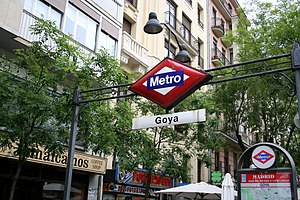
Goya (Madrid Metro)
Madrid Metro station
Distance: Approx. 228 meters
Latitude and longitude: 40.4250659,-3.6743144
Goya [ˈɣoʝa] is a station on Line 2 and Line 4 of the Madrid Metro. It is named for the painter Francisco Goya (1746–1828).

Manuel Becerra (Madrid Metro)
Madrid Metro station
Distance: Approx. 564 meters
Latitude and longitude: 40.4279069,-3.6692552
Manuel Becerra [maˈnwel βeˈθera] is a station on Line 2 and Line 6 of the Madrid Metro, located in the Plaza de Manuel Becerra, Salamanca district in fare Zone A. The station is named after the plaza, which was named for 19th-century politician Manuel Becerra y Bermúdez.
Lista (Madrid Metro)
Madrid Metro station
Distance: Approx. 265 meters
Latitude and longitude: 40.4291685,-3.6754098
Lista [ˈlista] is a station on Line 4 of the Madrid Metro. It is located in fare Zone A. It got its name from the street above, which was formerly named for the poet and educationalist Alberto Lista (1775–1848); in 1955 the street was renamed for the philosopher José Ortega y Gasset but the station kept its old name.

Church of La Concepción
Church in Spain
Distance: Approx. 613 meters
Latitude and longitude: 40.42471111,-3.68244722
The Church of the Conception (Spanish: Iglesia de la Concepción) is a Neogothic Catholic church in Madrid, Spain. It is located on Calle Goya at the corner of Calle de Núñez de Balboa, and its construction was carried out between 1912 and 1914. The architect in charge of the church's design was Eugenio Jiménez Correa until his death in 1910.

Goya (Madrid)
City neighborhood in Madrid, Community of Madrid, Spain
Distance: Approx. 191 meters
Latitude and longitude: 40.42527778,-3.67472222
Goya is an administrative neighborhood (barrio) of Madrid belonging to the district of Salamanca. It has an area of 0.771228 km2 (0.297773 sq mi). As of 1 March 2020, it has a population of 30,010.

St George's Anglican Church, Madrid
Church in Madrid, Spain
Distance: Approx. 603 meters
Latitude and longitude: 40.42649722,-3.68285278
St George's Anglican Church (Spanish: Iglesia Anglicana de San Jorge), also known as Iglesia Anglicana-Episcopaliana de San Jorge or, simply Capilla Británica ('British Chapel'), is a small Anglican church located in the barrio of Recoletos, district of Salamanca, Madrid, Spain, which belongs to the Diocese in Europe of the Church of England. The church was built in 1923 and was consecrated in March 1925.
Weather in this IP's area
broken clouds
12 Celsius
12 Celsius
11 Celsius
13 Celsius
1020 hPa
82 %
1020 hPa
939 hPa
10000 meters
3.09 m/s
80 degree
75 %
08:01:18
17:57:39
