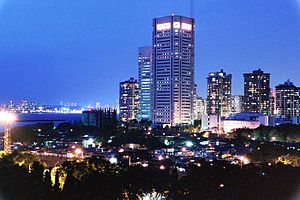
Country:
Region:
City:
Latitude and Longitude:
Time Zone:
Postal Code:
IP information under different IP Channel
ip-api
Country
Region
City
ASN
Time Zone
ISP
Blacklist
Proxy
Latitude
Longitude
Postal
Route
Luminati
Country
ASN
Time Zone
Asia/Kolkata
ISP
Tata Institute of Fundamental Research
Latitude
Longitude
Postal
IPinfo
Country
Region
City
ASN
Time Zone
ISP
Blacklist
Proxy
Latitude
Longitude
Postal
Route
db-ip
Country
Region
City
ASN
Time Zone
ISP
Blacklist
Proxy
Latitude
Longitude
Postal
Route
ipdata
Country
Region
City
ASN
Time Zone
ISP
Blacklist
Proxy
Latitude
Longitude
Postal
Route
Popular places and events near this IP address
Jamnalal Bajaj Institute of Management Studies
Faculty of the University of Mumbai
Distance: Approx. 805 meters
Latitude and longitude: 18.9089,72.8123
Jamnalal Bajaj Institute of Management Studies is the Department of Management Studies of the University of Mumbai. The institute is named after industrialist and philanthropist Jamnalal Bajaj.
Colaba
Neighbourhood in Mumbai City, Maharashtra, India
Distance: Approx. 666 meters
Latitude and longitude: 18.91,72.81
Colaba ([koˈlaːbaː]; or ISO: Kolābā) is a part of the city of Mumbai, India. It is one of the four peninsulas of Mumbai while the other three are Worli, Bandra and Malabar Hill. During Portuguese rule in the 16th century, the island was known as Kolbhat.
Tata Institute of Fundamental Research
Public research institute in Mumbai, India
Distance: Approx. 190 meters
Latitude and longitude: 18.90757,72.80601
Tata Institute of Fundamental Research (TIFR) is an Indian Research Institute under the Department of Atomic Energy of the Government of India. It is a public deemed university located at Navy Nagar, Colaba in Mumbai. It also has a campus in Bangalore, International Centre for Theoretical Sciences (ICTS), and an affiliated campus in Serilingampally near Hyderabad.

Afghan Church
Distance: Approx. 1062 meters
Latitude and longitude: 18.903648,72.815076
The Church of St John the Evangelist, better known as the Afghan Church, is a church of Anglican heritage, that belongs to the Mumbai diocese of the Church of North India. Located in Mumbai, Maharashtra, India, it was built by the British between 1847 and 1858 to commemorate the dead of the First Afghan War and the disastrous 1842 retreat from Kabul. Memorials at the rear of the nave also record casualties from the Second Anglo-Afghan War.

Navy Nagar
Neighbourhood in Mumbai City, Maharashtra, India
Distance: Approx. 736 meters
Latitude and longitude: 18.9012,72.8101
Navy Nagar is a cantonment area in Mumbai, India, and was established in 1796. The area is owned and managed solely by the Indian Navy and entry to this area is highly restricted. Entry and exit points to the area are heavily manned by Naval Police.
Colaba Causeway
Neighbourhood in Mumbai City, Maharashtra, India
Distance: Approx. 666 meters
Latitude and longitude: 18.91,72.81
Colaba Causeway, officially known as Shahid Bhagat Singh Road, is a commercial street, and a major causeway or land link between Colaba and the Old Woman's Island in the city of Mumbai, India. It lies close to the Fort area, and to the east of Cuffe Parade, an upmarket neighbourhood in South Mumbai, and close by are Mumbai's famous landmarks, the Gateway of India and Taj Mahal Palace & Tower.

Cuffe Parade
Neighbourhood in Mumbai City, Maharashtra, India
Distance: Approx. 666 meters
Latitude and longitude: 18.91,72.81
Cuffe Parade is a historic and significant business district of the city of Mumbai, India. It is home to a collection of commercial and office high-rises. It is bordered to the north by Nariman Point which, along with Cuffe Parade, forms the greater CBD region of the city.
BD Somani International School
Public school in Mumbai, Maharashtra, India
Distance: Approx. 1897 meters
Latitude and longitude: 18.91611111,72.81980556
B.D. Somani International School is an International Baccalaureate Diploma and IGCSE certified Reception to Grade 12 school in Mumbai, India. It is located in the Cuffe Parade area in South Mumbai.
1947 Ramdas ship disaster
Indian passenger ferry that sank in 1947
Distance: Approx. 666 meters
Latitude and longitude: 18.91,72.81
The 1947 Ramdas ship disaster occurred near Bombay (now Mumbai) in India. The Indian passenger ship SS Ramdas, while bound for Rewas in Maharashtra, capsized on 17 July 1947, near Gull Island (Kashyacha Khadak), ten miles from Colaba(South Mumbai)Point, killing 724 of the people on board.
Army Public School, Mumbai
School in Navy Nagar, Colaba, Mumbai, Maharashtra, India
Distance: Approx. 969 meters
Latitude and longitude: 18.9018,72.813359
Army Public School, Mumbai is a public school located in Colaba, Mumbai, India. It is run under Indian Army supervision and is part of the Army Public School network. Army Schools are located in Indian communities in and around Army installations.

Adarsh Housing Society scandal
Housing allocation scheme in Mumbai
Distance: Approx. 1256 meters
Latitude and longitude: 18.9093,72.8167
The Adarsh Housing Society is a 31-story building constructed on prime real estate in Colaba, Bombay, for the welfare of war Widows and personnel of India's Ministry of Defence. Over a period of several years, politicians, bureaucrats and military officers allegedly conspired to bend several rules concerning land ownership, zoning, floor space index and membership getting themselves flats allotted in this cooperative society at below-market rates. In year 2011, a report of the Comptroller and Auditor General of India (CAG) said, "The episode of Adarsh co-operative Housing Society reveals how a group of select officials, placed in key posts, could subvert rules and regulations in order to grab prime government land – a public property – for personal benefit." In January 2011, the Maharashtra government set up a two-member judicial commission to inquire into the matter.

World Trade Centre, Mumbai
Distance: Approx. 1630 meters
Latitude and longitude: 18.9145,72.8179
The Mumbai World Trade Centre at Cuffe Parade is a skyscraper built in the year 1970. It is the first world trade center in India. It consists of two towers, the M. Visvesaraya Industrial Research and Development Centre (MVIRDC) and the IDBI. MVIRDC is also known as Centre 1.
Weather in this IP's area
clear sky
26 Celsius
26 Celsius
26 Celsius
26 Celsius
1012 hPa
53 %
1012 hPa
1011 hPa
10000 meters
4.02 m/s
4.38 m/s
75 degree
06:42:53
18:02:25
