Country:
 USA
USARegion:
City:
Latitude and Longitude:
Time Zone:
Postal Code:
IP information under different IP Channel
ip-api
Country
Region
City
ASN
Time Zone
ISP
Blacklist
Proxy
Latitude
Longitude
Postal
Route
IPinfo
Country
Region
City
ASN
Time Zone
ISP
Blacklist
Proxy
Latitude
Longitude
Postal
Route
MaxMind
Country
Region
City
ASN
Time Zone
ISP
Blacklist
Proxy
Latitude
Longitude
Postal
Route
Luminati
Country
 MX
MXASN
Time Zone
America/Mexico_City
ISP
UNINET
Latitude
Longitude
Postal
db-ip
Country
Region
City
ASN
Time Zone
ISP
Blacklist
Proxy
Latitude
Longitude
Postal
Route
ipdata
Country
Region
City
ASN
Time Zone
ISP
Blacklist
Proxy
Latitude
Longitude
Postal
Route
Popular places and events near this IP address
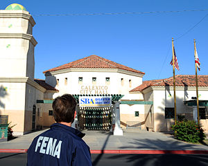
Calexico, California
City in California, United States
Distance: Approx. 10 meters
Latitude and longitude: 32.67888889,-115.49888889
Calexico () is a city in southern Imperial County, California. Situated on the Mexican border, it is linked economically with the much larger city of Mexicali, the capital of the Mexican state of Baja California. It is about 122 miles (196 km) east of San Diego and 62 miles (100 km) west of Yuma, Arizona.
Mexicali
Place in Baja California, Mexico
Distance: Approx. 3400 meters
Latitude and longitude: 32.66333333,-115.46777778
Mexicali (English: ; Spanish: [mexiˈkali] ) is the capital city of the Mexican state of Baja California. The city, which is the seat of the Mexicali Municipality, has a population of 689,775, according to the 2010 census, while the Calexico–Mexicali metropolitan area is home to 1,000,000 inhabitants on both sides of the Mexico–United States border. Mexicali is a regional economic and cultural hub for the border region of The Californias.
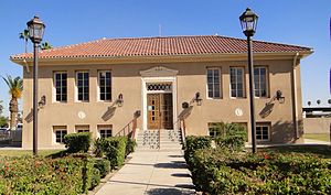
Calexico Mission School
Private school in California, United States
Distance: Approx. 1595 meters
Latitude and longitude: 32.66596,-115.4917
Calexico Mission Academy is a school under the control of the Southeastern California Conference of the Seventh-day Adventist Church. It is a part of the Seventh-day Adventist education system, the world's second largest Christian school system. It is located in Calexico, California, United States, and has just approximately 300 students in the K–12 levels, most of whom are from the neighbouring city of Mexicali, Mexico.
Calexico International Airport
International airport in Calexico, California, United States
Distance: Approx. 1706 meters
Latitude and longitude: 32.66944444,-115.51333333
Calexico International Airport (IATA: CXL, ICAO: KCXL, FAA LID: CXL) is a city-owned public-use airport located one mile (1.6 km) west of the central business district of Calexico, in Imperial County, California. The airport is mostly used for general aviation and to facilitate border crossing.

Vincent Memorial Catholic High School
Private, coeducational school in Calexico, , California, United States
Distance: Approx. 684 meters
Latitude and longitude: 32.6775,-115.50611111
Vincent Memorial Catholic High School is a private, Roman Catholic high school in Calexico, California. It is located in the Roman Catholic Diocese of San Diego The school serves approximately 300 students.

First federal electoral district of Baja California
Federal electoral district of Mexico
Distance: Approx. 3400 meters
Latitude and longitude: 32.66333333,-115.46777778
The first federal electoral district of Baja California (Distrito electoral federal 01 de Baja California) is one of the 300 electoral districts into which Mexico is divided for elections to the federal Chamber of Deputies and one of nine such districts in the state of Baja California. It elects one deputy to the lower house of Congress for each three-year legislative session by means of the first-past-the-post system. Votes cast in the district also count towards the calculation of proportional representation ("plurinominal") deputies elected from the first region.
Second federal electoral district of Baja California
Federal electoral district of Mexico
Distance: Approx. 4419 meters
Latitude and longitude: 32.65,-115.46666667
The second federal electoral district of Baja California (Distrito electoral federal 02 de Baja California) is one of the 300 electoral districts into which Mexico is divided for elections to the federal Chamber of Deputies and one of nine such districts in the state of Baja California. It elects one deputy to the lower house of Congress for each three-year legislative session by means of the first-past-the-post system. Votes cast in the district also count towards the calculation of proportional representation ("plurinominal") deputies elected from the first region.
Autonomous University of Baja California
Distance: Approx. 3309 meters
Latitude and longitude: 32.66335833,-115.46889444
The Autonomous University of Baja California (Spanish: Universidad Autónoma de Baja California, UABC) is a public institution of higher education in Baja California. Established in 1957, UABC has its headquarters located in the city of Mexicali. The UABC has three main campuses in the cities of Ensenada, Mexicali, and Tijuana.

Calexico West Port of Entry
Border crossing between Mexico and the U.S.
Distance: Approx. 1556 meters
Latitude and longitude: 32.665106,-115.496349
The Calexico West Port of Entry (formerly known simply as the Calexico Port of Entry, and sometimes called the "Downtown" port of entry) is one of two ports of entry in the Imperial Valley area of California. It is located in the business center of the Calexico-Mexicali metropolitan area that is divided by an international boundary. This crossing has easy access north to Interstate 8 via California State Route 111.
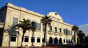
Calexico Carnegie Library
United States historic place
Distance: Approx. 1216 meters
Latitude and longitude: 32.66944444,-115.4925
The Calexico Carnegie Library is a Carnegie library located at 420 Heber Ave.
Calexico High School
Public school in Calexico, California
Distance: Approx. 1143 meters
Latitude and longitude: 32.6776,-115.4869
Calexico High School is a public high school located in Calexico, California.
Camp Salvation (Calexico)
Refugee camp along the Southern Emigrant Trail
Distance: Approx. 1126 meters
Latitude and longitude: 32.67002222,-115.49324166
Camp Salvation was a refugee camp set up on September 23, 1849, to help those traveling to the California Gold Rush. Emigrants were crossing the harsh Sonoran Desert to get to California through the Southern Emigrant Trail. The camp was located in the current town of Calexico, California.
Weather in this IP's area
clear sky
31 Celsius
31 Celsius
31 Celsius
31 Celsius
1005 hPa
38 %
1005 hPa
1004 hPa
10000 meters
2.6 m/s
3.48 m/s
109 degree
06:28:00
18:44:00