Country:
Region:
City:
Latitude and Longitude:
Time Zone:
Postal Code:
IP information under different IP Channel
ip-api
Country
Region
City
ASN
Time Zone
ISP
Blacklist
Proxy
Latitude
Longitude
Postal
Route
Luminati
Country
Region
4
City
sanktaegidi
ASN
Time Zone
Europe/Vienna
ISP
NETPLANET GmbH
Latitude
Longitude
Postal
IPinfo
Country
Region
City
ASN
Time Zone
ISP
Blacklist
Proxy
Latitude
Longitude
Postal
Route
db-ip
Country
Region
City
ASN
Time Zone
ISP
Blacklist
Proxy
Latitude
Longitude
Postal
Route
ipdata
Country
Region
City
ASN
Time Zone
ISP
Blacklist
Proxy
Latitude
Longitude
Postal
Route
Popular places and events near this IP address
Hofkirchen im Mühlkreis
Place in Upper Austria, Austria
Distance: Approx. 5194 meters
Latitude and longitude: 48.48388889,13.81194444
Hofkirchen im Mühlkreis is a municipality in the district of Rohrbach in the Austrian state of Upper Austria.

Pfarrkirchen im Mühlkreis
Place in Upper Austria, Austria
Distance: Approx. 6666 meters
Latitude and longitude: 48.50444444,13.82555556
Pfarrkirchen im Mühlkreis is a municipality in the district of Rohrbach in the Austrian state of Upper Austria.

Oberkappel
Place in Upper Austria, Austria
Distance: Approx. 8177 meters
Latitude and longitude: 48.55305556,13.77138889
Oberkappel is a municipality in the district of Rohrbach in the state of Upper Austria.

Neustift im Mühlkreis
Place in Upper Austria, Austria
Distance: Approx. 5296 meters
Latitude and longitude: 48.52888889,13.75611111
Neustift im Mühlkreis is a municipality in the district of Rohrbach in the Austrian state of Upper Austria.

Engelhartszell an der Donau
Place in Upper Austria, Austria
Distance: Approx. 2063 meters
Latitude and longitude: 48.5,13.73333333
Engelhartszell an der Donau (Central Bavarian: Engöhoartszö) is a municipality in the district of Schärding in the Austrian state of Upper Austria.
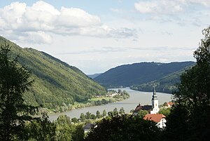
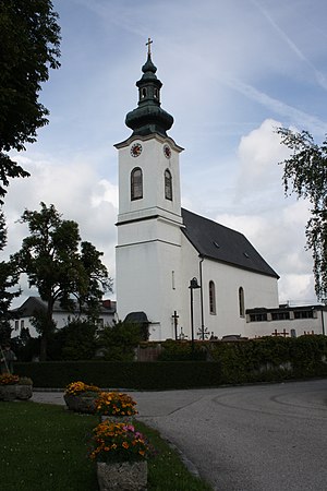
Sankt Aegidi
Place in Upper Austria, Austria
Distance: Approx. 621 meters
Latitude and longitude: 48.48333333,13.73333333
Sankt Aegidi is a municipality in the district of Schärding in the Austrian state of Upper Austria.

Waldkirchen am Wesen
Place in Upper Austria, Austria
Distance: Approx. 6605 meters
Latitude and longitude: 48.45,13.81666667
Waldkirchen am Wesen is a municipality in the district of Schärding in the Austrian state of Upper Austria.

Engelszell Abbey
Distance: Approx. 1942 meters
Latitude and longitude: 48.499,13.734
Engelszell Abbey (German: Stift Engelszell) was the last Trappist monastery in Austria. It is located near Engelhartszell an der Donau in the Innviertel in Upper Austria. In May 2023, the community of Engelszell was suppressed (ordered to be closed) by the Order of Cistercians of the Strict Observance.
Burg Vichtenstein
Distance: Approx. 8390 meters
Latitude and longitude: 48.5289,13.6522
Burg Vichtenstein is a castle in Upper Austria, Austria. Burg Vichtenstein is 531 metres (1,742 ft) above sea level. The Vichtenstein castle sits in the "sow forest" (upper Austria) above the Danube valley opposite to the market municipality of Upper Cell (Lower Bavaria).

Ranna Pumped Storage Power Station
Architectural structure
Distance: Approx. 4872 meters
Latitude and longitude: 48.51777778,13.78027778
Ranna Pumped Storage Power Station is a pumped storage hydroelectricity power plant of Upper Austria. It is located at lake Ranna which is situated at the river Danube. The Ranna Pumped Storage Power Station uses the dammed water of the river Ranna which merges into the river Danube closely behind the power station.
Sauwald
Distance: Approx. 6046 meters
Latitude and longitude: 48.50902778,13.67025
The Sauwald in Upper Austria is the largest part of the Bohemian Massif lying south of the Danube. Its plateau runs from Passau and Schärding on the Inn to Eferding.

Ranna (Danube)
River in Germany and Austria
Distance: Approx. 2691 meters
Latitude and longitude: 48.4741,13.7759
Ranna is a river of Bavaria, Germany and of Upper Austria, Austria. The Ranna springs southeast of Sonnen in Bavaria. It discharges at Rannamühl (Pfarrkirchen im Mühlkreis) from the left into the Danube.
Weather in this IP's area
light rain
5 Celsius
3 Celsius
4 Celsius
6 Celsius
1013 hPa
97 %
1013 hPa
949 hPa
4814 meters
2.4 m/s
8.49 m/s
239 degree
100 %
07:17:57
16:22:52


