Country:
Region:
City:
Latitude and Longitude:
Time Zone:
Postal Code:
IP information under different IP Channel
ip-api
Country
Region
City
ASN
Time Zone
ISP
Blacklist
Proxy
Latitude
Longitude
Postal
Route
IPinfo
Country
Region
City
ASN
Time Zone
ISP
Blacklist
Proxy
Latitude
Longitude
Postal
Route
MaxMind
Country
Region
City
ASN
Time Zone
ISP
Blacklist
Proxy
Latitude
Longitude
Postal
Route
Luminati
Country
Region
nh
City
amsterdam
ASN
Time Zone
Europe/Amsterdam
ISP
IP Visie Networking B.V.
Latitude
Longitude
Postal
db-ip
Country
Region
City
ASN
Time Zone
ISP
Blacklist
Proxy
Latitude
Longitude
Postal
Route
ipdata
Country
Region
City
ASN
Time Zone
ISP
Blacklist
Proxy
Latitude
Longitude
Postal
Route
Popular places and events near this IP address

Enneüs Heerma Bridge
Bridge in Amsterdam, Netherlands
Distance: Approx. 1923 meters
Latitude and longitude: 52.365,4.97666667
The Enneüs Heerma Bridge (Dutch: Enneüs Heermabrug) is a bridge in Amsterdam, Netherlands located in the new neighbourhood of IJburg, built on seven artificial islands in the IJmeer. It connects the district of Zeeburgereiland, on the eastern edge of the city, with Steigereiland, to the south. The bridge is named after Enneüs Heerma, who served as Leader of the Christian Democratic Appeal, alderman in Amsterdam and State Secretary twice under Prime Minister Ruud Lubbers.

Zeeburg
Distance: Approx. 2602 meters
Latitude and longitude: 52.36666667,4.96666667
Zeeburg (Dutch pronunciation: [ˈzeːˌbʏr(ə)x]) is a former borough of Amsterdam. It had 52,701 residents (January 2009) and an area of 19.31 km². The construction of new islands to the east called IJburg made it the most rapidly growing borough of Amsterdam.

IJburg
Neighbourhood in Amsterdam, Netherlands
Distance: Approx. 180 meters
Latitude and longitude: 52.355,4.99777778
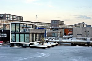
IJburg (Dutch pronunciation: [ˈɛibʏr(ə)x]) is a residential neighbourhood under construction in Amsterdam, Netherlands. It is situated in the IJmeer and is being built on artificial islands which have been raised from the lake. The Haveneiland, Rieteilanden, Steigereiland and Centrumeiland are already inhabited as of 2004.

Amsterdam Science Park
Science park in Amsterdam, Netherlands
Distance: Approx. 3216 meters
Latitude and longitude: 52.356,4.953
Amsterdam Science Park is a science park in the Oost borough of Amsterdam, Netherlands with foci on physics, mathematics, information technology and the life sciences. The 70 hectare (175 acre) park provides accommodations for science, business and housing. Resident groups include institutes of the natural science faculties of the University of Amsterdam, several research institutes, and related companies.

Diemen railway station
Railway station in the Netherlands
Distance: Approx. 2538 meters
Latitude and longitude: 52.34527778,4.96694444
Diemen (abbreviation: Dmn) is the main railway station of the municipality of Diemen, Netherlands. It is located on the Amsterdam–Zutphen railway between Amsterdam Science Park and Weesp. The station was first opened in 1882 and then closed in 1929.

Zeeburgereiland
Neighborhood of Amsterdam in North Holland, Netherlands
Distance: Approx. 2602 meters
Latitude and longitude: 52.36666667,4.96666667
The Zeeburgereiland is a triangular island on the east side of Amsterdam, in the Dutch province of North Holland. It lies between the Oranje Locks and the Diemerzeedijk and on the east is bordered by the IJ. Formerly an industrial area, the island is being redeveloped as part of the IJburg new neighbourhood. It is crossed by the A10 motorway and, since 2005, the IJ Tram line of the Amsterdam Tram system.
Rieteilanden
Neighborhood of Amsterdam in the Netherlands
Distance: Approx. 565 meters
Latitude and longitude: 52.35333333,4.99277778
Rieteilanden (Dutch pronunciation: [ˈrit.ɛiˌlɑndə(n)]) is a neighborhood of Amsterdam, Netherlands.

Vuurtoreneiland
Islet in North Holland, the Netherlands
Distance: Approx. 2047 meters
Latitude and longitude: 52.37183333,5.01413889
Vuurtoreneiland ("Lighthouse Island") is a small island in the IJmeer, Netherlands, just off the coast of Durgerdam. The island's main function is as a base for a lighthouse; a military fort on the island was abandoned in the 1930s.

Jewish Cemetery of Diemen
Cemetery in Amsterdam
Distance: Approx. 2024 meters
Latitude and longitude: 52.34361111,4.97777778
The Jewish Cemetery of Diemen, or Joodse Begraafplaats Diemen in Diemen, is owned by the Jewish community of Amsterdam, which is a subsection of the "Nederlands Israëlitisch Kerkgenootschap". It came into use in 1914 when the older Jewish Cemetery Zeeburg in Amsterdam reached its limit. In 1925 the cemetery was split by a train line.
Nescio Bridge
Bridge in Amsterdam IJburg neighbourhood
Distance: Approx. 1985 meters
Latitude and longitude: 52.3555,4.9711
The Nescio Bridge (or Nesciobrug in Dutch) is a cycle and footbridge in the Netherlands. This curved, steel suspension bridge, located in Amsterdam, is the country's first suspension bridge that carries only a cycle track and footway, and at almost 800 metres length it is also one of the country's longest cycle and footbridges. Additionally, it is the longest single cable suspension bridge in the Netherlands.

Sluishuis
Apartment building in Amsterdam, the Netherlands
Distance: Approx. 1626 meters
Latitude and longitude: 52.36444444,4.98138889
The Sluishuis (Dutch for 'sluice house') is an apartment building in IJburg, a neighbourhood on artificial islands in Amsterdam, the Netherlands. The building, which opened on 13 July 2022, was designed by Bjarke Ingels Group, an architecture firm based in Copenhagen and New York City, in collaboration with Rotterdam-based Barcode Architects. The Sluishuis is a sustainable building, with solar panels installed on the roof providing the energy for the lighting and heating, ventilation, and air conditioning in the complex.

Diemerpark
Park in Amsterdam, Netherlands
Distance: Approx. 971 meters
Latitude and longitude: 52.35243056,4.98693056
Diemerpark is the largest urban park in Amsterdam with an area of around 90 hectares, making it about twice as large as the famous Vondelpark in Amsterdam-Centrum. Diemerpark, located between IJburg and the Amsterdam-Rhine Canal, was opened in 2004 and offers numerous recreational opportunities for visitors.
Weather in this IP's area
few clouds
20 Celsius
20 Celsius
19 Celsius
21 Celsius
1006 hPa
64 %
1006 hPa
1006 hPa
10000 meters
4.12 m/s
170 degree
20 %
07:03:23
20:12:09
