Country:
 Netherlands
Region:
City:
Latitude and Longitude:
Time Zone:
Postal Code:
IP information under different IP Channel
ip-api
Country
Region
City
ASN
Time Zone
ISP
Blacklist
Proxy
Latitude
Longitude
Postal
Route
IPinfo
Country
Region
City
ASN
Time Zone
ISP
Blacklist
Proxy
Latitude
Longitude
Postal
Route
MaxMind
Country
Region
City
ASN
Time Zone
ISP
Blacklist
Proxy
Latitude
Longitude
Postal
Route
Luminati
Country
NLRegion
nb
City
shertogenbosch
ASN
Time Zone
Europe/Amsterdam
ISP
IP Visie Networking B.V.
Latitude
Longitude
Postal
db-ip
Country
Region
City
ASN
Time Zone
ISP
Blacklist
Proxy
Latitude
Longitude
Postal
Route
ipdata
Country
Region
City
ASN
Time Zone
ISP
Blacklist
Proxy
Latitude
Longitude
Postal
Route
Popular places and events near this IP address
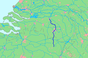
Dommel
River in Belgium, Netherlands
Distance: Approx. 1628 meters
Latitude and longitude: 51.695,5.30083333
The Dommel is a small river in Belgium and the Netherlands, left tributary of the Dieze. It is 120 km long, of which 85 km are in the Netherlands. The Dommel takes in water from the Keersop, Tongelreep, Run, Gender and Kleine Dommel streams and merges at 's-Hertogenbosch with the Aa stream to form the river Dieze, which subsequently flows towards the Meuse.

Aa (Meuse)
River in Netherlands
Distance: Approx. 1628 meters
Latitude and longitude: 51.695,5.30083333
The Aa (Dutch pronunciation: [aː]) is a small river in the Netherlands. It rises near Nederweert in the southeastern province of Limburg, in the Peel region. It flows northwest through the province of North Brabant towards 's-Hertogenbosch, roughly along the Zuid-Willemsvaart canal.

Binnendieze
River in Netherlands
Distance: Approx. 1578 meters
Latitude and longitude: 51.69583333,5.30083333
Binnendieze is the common name for the river and canal system within the city walls of 's-Hertogenbosch, the Netherlands. It is a tourist attraction. Near the north-west tip of the city walls, the confluence of the Binnendieze with the rivers Aa and Dommel forms the short river Dieze, tributary of the Meuse (Dutch: Maas).

Engelen
Place in North Brabant, Netherlands
Distance: Approx. 1802 meters
Latitude and longitude: 51.71666667,5.26666667
Engelen is a village in the Dutch province of North Brabant. It is part of the municipality of 's-Hertogenbosch.

Deuteren
Place in North Brabant, Netherlands
Distance: Approx. 2112 meters
Latitude and longitude: 51.68666667,5.26666667
Deuteren is a hamlet in the Dutch province of North Brabant. It is located in the municipality of 's-Hertogenbosch, about 2 km west of the city centre. According to the 19th-century historian A.J. van der Aa, this hamlet was the location of the first Reformed preaching in the area in 1566, by Cornelis van Diest.

's-Hertogenbosch railway station
Railway station located in 's-Hertogenbosch, the Netherlands
Distance: Approx. 1694 meters
Latitude and longitude: 51.69,5.293333
's-Hertogenbosch (Dutch pronunciation: [ˌsɛrtoːɣə(m)ˈbɔs] ) is a railway station located in 's-Hertogenbosch in North Brabant, Netherlands. The station and all services operating from it are operated by Nederlandse Spoorwegen.

HAS University of Applied Sciences
University of applied sciences in 's-Hertogenbosch, Netherlands
Distance: Approx. 1906 meters
Latitude and longitude: 51.68637778,5.28557222
HAS University of Applied Sciences (Dutch: HAS Green Academy) is an independent university of applied sciences, specialising in food, agriculture, horticulture, nature and environment. It is located in 's-Hertogenbosch, the regional capital of North Brabant and Venlo, Limburg. All bachelor programmes are accredited by the Dutch Flemish Accreditation Organisation.

't Misverstant
Restaurant in Den Bosch, Netherlands
Distance: Approx. 2391 meters
Latitude and longitude: 51.687325,5.30456667
Restaurant 't Misverstant is a restaurant in Den Bosch, Netherlands. It was a fine dining restaurant that was awarded one Michelin star in 1984 and retained that rating until 1995.

W2 Poppodium
Building in 's-Hertogenbosch, Netherlands
Distance: Approx. 1381 meters
Latitude and longitude: 51.6953,5.2967
Willem Twee Poppodium is a pop venue in the Dutch city 's-Hertogenbosch. The venue got its current name in 2017. It was formerly known as W2 poppodium (pop venue) and Willem II Concertzaal (concert venue).

Brabanthallen
Convention center in The Netherlands
Distance: Approx. 624 meters
Latitude and longitude: 51.701111,5.289722
The Brabanthallen (Dutch pronunciation: [ˈbraːbɑntˌɦɑlə(n)]; literally "Brabant Halls") is a convention center in 's-Hertogenbosch, Netherlands. Every year, it hosts several exhibitions, conferences, trade fairs, concerts and other big events. It is the third largest convention center in the Netherlands, after RAI Amsterdam and Jaarbeurs Utrecht.

Citadel of 's-Hertogenbosch
Fortress in the Netherlands
Distance: Approx. 1757 meters
Latitude and longitude: 51.69527778,5.30333333
The Citadel of 's-Hertogenbosch is a fortress on the north side of the town center of 's Hertogenbosch in the Netherlands. It was constructed from 1637 to 1642.

Jeroen Bosch Hospital
Hospital in Boxtel and Zaltbommel, Netherlands
Distance: Approx. 2105 meters
Latitude and longitude: 51.684555,5.277437
The Jeroen Bosch Hospital (Dutch: Jeroen Bosch Ziekenhuis, JBZ) is a general hospital in 's-Hertogenbosch. The building at the current location on the Henri Dunantlaan was opened in 2011.
Weather in this IP's area
moderate rain
14 Celsius
14 Celsius
13 Celsius
15 Celsius
1017 hPa
89 %
1017 hPa
1016 hPa
10000 meters
5.82 m/s
12.66 m/s
205 degree
90 %
08:10:20
18:36:54