Country:
Region:
City:
Latitude and Longitude:
Time Zone:
Postal Code:
IP information under different IP Channel
ip-api
Country
Region
City
ASN
Time Zone
ISP
Blacklist
Proxy
Latitude
Longitude
Postal
Route
IPinfo
Country
Region
City
ASN
Time Zone
ISP
Blacklist
Proxy
Latitude
Longitude
Postal
Route
MaxMind
Country
Region
City
ASN
Time Zone
ISP
Blacklist
Proxy
Latitude
Longitude
Postal
Route
Luminati
Country
Region
nb
City
waalwijk
ASN
Time Zone
Europe/Amsterdam
ISP
IP Visie Networking B.V.
Latitude
Longitude
Postal
db-ip
Country
Region
City
ASN
Time Zone
ISP
Blacklist
Proxy
Latitude
Longitude
Postal
Route
ipdata
Country
Region
City
ASN
Time Zone
ISP
Blacklist
Proxy
Latitude
Longitude
Postal
Route
Popular places and events near this IP address
Gouden Reael
Area in Amsterdam
Distance: Approx. 327 meters
Latitude and longitude: 52.38611111,4.88777778
The Gouden Reael is a traditional designation for an area of the city of Amsterdam in the Netherlands. It consists of the current neighborhood Westelijke Eilanden ("Western Islands", i.e. Prinseneiland, Bickerseiland and Realeneiland) plus the Westerdokseiland, Haarlemmerbuurt and Planciusbuurt.

Haarlemmertrekvaart
Distance: Approx. 329 meters
Latitude and longitude: 52.3856,4.8821
The Haarlemmertrekvaart [ˌhaːrlɛmərˈtrɛkfaːrt] (Haarlem's Tow-Canal) is a canal between Amsterdam and Haarlem in the province of North Holland, the Netherlands. It was dug in 1631, making it the oldest tow-canal in Holland. Travel on such canals was historically done by barges (or trekschuit in Dutch) which were towed by animals (and sometimes by man-power) on a path along the canal's edge (towpath).

Westelijke Eilanden
Neighborhood of Amsterdam in North Holland, Netherlands
Distance: Approx. 233 meters
Latitude and longitude: 52.38736111,4.88754167
Westelijke Eilanden (Dutch pronunciation: [ˌʋɛstələkə ˈʔɛilɑndə(n)]; "Western Islands") are three islands in the Centrum district of Amsterdam: Bickerseiland, Prinseneiland and Realeneiland. They are located to the south of the IJ and the Zeeheldenbuurt, to the north of the railway line between Central Station and Amsterdam-Sloterdijk, to the west of the Westerdok and to the east of the Planciusbuurt on the Westerkanaal. The Westelijke Eilanden form the core of the Golden Reael area, which also includes the adjacent Westerdok island, the Haarlemmerbuurt and the Planciusbuurt.
Amsterdam Westerpark train collision
2012 train crash in the Netherlands
Distance: Approx. 378 meters
Latitude and longitude: 52.387364,4.879003
On 21 April 2012 at 18:30 local time (16:30 UTC), two trains were involved in a head-on collision at Westerpark, near Sloterdijk, in the west of Amsterdam, Netherlands. Approximately 117 people were injured, one of whom later died in hospital. The collision is thought to have been caused by the driver of one of the trains passing a red signal.

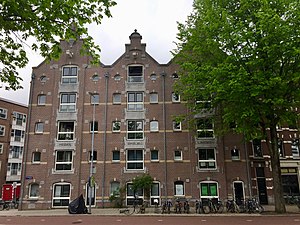
Warehouses Medan, Bindjeij and Laboean
Distance: Approx. 215 meters
Latitude and longitude: 52.390125,4.884599
As a continuation of the existing warehouses in the center of Amsterdam, around 1900 several new warehouses were built near the IJ bay. Most of these warehouses were converted into apartments at the end of 20th century.

Smallepadsgracht
Canal in Amsterdam
Distance: Approx. 133 meters
Latitude and longitude: 52.387442,4.885917
The Smallepadsgracht is a short and narrow canal in the Amsterdam-Centrum district of Amsterdam. It is in the Westelijke Eilanden (Western Islands) neighborhood.

Zoutkeetsgracht
Canal in Amsterdam
Distance: Approx. 230 meters
Latitude and longitude: 52.388333,4.887778
The Zoutkeetsgracht (Salt sheds canal) is a canal to the west of the center of Amsterdam.

Eilandsgracht
Canal in Amsterdam
Distance: Approx. 443 meters
Latitude and longitude: 52.384503,4.886831
The Eilandsgracht (Dutch pronunciation: [ˈɛilɑntsˌxrɑxt]) is a canal in Amsterdam between the Westelijke Eilanden (Western Islands) and the mainland. It originally ran between the mainland and two of the islands, Prinseneiland and Bickerseiland. In 1928 the section along Bickerseiland was filled in.

Prinseneilandsgracht
Canal in Amsterdam
Distance: Approx. 291 meters
Latitude and longitude: 52.385761,4.885921
The Prinseneilandsgracht is a canal in the Centrum district of Amsterdam. It runs between Prinseneiland, an artificial island, to the east and the mainland to the west. Until after World War II (1939–45) the canal was bordered almost exclusively by warehouses and factories.

Realengracht
Canal in Amsterdam
Distance: Approx. 260 meters
Latitude and longitude: 52.386943,4.887629
The Realengracht is a canal in Amsterdam, in the Centrum district.
Bickersgracht
Canal in Amsterdam
Distance: Approx. 434 meters
Latitude and longitude: 52.385085,4.888239
The Bickersgracht (Dutch pronunciation: [ˈbɪkərsˌxrɑxt]) is a canal in the center of Amsterdam at Westelijke Eilanden (Western Islands), but also a street.

Amsterdam Wooden Drydock II
Second floating dry dock of Amsterdam
Distance: Approx. 450 meters
Latitude and longitude: 52.388323,4.891018
Amsterdam Wooden Drydock II was the second floating dry dock of Amsterdam, and was moored in the Westerdok.
Weather in this IP's area
broken clouds
15 Celsius
14 Celsius
14 Celsius
15 Celsius
1016 hPa
84 %
1016 hPa
1015 hPa
10000 meters
5.66 m/s
180 degree
75 %
08:13:10
18:37:15


