Country:
 Netherlands
Region:
City:
Latitude and Longitude:
Time Zone:
Postal Code:
IP information under different IP Channel
ip-api
Country
Region
City
ASN
Time Zone
ISP
Blacklist
Proxy
Latitude
Longitude
Postal
Route
IPinfo
Country
Region
City
ASN
Time Zone
ISP
Blacklist
Proxy
Latitude
Longitude
Postal
Route
MaxMind
Country
Region
City
ASN
Time Zone
ISP
Blacklist
Proxy
Latitude
Longitude
Postal
Route
Luminati
Country
NLRegion
nh
City
amsterdam
ASN
Time Zone
Europe/Amsterdam
ISP
IP Visie Networking B.V.
Latitude
Longitude
Postal
db-ip
Country
Region
City
ASN
Time Zone
ISP
Blacklist
Proxy
Latitude
Longitude
Postal
Route
ipdata
Country
Region
City
ASN
Time Zone
ISP
Blacklist
Proxy
Latitude
Longitude
Postal
Route
Popular places and events near this IP address

El Tawheed Mosque
Mosque in Amsterdam, North Holland, Netherlands
Distance: Approx. 415 meters
Latitude and longitude: 52.3675,4.86388889
The El Tawheed Mosque is a Sunni mosque in Amsterdam, Netherlands. The foundation that manages the mosque was founded in 1986. The mosque is on Jan Hanzenstraat in the Old-West section of Amsterdam.

Vondelpark
Park in Amsterdam, Netherlands
Distance: Approx. 682 meters
Latitude and longitude: 52.358,4.868
The Vondelpark (Dutch pronunciation: [ˈvɔndəlˌpɑr(ə)k]) is a public urban park of 47 hectares (120 acres) in Amsterdam, Netherlands. It is part of the borough of Amsterdam-Zuid and situated west from the Leidseplein and the Museumplein. The park was opened in 1865 and originally named Nieuwe Park (English: New Park), but later renamed Vondelpark, after the 17th-century playwright and poet Joost van den Vondel.

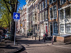
Amsterdam Oud-West
Neighbourhood of Amsterdam in North Holland, Netherlands
Distance: Approx. 300 meters
Latitude and longitude: 52.36666667,4.86666667
Oud-West is a neighborhood of Amsterdam, Netherlands, roughly covering the area between the Overtoom, a major thoroughfare west of the city centre, and the parallel De Clercqstraat, a shopping street. The exact boundaries are the Vondelpark and the Singelgracht, Hugo de Grootgracht and Kostverlorenvaart canals. The neighbourhood consists of two historically and demographically distinct communities: the Overtoombuurt in the south and the Kinkerbuurt in the north.

OT301
Legalized squat in Amsterdam
Distance: Approx. 428 meters
Latitude and longitude: 52.36015833,4.86569167
OT301 is a self-managed social centre in a legalized squat in the Dutch city of Amsterdam, located on Overtoom 301.
P.C. Hooftstraat
Street in Amsterdam
Distance: Approx. 964 meters
Latitude and longitude: 52.35944444,4.87805556
P.C. Hooftstraat is a high-end shopping street in Amsterdam, Netherlands. Built alongside the construction of nearby Vondel Park, it was named after Pieter Corneliszoon Hooft (1581–1647), a Dutch historian, poet and playwright, in 1876. The street is located in stadsdeel Amsterdam Oud-Zuid and runs from Stadhouderskade to Vondel Park.
Kinkerbuurt
Neighborhood of Amsterdam in North Holland, Netherlands
Distance: Approx. 335 meters
Latitude and longitude: 52.36694444,4.865
Kinkerbuurt (Dutch pronunciation: [ˈkɪŋkərˌbyːrt]) is the neighborhood in Amsterdam, Netherlands. Along with the Overtoombuurt, it is part of the neighborhood of Oud-West in the borough of Amsterdam-West. It was built at the beginning of the twentieth century when Amsterdam was being expanded.

Chassébuurt
Neighborhood of Amsterdam in North Holland, Netherlands
Distance: Approx. 360 meters
Latitude and longitude: 52.3671,4.8645
Chassébuurt is a neighborhood of Amsterdam, Netherlands. The Westermoskee is located in the neighborhood.

De Baarsjes
District of Amsterdam in North Holland, Netherlands
Distance: Approx. 715 meters
Latitude and longitude: 52.36777778,4.8575
De Baarsjes (Dutch pronunciation: [də ˈbaːrʃəs]) is a district (Dutch: wijk) in Amsterdam-West situated west of the city center of Amsterdam, Netherlands. Named after a former hamlet, urban development started in the 1920s. It contains the neighbourhoods Admiralenbuurt, Chassébuurt, Postjesbuurt, and Trompbuurt.
Grachtengordel
World Heritage Site in North Holland, Netherlands
Distance: Approx. 356 meters
Latitude and longitude: 52.36706,4.8645
The Grachtengordel ([ɣrɑxtə(ŋ)ˈɣɔrdəl], "canal belt (girdle);" known in English as the Canal District) is a neighborhood in Amsterdam, Netherlands located in the Centrum district. The seventeenth-century canals of Amsterdam, located in the center of Amsterdam, were added to the UNESCO World Heritage List in August 2010. The Amsterdam Canal District consists of the area around the city's four main canals: the Singel, the Herengracht, the Keizersgracht, and the Prinsengracht.

Blauwe Theehuis
Distance: Approx. 730 meters
Latitude and longitude: 52.35881944,4.87258333
The Blauwe Theehuis ("Blue Tea House") is a 1930s Modernist pavilion in the Vondelpark in Amsterdam, the capital city of the Netherlands. It is a ring-shaped building, somewhat reminiscent of a flying saucer. Originally a tea house, it is in use as a café and restaurant, surrounded by outside seating.

De Clercqstraat
Distance: Approx. 777 meters
Latitude and longitude: 52.3706,4.8697
The De Clercqstraat is a street in Amsterdam-West, Netherlands. It runs between the Singelgracht and Kostverlorenvaart. The street is named after Willem de Clercq (1795–1844), poet and Christian revivalist.

Westermoskee
Mosque in Netherlands
Distance: Approx. 438 meters
Latitude and longitude: 52.36611111,4.86055556
Westermoskee (Dutch pronunciation: [ˌʋɛstərmɔsˈkeː]; Turkish: Ayasofya Camii; English: Western Mosque) is a mosque located in Amsterdam, Netherlands. It is situated on the bank of the canalized river Schinkel in the Chassébuurt in De Baarsjes in the borough of Amsterdam-West. With a floor surface of 800 m2 and a capacity of 1700 people, it is the largest mosque in the Netherlands.
Weather in this IP's area
few clouds
20 Celsius
20 Celsius
19 Celsius
21 Celsius
1006 hPa
66 %
1006 hPa
1005 hPa
10000 meters
4.12 m/s
170 degree
20 %
07:03:55
20:12:42