Country:
Region:
City:
Latitude and Longitude:
Time Zone:
Postal Code:
IP information under different IP Channel
ip-api
Country
Region
City
ASN
Time Zone
ISP
Blacklist
Proxy
Latitude
Longitude
Postal
Route
Luminati
Country
Region
ia
City
urbana
ASN
Time Zone
America/Chicago
ISP
EIDG-AS1
Latitude
Longitude
Postal
IPinfo
Country
Region
City
ASN
Time Zone
ISP
Blacklist
Proxy
Latitude
Longitude
Postal
Route
db-ip
Country
Region
City
ASN
Time Zone
ISP
Blacklist
Proxy
Latitude
Longitude
Postal
Route
ipdata
Country
Region
City
ASN
Time Zone
ISP
Blacklist
Proxy
Latitude
Longitude
Postal
Route
Popular places and events near this IP address

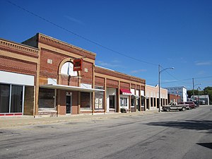
Urbana, Iowa
City in Iowa, United States
Distance: Approx. 1962 meters
Latitude and longitude: 42.22416667,-91.87805556
Urbana is a city in Benton County, Iowa, United States. The population was 1,554 at the time of the 2020 census. It is part of the Cedar Rapids Metropolitan Statistical Area.
KUNI (FM)
Radio station in Cedar Falls, Iowa
Distance: Approx. 8766 meters
Latitude and longitude: 42.31638889,-91.85861111
KUNI (90.9 MHz) is an FM radio station owned and operated by Iowa Public Radio (IPR) in Cedar Falls. It is one of two NPR outlets for Eastern Iowa; the other being WSUI in Iowa City. KUNI's transmitter is in Walker, Iowa, with its primary signal covering Cedar Falls, Waterloo, Cedar Rapids and Iowa City.

Benton Township, Benton County, Iowa
Township in Iowa, United States
Distance: Approx. 9643 meters
Latitude and longitude: 42.15388889,-91.88527778
Benton Township is one of twenty townships in Benton County, Iowa, United States. As of the 2000 census, its population was 900.

Harrison Township, Benton County, Iowa
Township in Iowa, United States
Distance: Approx. 8494 meters
Latitude and longitude: 42.25333333,-91.98861111
Harrison Township is one of twenty townships in Benton County, Iowa, United States. As of the 2000 census, its population was 354.

Polk Township, Benton County, Iowa
Township in Iowa, United States
Distance: Approx. 415 meters
Latitude and longitude: 42.24333333,-91.89027778
Polk Township is one of twenty townships in Benton County, Iowa, United States. As of the 2000 census, its population was 1,803.
James Greer McQuilkin Round Barn
United States historic place
Distance: Approx. 8004 meters
Latitude and longitude: 42.26416667,-91.79527778
The James Greer McQuilkin Round Barn is a historic building located near Eagle Center in rural Benton County, Iowa, United States. It was built in 1918 for James Greer McQuilkin. He farmed and sold barns that were designed by Johnston Brothers' Clay Works.
Spencers Grove, Iowa
Unincorporated community in Iowa, United States
Distance: Approx. 5108 meters
Latitude and longitude: 42.28444444,-91.86916667
Spencers Grove is an unincorporated community in Benton County, Iowa, United States.
Upper Stone Schoolhouse
United States historic place
Distance: Approx. 7363 meters
Latitude and longitude: 42.17444444,-91.89166667
The Upper Stone Schoolhouse, also known as the Scott House, is a historic One-room schoolhouse located east of Vinton, Iowa, United States. Built in 1875, this is an unusual example of a stone one-room school. There was only one other built in Benton County, about 2 miles (3.2 km) to the southeast.
Center Point–Urbana Community School District
Public school district in Center Point Iowa, United states
Distance: Approx. 9797 meters
Latitude and longitude: 42.188145,-91.791484
Center Point–Urbana Community School District (CPU) is a rural public school district headquartered in Center Point. The district is in Linn and Benton counties, and serves Center Point and Urbana.
Weather in this IP's area
overcast clouds
8 Celsius
5 Celsius
7 Celsius
8 Celsius
1012 hPa
91 %
1012 hPa
980 hPa
10000 meters
4.63 m/s
300 degree
100 %
06:47:30
16:54:56