157.254.216.2 - IP Lookup: Free IP Address Lookup, Postal Code Lookup, IP Location Lookup, IP ASN, Public IP
Country:
Region:
City:
Location:
Time Zone:
Postal Code:
ISP:
ASN:
language:
User-Agent:
Proxy IP:
Blacklist:
IP information under different IP Channel
ip-api
Country
Region
City
ASN
Time Zone
ISP
Blacklist
Proxy
Latitude
Longitude
Postal
Route
db-ip
Country
Region
City
ASN
Time Zone
ISP
Blacklist
Proxy
Latitude
Longitude
Postal
Route
IPinfo
Country
Region
City
ASN
Time Zone
ISP
Blacklist
Proxy
Latitude
Longitude
Postal
Route
IP2Location
157.254.216.2Country
Region
delaware
City
wilmington
Time Zone
America/New_York
ISP
Language
User-Agent
Latitude
Longitude
Postal
ipdata
Country
Region
City
ASN
Time Zone
ISP
Blacklist
Proxy
Latitude
Longitude
Postal
Route
Popular places and events near this IP address
Goldey–Beacom College
Private college in Wilmington, Delaware, US
Distance: Approx. 2154 meters
Latitude and longitude: 39.74202778,-75.68952778
Goldey–Beacom College is a private university in Wilmington, Delaware. Its setting is suburban with a campus of 24 acres (9.7 ha). It uses a semester-based academic calendar and is accredited to award certificates, associate, baccalaureate, master's, and doctoral degrees.
John Dickinson High School
Public school in Wilmington, Delaware, United States
Distance: Approx. 1055 meters
Latitude and longitude: 39.7284,-75.6734
The John Dickinson School, previously known as John Dickinson High School, is a public high school in the Pike Creek area of Wilmington, Delaware. It is one of five high schools in the Red Clay Consolidated School District and serves parts of Newport, Stanton, Hockessin, Wilmington, North Star, Pike Creek, Pike Creek Valley, Baynard Boulevard, and Brandywine Village.
Thomas McKean High School
Public school in Wilmington, Delaware, United States
Distance: Approx. 2406 meters
Latitude and longitude: 39.7574,-75.6668
Thomas McKean High School is a comprehensive public high school located on 301 McKennan's Church Road in unincorporated New Castle County, Delaware, with a Wilmington postal address. It is a part of the Red Clay Consolidated School District. The school opened in December 1966, and its first class graduated in June 1967.

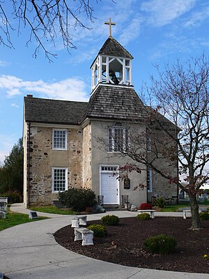
St. James Episcopal Church, Mill Creek
Historic church in Delaware, United States
Distance: Approx. 1963 meters
Latitude and longitude: 39.7186,-75.66064
St. James Episcopal Church, Mill Creek, also known as St. James Church or St.
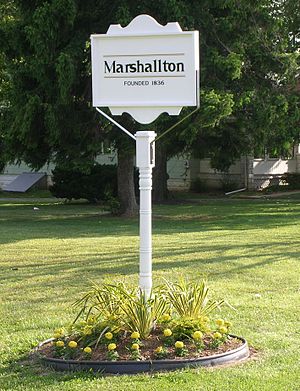
Marshallton, Delaware
Unincorporated community in Delaware, United States
Distance: Approx. 1508 meters
Latitude and longitude: 39.72555556,-75.65416667
Marshallton is an unincorporated community in Mill Creek Hundred, New Castle County, Delaware, United States. The community was founded in 1836 and is named for John Marshall, mill owner.

Red Clay Creek Presbyterian Church
Historic church in Delaware, United States
Distance: Approx. 1869 meters
Latitude and longitude: 39.75194444,-75.65972222
Red Clay Creek Presbyterian Church, also known as McKennan's Church, is a historic Presbyterian church located at Mill Creek and McKennan's Church Roads near Newark, New Castle County, Delaware. It was built in 1853, and is a two-story, stuccoed stone structure. It was originally rectangular in plan, but additions have given it an irregular cruciform shape.

J. McCormack Farm
United States historic place
Distance: Approx. 2244 meters
Latitude and longitude: 39.75472222,-75.65666667
J. McCormack Farm was a historic farm near Wilmington, New Castle County, Delaware. The property included four contributing buildings. They were a stone house (c.

Montgomery House (Wilmington, Delaware)
Historic house in Delaware, United States
Distance: Approx. 646 meters
Latitude and longitude: 39.73149,-75.67075
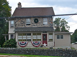
Montgomery House is a historic home located near Wilmington, New Castle County, Delaware. It was built in 1789, and is a two- to three-story, three bay wide, gable roofed, Penn Plan banked dwelling of uncoursed fieldstone. It has a two-story frame addition at the south side of the house that dates from the 1950s.

Hersey-Duncan House
Historic house in Delaware, United States
Distance: Approx. 2142 meters
Latitude and longitude: 39.734942,-75.640706
Hersey-Duncan House is a historic home located near Wilmington, New Castle County, Delaware. It was built about 1800, and is a two-story, five-bay, center passage plan dwelling with a gable roof and two-story, stone, rear kitchen wing. It is in a vernacular Federal style.

Thomas Justis House
Historic house in Delaware, United States
Distance: Approx. 634 meters
Latitude and longitude: 39.73416667,-75.65861111
Thomas Justis House is a historic home located near Wilmington, New Castle County, Delaware. The original section was built between 1804 and 1816, as a stuccoed stone, two-story, three-bay, gable-roofed building laid out on a double pile, side passage plan. About 1900, a frame, two-story, two-bay, gable-roofed wing was built on the northeast endwall.

Justis–Jones House
Historic house in Delaware, United States
Distance: Approx. 2332 meters
Latitude and longitude: 39.74333333,-75.64027778
Justis–Jones House, also known as the Henry S. McComb House, is a historic home located near Wilmington, New Castle County, Delaware. The original section was built about 1840, and is a two-story, two-bay, nearly square gable-roofed fieldstone dwelling in a vernacular Greek Revival style. A frame rear wing constructed in two phases between 1904 and 1924.
Milltown, Delaware
Unincorporated community in Delaware, United States
Distance: Approx. 554 meters
Latitude and longitude: 39.73083333,-75.66611111
Milltown is an unincorporated community in New Castle County, Delaware, United States. Milltown is located at the intersection of Delaware Route 7 and Milltown Road west of Wilmington.
Weather in this IP's area
snow
2 Celsius
-1 Celsius
2 Celsius
2 Celsius
1011 hPa
61 %
1011 hPa
1004 hPa
10000 meters
2.83 m/s
3.67 m/s
23 degree
86 %
