Country:
Region:
City:
Latitude and Longitude:
Time Zone:
Postal Code:
IP information under different IP Channel
ip-api
Country
Region
City
ASN
Time Zone
ISP
Blacklist
Proxy
Latitude
Longitude
Postal
Route
IPinfo
Country
Region
City
ASN
Time Zone
ISP
Blacklist
Proxy
Latitude
Longitude
Postal
Route
MaxMind
Country
Region
City
ASN
Time Zone
ISP
Blacklist
Proxy
Latitude
Longitude
Postal
Route
Luminati
Country
Region
qc
City
fossambaultsurlelac
ASN
Time Zone
America/Toronto
ISP
CC-3272
Latitude
Longitude
Postal
db-ip
Country
Region
City
ASN
Time Zone
ISP
Blacklist
Proxy
Latitude
Longitude
Postal
Route
ipdata
Country
Region
City
ASN
Time Zone
ISP
Blacklist
Proxy
Latitude
Longitude
Postal
Route
Popular places and events near this IP address
CHOI-FM
Radio station in Quebec City, Quebec
Distance: Approx. 9573 meters
Latitude and longitude: 46.82138889,-71.49611111
CHOI-FM is a French-language FM radio station that broadcasts on the frequency 98.1 MHz out of Quebec City, Quebec, Canada, with a talk format. Locally, it is known as Radio X (a reference to "Generation X", as most of CHOI's listeners consider themselves). It has been owned by Genex Communications since July 1996.
Shannon, Quebec
City in Quebec, Canada
Distance: Approx. 8490 meters
Latitude and longitude: 46.88333333,-71.51666667
Shannon is a city in Quebec, Canada, along the Jacques-Cartier River northwest of Quebec City. It was formed in December 1946 when it separated from the territory of Sainte-Catherine-de-Fossambault, following protests of this part of the population against the municipal taxes. The community was founded by Irish immigrants and once contained a substantial English-speaking population, though today it is chiefly French-speaking.

Lac-Sergent
City in Quebec, Canada
Distance: Approx. 8966 meters
Latitude and longitude: 46.85,-71.73333333
Lac-Sergent is a village situated alongshore Sergent Lake in Portneuf Regional County Municipality in the Canadian province of Quebec. It is about 50 kilometres (31 mi) north-west of Quebec City.

Sainte-Catherine-de-la-Jacques-Cartier
City in Quebec, Canada
Distance: Approx. 227 meters
Latitude and longitude: 46.85,-71.61666667
Sainte-Catherine-de-la-Jacques-Cartier (French pronunciation: [sɛ̃t katʁin də la ʒak kaʁtje]) is a town in Quebec, Canada, located in the regional county municipality of La Jacques-Cartier, in the administrative region of Capitale-Nationale. The Jacques-Cartier River passes through the city. Local attractions include bicycle paths, the Anne-Hébert Social and Cultural Centre, the Ice Hotel and the Duchesnay Inn.

Fossambault-sur-le-Lac
City in Quebec, Canada
Distance: Approx. 2068 meters
Latitude and longitude: 46.86666667,-71.61666667
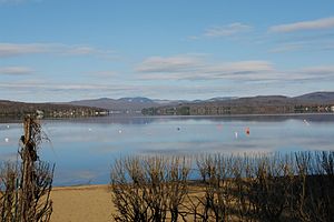
Fossambault-sur-le-Lac is a city in the south part of Quebec, Canada, in La Jacques-Cartier Regional County Municipality, just north of Quebec City. It had a population of 2,327 as of the Canada 2021 Census. It is located near Saint-Joseph Lake.
Jules-Carpentier Ecological Reserve
Distance: Approx. 8710 meters
Latitude and longitude: 46.7778,-71.6658
Jules-Carpentier Ecological Reserve is an ecological reserve in Quebec, Canada. It was established on May 18, 2000. The reserve is named after local Jules Carpentier.

Lac-Saint-Joseph
City in Quebec, Canada
Distance: Approx. 8069 meters
Latitude and longitude: 46.91666667,-71.65
Lac-Saint-Joseph is a town in Quebec, Canada, located on the namesake Saint-Joseph Lake.

Rivière aux Pins (Saint-Joseph Lake)
River in Quebec, Canada
Distance: Approx. 5955 meters
Latitude and longitude: 46.90111,-71.62611
The Rivière aux Pins is a watercourse flowing in several municipalities of La Jacques-Cartier Regional County Municipality, in the administrative region of Capitale-Nationale, in Quebec, in Canada. The municipalities crossed by this 32.7 kilometres (20.3 mi) river (measured by the current), are Saint-Gabriel-de-Valcartier (18.9 km), Shannon (11,0 km) and Fossambault-sur-le-Lac (2.8 km). The lower part of the Pins river valley is mainly served by the Duchesnay road and the Kilkenny street (west bank).

Saint-Joseph Lake
Lake of dam in Capitale-Nationale, Quebec
Distance: Approx. 7640 meters
Latitude and longitude: 46.91389,-71.64417
Saint-Joseph Lake (French: Lac Saint-Joseph) is a freshwater body located in the La Jacques-Cartier Regional County Municipality, in the administrative region of Capitale-Nationale, in the province of Quebec, Canada. Recreational and tourist activities, especially vacationing, are the main economic activity around the lake; forestry, second. The shores all around Lake Saint-Joseph are highly renowned for vacationing, particularly because of the forest, mountain environment, recreational tourism, road access, proximity to the city of Quebec and especially the Duchesnay tourist resort which surrounds Lake Saint-Joseph three-quarters (west, north and east).

Duchesnay tourist resort
Building in Quebec, Canada
Distance: Approx. 3029 meters
Latitude and longitude: 46.86944444,-71.64027778
The Station touristique Duchesnay (French: "Station touristique Duchesnay"), formerly known as the “Sanctuaire de Duchesnay”, is a resort park located on the edge of Saint-Joseph Lake, in the La Jacques-Cartier Regional County Municipality, in the administrative region of Capitale-Nationale, in Quebec (Canada). The territory of this station extends over several municipalities: Lac-Saint-Joseph, Sainte-Catherine-de-la-Jacques-Cartier (to the south), Lac-Sergent and Saint-Raymond (north). Duchesnay is operated by Société des établissements de plein air du Québec (SÉPAQ).

Sergent Lake
Lake in Capitale-Nationale, Québec, Canada
Distance: Approx. 8205 meters
Latitude and longitude: 46.8758,-71.7155
Lake Sergent is a freshwater body located in the municipality of Lac-Sergent, in the Portneuf Regional County Municipality, in the administrative region of Capitale-Nationale, in Quebec, in Canada. The shores of Lac Sergent have a high density of residences and chalets, particularly in the village of Lac-Sergent, located south of the lake. Vacationing began around 1896 at Lac Sergent, whereas at Sept-Îles Lake it dates back to 1857–1858.
Tourbière-de-Shannon Ecological Reserve
Distance: Approx. 8197 meters
Latitude and longitude: 46.90246,-71.542931
The Tourbière-de-Shannon Ecological Reserve (French: Réserve écologique de la Tourbière-de-Shannon) is a strictly protected ecological reserve of Quebec, Canada.
Weather in this IP's area
clear sky
7 Celsius
7 Celsius
6 Celsius
10 Celsius
1032 hPa
79 %
1032 hPa
1016 hPa
10000 meters
1.03 m/s
07:09:00
17:53:42

