157.20.122.69 - IP Lookup: Free IP Address Lookup, Postal Code Lookup, IP Location Lookup, IP ASN, Public IP
Country:
Region:
City:
Location:
Time Zone:
Postal Code:
IP information under different IP Channel
ip-api
Country
Region
City
ASN
Time Zone
ISP
Blacklist
Proxy
Latitude
Longitude
Postal
Route
Luminati
Country
ASN
Time Zone
Asia/Jakarta
ISP
PT. Borneo Cakrawala Media
Latitude
Longitude
Postal
IPinfo
Country
Region
City
ASN
Time Zone
ISP
Blacklist
Proxy
Latitude
Longitude
Postal
Route
IP2Location
157.20.122.69Country
Region
jawa timur
City
gresik
Time Zone
Asia/Jakarta
ISP
Language
User-Agent
Latitude
Longitude
Postal
db-ip
Country
Region
City
ASN
Time Zone
ISP
Blacklist
Proxy
Latitude
Longitude
Postal
Route
ipdata
Country
Region
City
ASN
Time Zone
ISP
Blacklist
Proxy
Latitude
Longitude
Postal
Route
Popular places and events near this IP address
Petrokimia Stadium
Stadium in East Java, Indonesia
Distance: Approx. 2002 meters
Latitude and longitude: -7.15994444,112.63902778
Petrokimia Stadium (also known as Tri Dharma Stadium) is a multi-use stadium in Gresik Regency, East Java, Indonesia. It has a capacity of 25,000 people and is the home of Gresik United (formerly known as Petrokimia Putra).
Kamal Harbour
Port on Madura Island in Indonesia
Distance: Approx. 7135 meters
Latitude and longitude: -7.16778,112.71917
Kamal is a port, on Madura Island in Indonesia. It is a ferry port, and connects with Surabaya's harbour of Tanjung Perak.
Raid on Griessie
Part of the Napoleonic Wars
Distance: Approx. 1802 meters
Latitude and longitude: -7.13805556,112.65277778
The Raid on Griessie was a British attack on the Dutch port of Griessie (later renamed Gresik) on Java in the Dutch East Indies in December 1807 during the Napoleonic Wars. The raid was the final action in a series of engagements fought by the British squadron based in the Indian Ocean against the Dutch naval forces in Java. It completed the destruction of the Dutch squadron with the scuttling of three ships of the line, the last Dutch warships in the region.

Gelora Bung Tomo Stadium
Sports venue in Surabaya, Indonesia
Distance: Approx. 8558 meters
Latitude and longitude: -7.22327778,112.62272222
Gelora Bung Tomo Stadium is a multi-purpose stadium in Benowo, Surabaya, East Java, Indonesia. It is a part of the Surabaya Sports Center. The rest of the sports complex consists of an indoor stadium, a racing circuit, a roller skating track, three football training pitches, and a mosque.
Trunojoyo University
Distance: Approx. 7951 meters
Latitude and longitude: -7.12775,112.723083
Trunojoyo University (Unijoyo) is a public university in the Bangkalan Regency (on Madura island), in East Java province, Indonesia. Unijoyo was redesignated as a public university under the Presidential Decree dated July 5, 2001. The college was inaugurated on 23 July 2001 by President Abdurrahman Wahid.

Gresik Regency
Metropolitan regency in Indonesia
Distance: Approx. 2 meters
Latitude and longitude: -7.15388889,112.65611111
Gresik Regency (older spelling: Grissee, Javanese: ꦒꦽꦱꦶꦏ꧀) is a regency within East Java Province of Indonesia. As well as a large part of the northern and western suburbs of the city of Surabaya, it includes the offshore Bawean Island, some 125 km to the north of Java and Madura. Almost a third of the Gresik Regency's area is the coastal area; the Districts in this zone are Kebomas District, (part of) Gresik District, Manyar District, Bungah District, and Ujungpangkah District.

Petrokimia Gresik
Indonesian fertilizer company
Distance: Approx. 1807 meters
Latitude and longitude: -7.156935,112.640031
Petrokimia Gresik is a fertilizer company located in Gresik, East Java, Indonesia, which was initially established under the name 'Project of Petrokimia Surabaya'. The construction agreement was mutually signed on August 10, 1964 with the effective date on December 8, 1964. The project was officially inaugurated by the President of the Republic of Indonesia on July 10, 1972.

Gelora Joko Samudro Stadium
Stadium in Gresik Regency, Indonesia
Distance: Approx. 3555 meters
Latitude and longitude: -7.18538889,112.65075
Gelora Joko Samudro is a multi-purpose stadium in the town of Kebomas, Gresik Regency, East Java, Indonesia. It is mostly used for football matches and is the new home stadium of Gresik United. The stadium hold 25,000 spectators.

Port of Tanjung Perak
Port in Indonesia
Distance: Approx. 8871 meters
Latitude and longitude: -7.19833333,112.72277778
Port of Tanjung Perak (Indonesian: Pelabuhan Tanjung Perak) is the second busiest sea port in Indonesia, located at Surabaya, East Java. It is the main port for the eastern part of the island of Java. The port is accessed from the north through the Madura Strait, a 25-mile (40-kilometer) long, 100-meter (110-yard) wide, and 9.5-meter (31-foot) deep channel between East Java and Madura Island.
Java Integrated Industrial and Port Estate
Special Economic Zone in Java, Indonesia
Distance: Approx. 9343 meters
Latitude and longitude: -7.085696,112.60681
Java Integrated Industrial and Ports Estate or JIIPE is an industrial area, integrated with deep sea port, residential estate and industrial area at Gresik, East Java, Indonesia. The project is located 24 km from Surabaya. It is a Public Private Partnership development, which is jointly developed by PT Usaha Era Pratama Nusantara, a subsidiary of PT AKR Corporindo Tbk, and PT Berlian Jasa Terminal Indonesia, a subsidiary of state owned company Pelindo III. JIIPE is located strategically in the mouth of Madura Strait, the first integrated industrial city and port development project in Indonesia.

Surabaya Dock of 3,500 tons
Floating dry dock in Indonesia from 1913 to 1956
Distance: Approx. 9702 meters
Latitude and longitude: -7.201023,112.729993
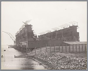
Surabaya Dock of 3,500 tons was a floating dry dock which served in Indonesia from about 1913 till about 1956.

Surabaya Dock of 14,000 tons
Floating dry dock in the Dutch East Indies
Distance: Approx. 9702 meters
Latitude and longitude: -7.201023,112.729993
The Surabaya Dock of 14,000 tons was a floating dry dock which served in the Dutch East Indies and Indonesia from 1916 until at least the late 1950s.
Weather in this IP's area
overcast clouds
26 Celsius
26 Celsius
26 Celsius
26 Celsius
1009 hPa
91 %
1009 hPa
1007 hPa
10000 meters
1.46 m/s
2.23 m/s
253 degree
100 %
