157.167.126.140 - IP Lookup: Free IP Address Lookup, Postal Code Lookup, IP Location Lookup, IP ASN, Public IP
Country:
Region:
City:
Location:
Time Zone:
Postal Code:
IP information under different IP Channel
ip-api
Country
Region
City
ASN
Time Zone
ISP
Blacklist
Proxy
Latitude
Longitude
Postal
Route
Luminati
Country
Region
t
City
charlotteamalie
ASN
Time Zone
America/St_Thomas
ISP
Forcepoint Cloud Ltd
Latitude
Longitude
Postal
IPinfo
Country
Region
City
ASN
Time Zone
ISP
Blacklist
Proxy
Latitude
Longitude
Postal
Route
IP2Location
157.167.126.140Country
Region
virgin islands, u.s.
City
charlotte amalie
Time Zone
America/St_Thomas
ISP
Language
User-Agent
Latitude
Longitude
Postal
db-ip
Country
Region
City
ASN
Time Zone
ISP
Blacklist
Proxy
Latitude
Longitude
Postal
Route
ipdata
Country
Region
City
ASN
Time Zone
ISP
Blacklist
Proxy
Latitude
Longitude
Postal
Route
Popular places and events near this IP address

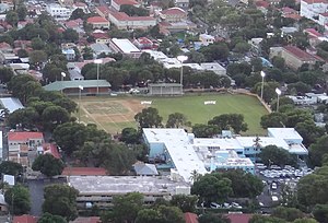
Lionel Roberts Stadium
Stadium in Saint Thomas, US Virgin Islands
Distance: Approx. 451 meters
Latitude and longitude: 18.34462778,-64.92754444
Lionel Roberts Stadium is a multi-use stadium in Charlotte Amalie, United States Virgin Islands. It is currently used mostly for soccer matches, as well as baseball and American football. The stadium holds 9,000.

Blackbeard's Castle
United States historic place
Distance: Approx. 246 meters
Latitude and longitude: 18.34384167,-64.92959167
Blackbeard's Castle is one of five National Historic Landmarks in the U.S. Virgin Islands. It is located in the city of Charlotte Amalie, on the island of St. Thomas.
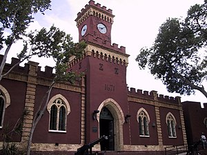
Fort Christian
United States historic place
Distance: Approx. 157 meters
Latitude and longitude: 18.34083333,-64.92972222
Fort Christian is a Dano-Norwegian-built fort in Charlotte Amalie, Saint Thomas, U.S. Virgin Islands. Built 1672-1680, early in the first successful colonial establishment on the island, the fort served as a critical point of defense and government during the entire period of Dano-Norwegian, and later Danish, administration, which ended in 1917 with the sale of the islands to the United States. It currently holds the St.

St. Thomas Synagogue
Reform synagogue in the US Virgin Islands
Distance: Approx. 401 meters
Latitude and longitude: 18.34472222,-64.93305556
St. Thomas Synagogue, officially Congregation Beracha Veshalom Vegmiluth Hasadim (Hebrew: קהל קדוש ברכה ושלום וגמילות חסדים) or The Hebrew Congregation of St. Thomas, is a historic Reform Jewish synagogue located at 2116 Crystal Gade, Queens Quarters, in Charlotte Amalie on the island of Saint Thomas in the U.S. Virgin Islands.
All Saints Cathedral School
College preparatory school in St. Thomas, United States Virgin Islands, United States
Distance: Approx. 342 meters
Latitude and longitude: 18.3449,-64.9314
The All Saints Cathedral School, founded in 1928, is a private Episcopal college preparatory day school located on the island of St. Thomas in the United States Virgin Islands on Commandant Gade, or Garden Street. It serves students from all over the island.
Sts. Peter & Paul School
Private coeducational school in St. Thomas, United States
Distance: Approx. 204 meters
Latitude and longitude: 18.34361111,-64.93138889
Sts. Peter & Paul School is a private Roman Catholic high school in St. Thomas, United States Virgin Islands.

Estate Catherineberg
Distance: Approx. 356 meters
Latitude and longitude: 18.34388889,-64.93333333
Estate Catherineberg is a historic mansion on Denmark Hill in Charlotte Amalie, on Saint Thomas island, in the territory of the United States Virgin Islands. It is owned by the Virgin Islands territorial government and previously served as a residence for the governor of the U.S. Virgin Islands. The last governor to reside there was Charles Turnbull.
Fort Christian, U.S. Virgin Islands
Distance: Approx. 157 meters
Latitude and longitude: 18.34083333,-64.92972222
Fort Christian is a settlement on the island of Saint Thomas in the United States Virgin Islands.

Emancipation Garden
Distance: Approx. 89 meters
Latitude and longitude: 18.3412,-64.9303
Emancipation Garden is a park in Saint Thomas, U.S. Virgin Islands The park was built to commemorate the freeing of the slaves which took place on July 3, 1848. A commemorative plaque, a bronze bust of a freed slave blowing a conch shell, and a replica of the Liberty Bell are featured. The park was also ringed with a fence of old ships' anchor chain and cannons recovered from the harbor.
Cathedral Church of All Saints (St. Thomas, U.S. Virgin Islands)
Church in United States Virgin Islands, United States
Distance: Approx. 355 meters
Latitude and longitude: 18.34500278,-64.93145833
The Cathedral Church of All Saints is an Episcopal cathedral in St. Thomas, U.S. Virgin Islands, United States. It is the seat of the Diocese of the Virgin Islands and it is located in the City of Charlotte Amalie.
Charlotte Amalie Historic District
United States historic place
Distance: Approx. 369 meters
Latitude and longitude: 18.345,-64.931944
The Charlotte Amalie Historic District in Charlotte Amalie in Saint Thomas, U.S. Virgin Islands is a 165.3 acres (0.669 km2) historic district which was listed on the National Register of Historic Places in 1976. The district then included 574 contributing buildings, three contributing structures, and a contributing object. It included the entire Charlotte Amalie National Historic Site (also known as St.
Hamburg-America Shipping Line Administrative Offices
United States historic place
Distance: Approx. 77 meters
Latitude and longitude: 18.341667,-64.931389
The Hamburg-America Shipping Line Administrative Offices, also known as United States District Courts Building, in Charlotte Amalie in Saint Thomas, U.S. Virgin Islands, was built in 1914. It was listed on the National Register of Historic Places in 1978. It was built for the Hamburg-Amerikanische Packetfahrt Aktien Gesellschaft and held offices for the Superintendent Counsul and also for the Imperial German Consulate.
Weather in this IP's area
clear sky
26 Celsius
27 Celsius
25 Celsius
26 Celsius
1017 hPa
83 %
1017 hPa
1013 hPa
10000 meters
3.09 m/s
80 degree


