Country:
Region:
City:
Latitude and Longitude:
Time Zone:
Postal Code:
IP information under different IP Channel
ip-api
Country
Region
City
ASN
Time Zone
ISP
Blacklist
Proxy
Latitude
Longitude
Postal
Route
Luminati
Country
ASN
Time Zone
Asia/Jakarta
ISP
PT BUKIT MAKMUR MANDIRI UTAMA
Latitude
Longitude
Postal
IPinfo
Country
Region
City
ASN
Time Zone
ISP
Blacklist
Proxy
Latitude
Longitude
Postal
Route
db-ip
Country
Region
City
ASN
Time Zone
ISP
Blacklist
Proxy
Latitude
Longitude
Postal
Route
ipdata
Country
Region
City
ASN
Time Zone
ISP
Blacklist
Proxy
Latitude
Longitude
Postal
Route
Popular places and events near this IP address
Pluit
Administrative village in Penjaringan, Jakarta
Distance: Approx. 1331 meters
Latitude and longitude: -6.11666667,106.78333333
Pluit is an administrative village (kelurahan) located in Penjaringan, Jakarta. In majority, of its residents are mainly inhabited by ethnic Chinese Indonesians. Pluit is a bustling area with residential and commercial establishments supported by modern amenities.

Sunda Kelapa
Port in Indonesia
Distance: Approx. 2202 meters
Latitude and longitude: -6.123871,106.80861
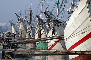
Sunda Kelapa (Sundanese: ᮞᮥᮔ᮪ᮓ ᮊᮜᮕ, Sunda Kalapa) is the old port of Jakarta, located on the estuary of the Ciliwung River. "Sunda Kalapa" (Sundanese: "Coconut of Sunda") is the original name, and it was the main port of the Sunda Kingdom. The port is situated in Penjaringan District, of North Jakarta, Indonesia.

Maritime Museum (Indonesia)
Maritime museum in Jakarta , Indonesia
Distance: Approx. 2136 meters
Latitude and longitude: -6.12698333,106.8083
The Maritime Museum (Indonesian: Museum Bahari) is located in the old Sunda Kelapa harbor area in Penjaringan Administrative Village, Penjaringan Subdistrict, Jakarta, Indonesia. The museum was inaugurated inside the former Dutch East India Company warehouses. The museum focuses on the maritime history of Indonesia and the importance of the sea to the economy of present-day Indonesia.

1740 Batavia massacre
Pogrom of ethnic Chinese in the Dutch East Indies
Distance: Approx. 1195 meters
Latitude and longitude: -6.13083333,106.79916667
The 1740 Batavia massacre (Dutch: Chinezenmoord, lit. 'Murder of the Chinese'; Indonesian: Geger Pacinan, lit. 'Chinatown tumult') was a massacre and pogrom of ethnic Chinese residents of the port city of Batavia, Dutch East Indies, (present-day Jakarta) in the Dutch East Indies. It was carried out by European soldiers of the Dutch East India Company and allied members of other Batavian ethnic groups. The violence in the city lasted from 9 October 1740, until 22 October, with minor skirmishes outside the walls continuing late into November that year.

Angke River
River in Jakarta, Indonesia
Distance: Approx. 1613 meters
Latitude and longitude: -6.124396,106.774703
The Angke River (Indonesian: Kali Angke or Sungai Angke, Chinese: 紅溪; pinyin: Hóng xī; Pe̍h-ōe-jī: Âng-khe) is a 91.25-kilometre (56.70 mi) long river in Jakarta, Indonesia. The river flows from the Bogor area of West Java, passing through the cities of Tangerang (Banten) and Jakarta into the Java Sea via the Cengkareng Drain. The river is connected with the Cisadane River by the Mookervaart Canal.

Angke Mosque
Mosque in Tambora, Jakarta, Indonesia
Distance: Approx. 1950 meters
Latitude and longitude: -6.143371,106.795797
Angke Mosque, officially known as Masjid Jami Angke or Masjid Al-Anwar, located at Tambora, Jakarta, Indonesia. It is one of the oldest mosques in Jakarta. Well-maintained and retaining its original form, the mosque has been called by the historian Denys Lombard as 'une des plus élégantes de la vieille villa' (one of the most elegant of the old town).

Grogol River
River in Indonesia
Distance: Approx. 1073 meters
Latitude and longitude: -6.13611111,106.78527778
The Grogol River (Kali Grogol) is a small river in the western part of the Special Capital Region of Jakarta, Indonesia. The lower portions of the original river have been channelized with levees built along its banks, but flooding remains a real concern. Illegal buildings built along its banks were removed in 2014, and fifty-eight village families were provided with replacement housing, but most of them could not be accommodated.

Green Bay Pluit
Shopping mall, Residential in Jakarta, Indonesia
Distance: Approx. 1921 meters
Latitude and longitude: -6.11173,106.78134
Green Bay Pluit is a mixed development complex with an area of about 12.5 hectares (31 acres), located at Pluit in North Jakarta, Indonesia. This super-block is built on the seafront, which has a Mall, 12 towers of apartment and condominium. It has a botanical garden of 3 hectares (7.4 acres) area & water sports recreation facilities.

Jami Kampung Baru Inpak Mosque
Mosque in Jakarta, Indonesia
Distance: Approx. 1846 meters
Latitude and longitude: -6.136573,106.802767
Masjid Jami Kampung Baru Inpak, also known as Masjid Kampung Baru or Bandengan Mosque, is one of the oldest mosques in Jakarta, Indonesia. It is located at Jalan Bandengan Selatan, Pekojan, Tambora, Jakarta, close to Masjid Al-Anshor. It is one of the mosques that was built by Muslim merchants from India who used to travel to and live in Batavia.

Kalijodo Park
Public park in Jakarta, Indonesia
Distance: Approx. 1352 meters
Latitude and longitude: -6.139342,106.789471
Kalijodo Park (Indonesian: Taman Kalijodo) is an urban park at Penjaringan, North Jakarta, Indonesia. The park has a land area of 3.4 hectares (8.4 acres) and located by the side of Krendang River, which was formally opened on 22 February 2017. The park is built after demolishing a red light area.

Emporium Mall Pluit
Shopping mall in Jakarta, Indonesia
Distance: Approx. 197 meters
Latitude and longitude: -6.127589,106.790735
Emporium Mall is a shopping mall located at Pluit, Jakarta, Indonesia. Emporium Pluit developed by PT. Pluit Propertindo a subsidiary of Agung Podomoro Land. The mall is located at Jl.
Pluit Village
Shopping mall in North Jakarta, Indonesia
Distance: Approx. 271 meters
Latitude and longitude: -6.126335,106.791283
Pluit Village is a shopping center located on Jl. Pluit Indah Raya, Pluit, Penjaringan, North Jakarta, Indonesia. Built on an area of 21 hectares (52 acres) with lakeside view, Pluit village is a shopping center which was previously known as Mega Mall Pluit.
Weather in this IP's area
haze
31 Celsius
35 Celsius
31 Celsius
31 Celsius
1011 hPa
62 %
1011 hPa
1011 hPa
7000 meters
1.54 m/s
50 degree
20 %
05:25:45
17:47:41