Country:
 USA
USARegion:
City:
Latitude and Longitude:
Time Zone:
Postal Code:
IP information under different IP Channel
ip-api
Country
Region
City
ASN
Time Zone
ISP
Blacklist
Proxy
Latitude
Longitude
Postal
Route
IPinfo
Country
Region
City
ASN
Time Zone
ISP
Blacklist
Proxy
Latitude
Longitude
Postal
Route
MaxMind
Country
Region
City
ASN
Time Zone
ISP
Blacklist
Proxy
Latitude
Longitude
Postal
Route
Luminati
Country
USRegion
ca
City
sanfrancisco
ASN
Time Zone
America/Los_Angeles
ISP
AS-SONICTELECOM
Latitude
Longitude
Postal
db-ip
Country
Region
City
ASN
Time Zone
ISP
Blacklist
Proxy
Latitude
Longitude
Postal
Route
ipdata
Country
Region
City
ASN
Time Zone
ISP
Blacklist
Proxy
Latitude
Longitude
Postal
Route
Popular places and events near this IP address

Castro Theatre
Historic movie palace in San Francisco
Distance: Approx. 316 meters
Latitude and longitude: 37.762,-122.435
The Castro Theatre is a historic movie palace in the Castro District of San Francisco, California. The venue became San Francisco Historic Landmark #100 in September 1976. Located at 429 Castro Street, it was built in 1922 with a California Churrigueresque façade that pays homage—in its great arched central window surmounted by a scrolling pediment framing a niche—to the basilica of Mission Dolores nearby.
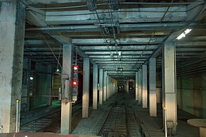
Eureka Valley station
Abandoned streetcar station in San Francisco, California
Distance: Approx. 284 meters
Latitude and longitude: 37.76175,-122.43822222
Eureka Valley station is an abandoned underground streetcar station in San Francisco, California. It was located inside the Twin Peaks Tunnel, very close to its eastern end in the Eureka Valley neighborhood. The station opened in 1918, and was closed in 1972 during the construction of the Market Street subway.

Most Holy Redeemer Church, San Francisco
Roman catholic church in San Francisco
Distance: Approx. 107 meters
Latitude and longitude: 37.76029,-122.4374
Most Holy Redeemer Church in San Francisco, California, United States, is a Roman Catholic parish situated in The Castro district, located at 100 Diamond Street (at 18th Street).
Theatre Rhinoceros
LGBTQ theatre
Distance: Approx. 122 meters
Latitude and longitude: 37.7606,-122.4367
Theatre Rhinoceros, Theatre Rhino, or The Rhino is a gay and lesbian theatre in San Francisco. Theatre Rhinoceros claims to be the world's longest-running professional queer theatre company. It was founded in the spring of 1977 by Lanny Baugniet (who became the theater's General Manager) and his late partner Allan B. Estes, Jr.

Alfred E. Clarke Mansion
Mansion in California, USA
Distance: Approx. 249 meters
Latitude and longitude: 37.75961,-122.43953
The Alfred E. Clarke Mansion, also known as the Caselli Mansion, Nobby Clarke's Castle and Nobby Clarke's Folly, is a mansion at 250 Douglass Street on the corner of Caselli Avenue in Eureka Valley, San Francisco, California. Built in 1891 by Alfred "Nobby" Clarke, it has been a hospital and is now an apartment building. It became a San Francisco Designated Landmark in 1975.

Castro Camera
Building in California, United States of America
Distance: Approx. 181 meters
Latitude and longitude: 37.759786,-122.43468
Castro Camera was a camera store in the Castro District of San Francisco, California, operated by Harvey Milk from 1972 until his assassination in 1978. During the 1970s the store became the center of the neighborhood's growing gay community, as well as campaign headquarters for Milk's various campaigns for elected office.

Pink Triangle Park
Park and memorial in the Castro District, San Francisco, California, U.S.
Distance: Approx. 307 meters
Latitude and longitude: 37.76222222,-122.43611111
The Pink Triangle Park is a triangle-shaped mini-park located in the Castro District of San Francisco, California. The park is less than 4,000 square feet (370 m2) and faces Market Street with 17th Street to its back. The park sits directly above the Castro Street Station of Muni Metro, across from Harvey Milk Plaza.
Moby Dick Records
Record label
Distance: Approx. 229 meters
Latitude and longitude: 37.76075,-122.43463889
Moby Dick Records was a small disco record label founded by Boys Town Gang producers Bill Motley (DJ Bill Motley) and Victor Swedosh in 1980. Its headquarters were located at 573 Castro Street, San Francisco, California, United States. Swedosh also owned the Moby Dick Bar (opened in 1977) located in the Castro district.

Castro District, San Francisco
Gay neighborhood in Eureka Valley in San Francisco
Distance: Approx. 211 meters
Latitude and longitude: 37.76083333,-122.435
The Castro District, commonly referred to as the Castro, is a neighborhood in Eureka Valley in San Francisco. The Castro was one of the first gay neighborhoods in the United States. Having transformed from a working-class neighborhood through the 1960s and 1970s, the Castro remains one of the most prominent symbols of lesbian, gay, bisexual, and transgender (LGBTQ) activism and events in the world.

Toad Hall Bar
Gay bar in San Francisco, California, U.S.
Distance: Approx. 179 meters
Latitude and longitude: 37.76099,-122.43593
Toad Hall Bar is a gay bar in San Francisco's Castro District, in the U.S. state of California.

Badlands (San Francisco)
Defunct gay bar and nightclub in San Francisco, California, U.S.
Distance: Approx. 175 meters
Latitude and longitude: 37.76074,-122.435477
Badlands (sometimes Badlands San Francisco, Badlands SF, or San Francisco Badlands) is a gay bar and nightclub in San Francisco's Castro District, in the U.S. state of California. The bar opened in 1975 and closed in July 2020. It reopened in October 2023.
Rainbow Honor Walk
LGBT monument in USA
Distance: Approx. 42 meters
Latitude and longitude: 37.75913,-122.43681
The Rainbow Honor Walk (RHW) is a walk of fame installation in San Francisco, California to honor notable lesbian, gay, bisexual, transgender, and queer (LGBTQ) individuals from around the world "who left a lasting mark on society." Its bronze plaques honor LGBTQ individuals who "made significant contributions in their fields". The plaques mark a walk located within the business district of the Castro neighborhood, which for decades has been the city's center of LGBTQ activism and culture. The project was founded by David Perry to honor LGBTQ pioneers, who are considered to have laid the groundwork for LGBTQ rights, and to teach future generations about them.
Weather in this IP's area
few clouds
12 Celsius
12 Celsius
11 Celsius
14 Celsius
1014 hPa
89 %
1014 hPa
1006 hPa
10000 meters
4.92 m/s
8.05 m/s
360 degree
20 %
06:53:50
19:14:23