157.100.69.33 - IP Lookup: Free IP Address Lookup, Postal Code Lookup, IP Location Lookup, IP ASN, Public IP
Country:
Region:
City:
Location:
Time Zone:
Postal Code:
IP information under different IP Channel
ip-api
Country
Region
City
ASN
Time Zone
ISP
Blacklist
Proxy
Latitude
Longitude
Postal
Route
Luminati
Country
Region
g
City
guayaquil
ASN
Time Zone
America/Guayaquil
ISP
UFINET PANAMA S.A.
Latitude
Longitude
Postal
IPinfo
Country
Region
City
ASN
Time Zone
ISP
Blacklist
Proxy
Latitude
Longitude
Postal
Route
IP2Location
157.100.69.33Country
Region
manabi
City
puerto lopez
Time Zone
America/Guayaquil
ISP
Language
User-Agent
Latitude
Longitude
Postal
db-ip
Country
Region
City
ASN
Time Zone
ISP
Blacklist
Proxy
Latitude
Longitude
Postal
Route
ipdata
Country
Region
City
ASN
Time Zone
ISP
Blacklist
Proxy
Latitude
Longitude
Postal
Route
Popular places and events near this IP address

Puerto López
Town in Manabí, Ecuador
Distance: Approx. 112 meters
Latitude and longitude: -1.55888889,-80.81055556
Puerto López, with a population of 12,598, is a fishing village set in an arched bay on the Pacific coast in the Ecuadorian Manabí Province. Puerto Lopéz is the Machalilla National Park headquarters. The main industries include fishing and ecotourism.

Agua Blanca, Ecuador
Commune in Manabí, Ecuador
Distance: Approx. 8962 meters
Latitude and longitude: -1.53333333,-80.73333333
Agua Blanca is a commune in Machalilla Parish, Puerto López Canton, Manabí Province, Ecuador. It is east of the city of Puerto López. The community has a small church and a museum in the center of the village.

Machalilla National Park
Distance: Approx. 2300 meters
Latitude and longitude: -1.5625,-80.83
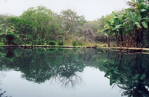
Machalilla National Park (Spanish: Parque Nacional Machalilla) is a preserve in the Ecuadorian Manabí Province near Puerto López and the rural parish of Machalilla, a small fishing village in the vicinity of the park. Established in 1979, Machalilla National Park near Puerto Lopéz rests along the Pacific coast. It incorporates beaches, fog forest, dry forest, small islands and two larger islands, Salango and Isla de la Plata, the latter named for a legendary hoard of silver left by Sir Francis Drake.
Salango
Rural parish in Manabí, Ecuador
Distance: Approx. 5303 meters
Latitude and longitude: -1.59444444,-80.84166667
Communidad Salango is a rural parish of Puerto López Canton, Manabí Province, Ecuador.

Puerto López Canton
Canton in Manabí Province, Ecuador
Distance: Approx. 2389 meters
Latitude and longitude: -1.54,-80.8
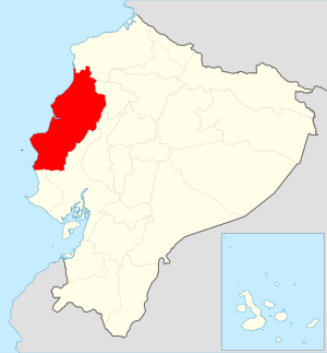
Puerto López Canton is a canton of Ecuador, located in Manabí Province. Its capital is the town of Puerto López. Its population at the 2001 census was 16,626.
Assassination of Omar Menéndez
2023 murder in Puerto López, Ecuador
Distance: Approx. 293 meters
Latitude and longitude: -1.56083333,-80.81166667
On 4 February 2023, Omar Menéndez, a 41-year-old Ecuadorian man who was running as the Citizen Revolution Movement party's candidate for mayor in the canton of Puerto López, Manabí Province in the 2023 Ecuadorian local elections, was shot and killed by two unidentified men just a few hours before the ballots were officially opened. Three other people were injured in the same shooting, including a 16-year-old volunteer, who eventually died from complications after being taken to the hospital. Menéndez was one of the several candidates targeted by violent attacks in the run-up to the elections, which were held alongside the 2023 Ecuadorian constitutional referendum and in the midst of an escalating wave of crime and violence across Ecuador, mainly linked to the then ongoing nationwide security crisis and the growing influence of criminal organizations with connections to drug trafficking in the country.

Salango Island
Ecuadorian island
Distance: Approx. 7807 meters
Latitude and longitude: -1.6,-80.86666667
Salango Island is a South American island of approximately one square kilometer located in the Pacific Ocean one kilometer off the coast of the province Manabí in Ecuador near the town of Salango. The island is part of the Machalilla National Park and is home to species such as the blue-footed booby (Sula nebouxii), while in the waters of the island, it is occasionally possible to observe whales.
Weather in this IP's area
light rain
23 Celsius
24 Celsius
23 Celsius
23 Celsius
1013 hPa
87 %
1013 hPa
1010 hPa
10000 meters
2.32 m/s
2.49 m/s
191 degree
99 %