156.112.133.21 - IP Lookup: Free IP Address Lookup, Postal Code Lookup, IP Location Lookup, IP ASN, Public IP
Country:
Region:
City:
Location:
Time Zone:
Postal Code:
ISP:
ASN:
language:
User-Agent:
Proxy IP:
Blacklist:
IP information under different IP Channel
ip-api
Country
Region
City
ASN
Time Zone
ISP
Blacklist
Proxy
Latitude
Longitude
Postal
Route
db-ip
Country
Region
City
ASN
Time Zone
ISP
Blacklist
Proxy
Latitude
Longitude
Postal
Route
IPinfo
Country
Region
City
ASN
Time Zone
ISP
Blacklist
Proxy
Latitude
Longitude
Postal
Route
IP2Location
156.112.133.21Country
Region
ohio
City
columbus
Time Zone
America/New_York
ISP
Language
User-Agent
Latitude
Longitude
Postal
ipdata
Country
Region
City
ASN
Time Zone
ISP
Blacklist
Proxy
Latitude
Longitude
Postal
Route
Popular places and events near this IP address

Olentangy River
River in Ohio, United States of America
Distance: Approx. 329 meters
Latitude and longitude: 39.9659,-83.0166
The Olentangy River is a 97-mile-long (156 km) tributary of the Scioto River in Ohio, United States.

Huntington Park (Columbus, Ohio)
Baseball stadium in Columbus, Ohio, US
Distance: Approx. 303 meters
Latitude and longitude: 39.968619,-83.010743
Huntington Park is a baseball stadium located in Columbus, Ohio, United States. It primarily serves as the home of the Columbus Clippers of the International League, the Triple-A minor league affiliate of the Cleveland Guardians since 2009. Groundbreaking for the ballpark took place on August 2, 2007, with construction being completed in April 2009.
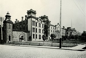
Ohio Penitentiary
Ohio prison operating from 1834 to 1984
Distance: Approx. 404 meters
Latitude and longitude: 39.96756944,-83.00831111
The Ohio Penitentiary, also known as the Ohio State Penitentiary, was a prison operated from 1834 to 1984 in downtown Columbus, Ohio, in what is now known as the Arena District. The state had built a small prison in Columbus in 1813, but as the state's population grew the earlier facility was not able to handle the number of prisoners sent to it by the courts. When the penitentiary first opened in 1834, not all of the buildings were completed.
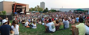
KEMBA Live!
Distance: Approx. 442 meters
Latitude and longitude: 39.969811,-83.010142
KEMBA Live! (originally the PromoWest Pavilion) is a multi-purpose concert venue located in the Arena District of Columbus, Ohio. Opening in 2001, the venues operates year-round with indoor and outdoor facilities: the Indoor Music Hall and Outdoor Amphitheater.
The Condominiums at North Bank Park
Residential high rise at 300 W. Spring St. in the Arena District of Columbus, Ohio
Distance: Approx. 241 meters
Latitude and longitude: 39.96611111,-83.01
The Condominiums at North Bank Park is a 267 feet (81 m) tall residential high rise at 300 W. Spring St. in the Arena District just north of downtown Columbus, Ohio. It was constructed from 2006 to 2007 and has 20 floors and is one of the tallest structures in the city The building was developed by Nationwide Realty Investors, a development entity created by Nationwide Insurance which is headquartered nearby.
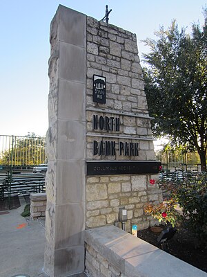
North Bank Park
Park in Columbus, Ohio, U.S.
Distance: Approx. 284 meters
Latitude and longitude: 39.96520306,-83.00986111
North Bank Park is an 11-acre (4.5 ha) park in downtown Columbus, Ohio, United States. The park includes a work of art, Flowing Kiss, installed in 2013.

The Father of Columbus Baseball
Sculpture in Columbus, Ohio, U.S.
Distance: Approx. 327 meters
Latitude and longitude: 39.96830556,-83.00988889
The Father of Columbus Baseball is a bronze sculpture depicting Harold Cooper by Alan Hamwi, installed outside Huntington Park (whose predecessor stadium was in named in his honor for) in Columbus, Ohio's Arena District, in the United States. The statue was unveiled in 2009.
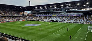
Lower.com Field
Soccer stadium in downtown Columbus, Ohio
Distance: Approx. 432 meters
Latitude and longitude: 39.96846111,-83.01708889
Lower.com Field is a soccer-specific stadium in Columbus, Ohio, United States. It serves primarily as the home stadium of the Columbus Crew of Major League Soccer, replacing the club's previous home, Historic Crew Stadium. The new stadium cost $314 million and is located at the center of the mixed-use Astor Park development adjacent to the Arena District and downtown.
Flowing Kiss
Sculpture in Columbus, Ohio, U.S.
Distance: Approx. 287 meters
Latitude and longitude: 39.96565833,-83.00958333
Flowing Kiss is an art installation consisting of two 2013 stainless steel sculptures by Lawrence Argent, installed at North Bank Park in Columbus, Ohio, United States. According to The Sculpture Center's Outdoor Sculpture Inventory, the sculptures face one another, and "both are wide, rippling shape that narrows to lips ready for a kiss". They were installed in 2013.
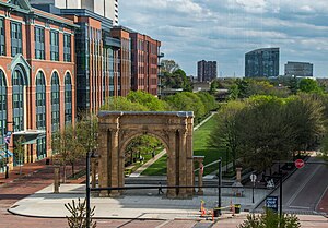
McFerson Commons
Park in Columbus, Ohio, U.S.
Distance: Approx. 474 meters
Latitude and longitude: 39.967,-83.0073
McFerson Commons, originally Arena Park, is a 2.2-acre (0.9 ha) park in Columbus, Ohio's Arena District neighborhood. The focal point of the park is the Union Station arch, salvaged before the demolition of Columbus's Union Station. The park was created around 1999 after demolition of the Ohio Penitentiary, as a recreation area for residents of the surrounding Arena District.
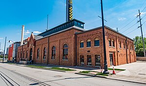
Municipal Light Plant
United States historic building in Columbus, Ohio
Distance: Approx. 474 meters
Latitude and longitude: 39.96691,-83.01832
The Municipal Light Plant is a historic building in the Arena District of Downtown Columbus, Ohio. It was listed on the National Register of Historic Places in 2015. The structure includes an early 20th century Romanesque Revival building and a mid-20th century Art Deco addition.
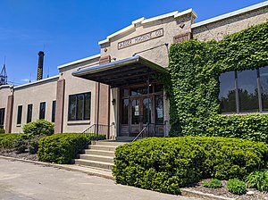
Jaeger Machine Company Office Building
United States historic place
Distance: Approx. 318 meters
Latitude and longitude: 39.966521,-83.016524
The Jaeger Machine Company Office Building is a historic building in the Arena District neighborhood of Columbus, Ohio. It was listed on the National Register of Historic Places in 1983. The two-story concrete building was constructed in 1936.
Weather in this IP's area
broken clouds
-1 Celsius
-6 Celsius
-2 Celsius
0 Celsius
1026 hPa
61 %
1026 hPa
995 hPa
10000 meters
6.17 m/s
210 degree
75 %
