155.58.181.138 - IP Lookup: Free IP Address Lookup, Postal Code Lookup, IP Location Lookup, IP ASN, Public IP
Country:
Region:
City:
Location:
Time Zone:
Postal Code:
ISP:
ASN:
language:
User-Agent:
Proxy IP:
Blacklist:
IP information under different IP Channel
ip-api
Country
Region
City
ASN
Time Zone
ISP
Blacklist
Proxy
Latitude
Longitude
Postal
Route
db-ip
Country
Region
City
ASN
Time Zone
ISP
Blacklist
Proxy
Latitude
Longitude
Postal
Route
IPinfo
Country
Region
City
ASN
Time Zone
ISP
Blacklist
Proxy
Latitude
Longitude
Postal
Route
IP2Location
155.58.181.138Country
Region
louisiana
City
new orleans
Time Zone
America/Chicago
ISP
Language
User-Agent
Latitude
Longitude
Postal
ipdata
Country
Region
City
ASN
Time Zone
ISP
Blacklist
Proxy
Latitude
Longitude
Postal
Route
Popular places and events near this IP address

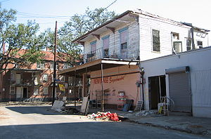
Storyville, New Orleans
Former red-light district in Louisiana, US
Distance: Approx. 346 meters
Latitude and longitude: 29.95908056,-90.07381389
Storyville was the red-light district of New Orleans, Louisiana, from 1897 to 1917. It was established by municipal ordinance under the New Orleans City Council, to regulate prostitution. Sidney Story, a city alderman, wrote guidelines and legislation to control prostitution within the city.

WWOZ
Community radio station in New Orleans
Distance: Approx. 151 meters
Latitude and longitude: 29.9571,-90.0754
WWOZ (90.7 FM) is a non-profit community-supported radio station in New Orleans. It is owned by the New Orleans Jazz & Heritage Foundation. The station specializes in music from or relating to the cultural heritage of New Orleans and the surrounding region of Louisiana.

New Orleans Public Library
Public library system in New Orleans, Louisiana
Distance: Approx. 371 meters
Latitude and longitude: 29.9544,-90.0755
The New Orleans Public Library (NOPL) is the public library of the city of New Orleans, Louisiana, United States. Succeeding earlier libraries in the city, it opened in 1897. Three branches were added by 1908.

Iberville Projects
New Orleans Neighborhood in Louisiana, United States
Distance: Approx. 384 meters
Latitude and longitude: 29.95944444,-90.07361111
Iberville Projects was a neighborhood in the city of New Orleans and one of the low-income Housing Projects of New Orleans. The Iberville was the last of the New Deal-era public housing remaining in the city. Its boundaries were St.

Saenger Theatre (New Orleans)
Performance venue in New Orleans, Louisiana
Distance: Approx. 435 meters
Latitude and longitude: 29.95579722,-90.07284444
Saenger Theatre is an atmospheric theatre in downtown New Orleans, Louisiana, which is on the National Register of Historic Places. Once the flagship of Julian and Abe Saenger's theatre empire, today it is one of only a handful of Saenger movie palaces that remain.

Charity Hospital (New Orleans)
Hospital in New Orleans, Louisiana
Distance: Approx. 257 meters
Latitude and longitude: 29.9554,-90.078
Charity Hospital was one of two teaching hospitals which were part of the Medical Center of Louisiana at New Orleans (MCLNO), the other being University Hospital. Three weeks after the events of Hurricane Katrina, then-Governor Kathleen Blanco said that Charity Hospital would not reopen as a functioning hospital. The Louisiana State University System, which owns the building, stated that it had no plans to reopen the hospital in its original location.

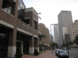
Tulane University School of Public Health and Tropical Medicine
Public health institute of Tulane University
Distance: Approx. 158 meters
Latitude and longitude: 29.95722,-90.07529
The Tulane University School of Public Health and Tropical Medicine (officially Celia Scott Weatherhead School of Public Health and Tropical Medicine) is an affiliated school of Tulane University, a private university in New Orleans, Louisiana.

State Palace Theatre (New Orleans)
Distance: Approx. 406 meters
Latitude and longitude: 29.95546944,-90.0734
State Palace Theatre is a performing arts venue located in downtown New Orleans, Louisiana. It is located at the uptown lake corner of Canal Street and Rampart Street. The Saenger Theater is directly opposite the State Palace on Canal Street.
Tulane Medical Center
Hospital in Louisiana, United States
Distance: Approx. 227 meters
Latitude and longitude: 29.955658,-90.075884
The Tulane Medical Center is an Emergency Department located in New Orleans, Louisiana. The Tulane Medical Center has centers and clinics covering nearly all major specialties of medicine, and is the primary teaching hospital for the Tulane University School of Medicine. The hospital is jointly owned by LCMC Health and Tulane University (17.5%).
Grand Palace Hotel, New Orleans
Distance: Approx. 236 meters
Latitude and longitude: 29.9591,-90.0785
The Grand Palace Hotel was a 17-story building located in the Mid City area of New Orleans, Louisiana. The building became known worldwide for its implosion on 22 July 2012.
St. James AME Church (New Orleans, Louisiana)
Historic church in Louisiana, United States
Distance: Approx. 406 meters
Latitude and longitude: 29.96083333,-90.07861111
Historic St. James AME Church is a historic church, affiliated with the African Methodist Episcopal Church, the oldest predominantly African American denomination in the United States. The church is located at 222 N. Roman Street in New Orleans, Louisiana.

Southern Railway Terminal (New Orleans)
Distance: Approx. 383 meters
Latitude and longitude: 29.9565,-90.0731
The Southern Railway Terminal, originally officially "New Orleans Terminal", in New Orleans was constructed by the Southern Railway in 1908 on the neutral ground of Basin Street at the intersection of Canal Street. The building was designed by Daniel Burnham, who was also the architect for the Union Station in Washington D.C. The station also served the New Orleans and Northeastern Railroad and the New Orleans Terminal Company. It was the terminus for many of Southern's premier trains, most notably the Crescent.
Weather in this IP's area
clear sky
1 Celsius
-5 Celsius
1 Celsius
1 Celsius
1031 hPa
47 %
1031 hPa
1031 hPa
10000 meters
6.45 m/s
8.79 m/s
18 degree

