155.48.221.128 - IP Lookup: Free IP Address Lookup, Postal Code Lookup, IP Location Lookup, IP ASN, Public IP
Country:
Region:
City:
Location:
Time Zone:
Postal Code:
ISP:
ASN:
language:
User-Agent:
Proxy IP:
Blacklist:
IP information under different IP Channel
ip-api
Country
Region
City
ASN
Time Zone
ISP
Blacklist
Proxy
Latitude
Longitude
Postal
Route
db-ip
Country
Region
City
ASN
Time Zone
ISP
Blacklist
Proxy
Latitude
Longitude
Postal
Route
IPinfo
Country
Region
City
ASN
Time Zone
ISP
Blacklist
Proxy
Latitude
Longitude
Postal
Route
IP2Location
155.48.221.128Country
Region
massachusetts
City
babson park
Time Zone
America/New_York
ISP
Language
User-Agent
Latitude
Longitude
Postal
ipdata
Country
Region
City
ASN
Time Zone
ISP
Blacklist
Proxy
Latitude
Longitude
Postal
Route
Popular places and events near this IP address
Babson College
Business school in Wellesley, Massachusetts, US
Distance: Approx. 106 meters
Latitude and longitude: 42.29823056,-71.26119167
Babson College is a private business school in Wellesley, Massachusetts, United States. It was established in 1919 by Roger W. Babson as an all-male business institute and became coeducational in 1970.
Olin College
Private engineering college in Needham, Massachusetts
Distance: Approx. 658 meters
Latitude and longitude: 42.29345556,-71.26394167
Olin College of Engineering, officially Franklin W. Olin College of Engineering, is a private college focused on engineering and located in Needham, Massachusetts. Its endowment had been funded primarily by the defunct F. W. Olin Foundation. The college covers half of each admitted student's tuition through the Olin Scholarship.
Massachusetts Bay Community College
Public college in Wellesley, Massachusetts, US
Distance: Approx. 1492 meters
Latitude and longitude: 42.31171111,-71.26375278
Massachusetts Bay Community College (MassBay) is a public community college in Norfolk and Middlesex Counties. Founded in 1961, MassBay currently serves more than 4,400 full-time and part-time students on its three locations: Wellesley, Ashland, and Framingham. MassBay offers more than 70 degree and certificate programs aimed at helping students transfer to a four-year college or university or towards direct placement into a career.
Wellesley Hills station
Rail station in Wellesley, Massachusetts, US
Distance: Approx. 1904 meters
Latitude and longitude: 42.3102,-71.277
Wellesley Hills station is an MBTA Commuter Rail station in Wellesley, Massachusetts, United States. It serves the Framingham/Worcester Line. It is located off Washington Street (MA-16) in Wellesley, Massachusetts.

Davis Mills House
Historic house in Massachusetts, United States
Distance: Approx. 1348 meters
Latitude and longitude: 42.28805556,-71.25194444
The Davis Mills House is a historic house in Needham, Massachusetts. It is 2+1⁄2-story wood-frame house, five bays wide, with a side gable roof, two interior chimneys, and clapboard siding. It has a Greek Revival entrance, flanked by sidelight windows and pilasters and topped by an entablature.

Israel Whitney House
Historic house in Massachusetts, United States
Distance: Approx. 1364 meters
Latitude and longitude: 42.28777778,-71.25222222
The Israel Whitney House is a historic house in Needham, Massachusetts. It is a 2+1⁄2-story wood-frame house, five bays wide, with a side gable roof and clapboard siding. Its front facade is symmetrical, with a center entrance flanked by sidelight windows and pilasters, and a corniced entablature on top.

Needham Town Hall Historic District
Historic district in Massachusetts, United States
Distance: Approx. 1932 meters
Latitude and longitude: 42.28888889,-71.24055556
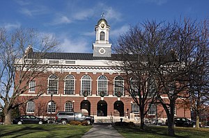
The Needham Town Hall Historic District is a historic district on Great Plain Avenue between Highland Avenue and Chapel Street in Needham, Massachusetts. It encompasses Needham Town Hall, a Georgian Revival structure built in 1902 to a design by Winslow & Bigelow, and the grassy public park in front of it, which was established in 1884. The district was listed on the National Register of Historic Places in 1990.

Robert Fuller House
Historic house in Massachusetts, United States
Distance: Approx. 592 meters
Latitude and longitude: 42.29361111,-71.2575
The Robert Fuller House is a historic house at 3 Burrill Lane in Needham, Massachusetts. Built in 1707 and moved to its present location in 1750, it is the oldest house in Needham. It is a well-preserved example of First Period architecture, adaptively modified over the centuries to adapt to later uses.

Elm Park and Isaac Sprague Memorial Tower
United States historic place
Distance: Approx. 1973 meters
Latitude and longitude: 42.3125,-71.27486111
Elm Park, also known as Clocktower Park, is a historic park near the junction of Massachusetts Route 16 and Massachusetts Route 9 in the Wellesley Hills section of Wellesley, Massachusetts. It is a triangular parcel of 1.24 acres (0.50 ha), laid out for passive recreation. Its focal point is the 75-foot (23 m) brick and masonry Sprague Tower, designed by Benjamin Proctor, Jr., and built in 1928 to house a clock and bell given to the town in 1874.

Intermediate Building
United States historic place
Distance: Approx. 1850 meters
Latitude and longitude: 42.31069444,-71.27541667
The Intermediate Building is a historic municipal building at 324 Washington Street in Wellesley Hills, Massachusetts. Designed by architects Hartwell and Richardson, and completed in 1894, it is a two-story brick building with Romanesque styling. It has a hip roof pierced by hip-roof dormers, the central one larger than those flanking it.

Townsend House (Needham, Massachusetts)
United States historic place
Distance: Approx. 1204 meters
Latitude and longitude: 42.29111111,-71.24944444
The Townsend House is a historic late First Period house in Needham, Massachusetts, United States. The 2+1⁄2-story wood-frame house was built in 1720 by Gregory Sugars, a sea captain, for his son-in-law, Rev. Jonathan Townsend.

Fuller Brook Park
United States historic place
Distance: Approx. 1778 meters
Latitude and longitude: 42.31083333,-71.27388889
Fuller Brook Park is a public park of the town of Wellesley, Massachusetts. The park was established in 1899 as a roughly linear park for both recreational and flood control purposes, and did not reach mature completion until the 1930s. The park was designed by John Charles Olmsted (nephew of Frederick Law Olmsted and a noted landscape designer in his own right) and others.
Weather in this IP's area
clear sky
2 Celsius
-3 Celsius
1 Celsius
3 Celsius
996 hPa
49 %
996 hPa
990 hPa
10000 meters
6.17 m/s
240 degree

