Country:
 USA
USARegion:
City:
Latitude and Longitude:
Postal Code:
Time Zone:
language:
User-Agent:
Proxy IP:
Blacklist:
IP information under different IP Channel
Luminati
155.216.186.76Country
USRegion
nj
City
trenton
ASN
Time Zone
America/New_York
ISP
DNIC-ASBLK-00306-00371
Latitude
Longitude
Postal
Popular places and events near this IP address
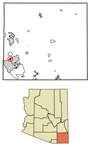
Huachuca City, Arizona
Town in Cochise County, Arizona
Distance: Approx. 8964 meters
Latitude and longitude: 31.63611111,-110.33638889
Huachuca City is a town in Cochise County, Arizona, United States. As of the 2020 census, the population was 1,626. Fort Huachuca, a U.S. Army base, is located just south of the municipality.

Sierra Vista, Arizona
City in Arizona, United States
Distance: Approx. 7145 meters
Latitude and longitude: 31.54555556,-110.27638889
Sierra Vista (; Spanish: [ˈsjera ˈβista]) is a city in Cochise County, Arizona, United States. According to the 2020 Census, the population of the city is 45,308, and is the 27th most populous city in Arizona. The city is part of the Sierra Vista-Douglas Metropolitan Area, with a 2010 population of 131,346.
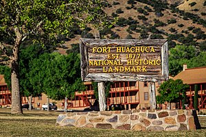
Fort Huachuca
US Army base on Cochise County, Arizona
Distance: Approx. 150 meters
Latitude and longitude: 31.555357,-110.349754
Fort Huachuca is a United States Army installation, established on 3 March 1877 as Camp Huachuca. The garrison is now under the command of the United States Army Installation Management Command. It is in Cochise County in southeast Arizona, approximately 15 miles (24 km) north of the border with Mexico and at the northern end of the Huachuca Mountains, adjacent to the town of Sierra Vista.
Military Intelligence Hall of Fame
US military hall of fame
Distance: Approx. 159 meters
Latitude and longitude: 31.5553,-110.3497
The Military Intelligence Hall of Fame is a hall of fame established by the Military Intelligence Corps of the United States Army in 1988 to honor soldiers and civilians who have made exceptional contributions to military intelligence. The hall is administered by the United States Army Intelligence Center at Fort Huachuca, Arizona.

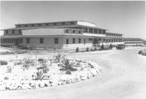
United States Army Intelligence Center
U.S. Army's school for professional training in military intelligence
Distance: Approx. 159 meters
Latitude and longitude: 31.5553,-110.3497
The United States Army Intelligence Center of Excellence (USAICoE) is the United States Army's school for professional training of military intelligence personnel. It is a component of United States Army Training and Doctrine Command (TRADOC).

The Mall at Sierra Vista
Shopping mall in Cochise County, Arizona, US
Distance: Approx. 9149 meters
Latitude and longitude: 31.5291,-110.259686
The Mall at Sierra Vista is an indoor shopping center in Sierra Vista, Arizona, United States owned and managed by Kohan Retail Investment Group. It was constructed during the late 1990s. Sierra Vista was one of the fastest-growing communities in Arizona and the major population center for southeastern Arizona.
KKYZ
Radio station in Sierra Vista, Arizona
Distance: Approx. 9125 meters
Latitude and longitude: 31.6375,-110.33583333
KKYZ (101.7 FM) is a radio station broadcasting an Oldies format. Licensed to Huachuca City, Arizona, the station serves the Sierra Vista area. It is owned by Cochise Broadcasting, a Wyoming LLC. KKYZ is a Class A FM station, with an effective radiated power (ERP) of 6,000 watts.
Sierra Vista Unified School District
School district in Arizona, United States
Distance: Approx. 8173 meters
Latitude and longitude: 31.55555556,-110.26444444
The Sierra Vista Unified School District is the school district for Sierra Vista, Arizona. It operates Buena High School, Joyce Clark Middle School, and six elementary schools in its service area. The district serves high school aged dependent children on Fort Huachuca.
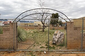
Mountain View Officers' Club
Historic military officers' club for African American soldiers in Arizona, United States
Distance: Approx. 1775 meters
Latitude and longitude: 31.54584,-110.33669
Mountain View Officers' Club, built in 1942, is a historic structure that originally served as an officers' club for African American soldiers stationed at Fort Huachuca, Arizona. It was long vacant, but was listed on the National Register of Historic Places in 2017 and there have been plans for its renovation.
Fry Pioneer Cemetery
United States historic place
Distance: Approx. 5590 meters
Latitude and longitude: 31.55611111,-110.29166667
Fry Pioneer Cemetery is the original cemetery in Fry, Arizona, which was the name of Sierra Vista prior to its renaming and incorporation in 1956. It is a half-acre site, and includes more than 200 known graves, most of which are unmarked. It has sparse vegetation and is surrounded by a chain-link fence.
Weather in this IP's area
clear sky
27 Celsius
26 Celsius
25 Celsius
28 Celsius
1016 hPa
13 %
10000 meters
5.66 m/s
7.72 m/s
150 degree
19:00:00
21:00:00
The latest IP detection test
- 68.112.85.69
- 37.38.161.91
- 246.47.55.139
- 237.219.100.116
- 168.59.86.126
- 115.175.36.108
- 50.122.29.236
- 196.186.53.26
- 94.237.209.158
- 120.169.128.39