Country:
Region:
City:
Latitude and Longitude:
Time Zone:
Postal Code:
IP information under different IP Channel
ip-api
Country
Region
City
ASN
Time Zone
ISP
Blacklist
Proxy
Latitude
Longitude
Postal
Route
Luminati
Country
ASN
Time Zone
Europe/London
ISP
Natwest Markets PLC
Latitude
Longitude
Postal
IPinfo
Country
Region
City
ASN
Time Zone
ISP
Blacklist
Proxy
Latitude
Longitude
Postal
Route
db-ip
Country
Region
City
ASN
Time Zone
ISP
Blacklist
Proxy
Latitude
Longitude
Postal
Route
ipdata
Country
Region
City
ASN
Time Zone
ISP
Blacklist
Proxy
Latitude
Longitude
Postal
Route
Popular places and events near this IP address
Angel tube station
London Underground station
Distance: Approx. 129 meters
Latitude and longitude: 51.532,-0.106
Angel is a London Underground station in the Angel area of the London Borough of Islington. It is on the Bank branch of the Northern line, between King's Cross St. Pancras and Old Street stations, in Travelcard Zone 1.

The Angel, Islington
Historic landmark in Islington, London, England
Distance: Approx. 129 meters
Latitude and longitude: 51.532,-0.106
The Angel, Islington, is a historic landmark and a series of buildings that have stood on the corner of Islington High Street and Pentonville Road in Islington, London, England. The land originally belonged to the Clerkenwell Priory and has had various properties built on it since the 16th century. An inn on the site was called the "Angel Inn" by 1614, and the crossing became generally known as "the Angel".

O2 Academy Islington
Music venue in London, England
Distance: Approx. 174 meters
Latitude and longitude: 51.5345,-0.1058
The O2 Academy Islington, formerly known as the Carling Academy Islington, is an indoor music venue situated in the N1 Shopping Centre accessible via Upper Street and Liverpool Road, in the London Borough of Islington. It is run by the Academy Music Group. The main venue has a capacity of 800, and the adjacent O2 Academy 2 holds 250.

Camden Passage
Pedestrian street in London, England
Distance: Approx. 281 meters
Latitude and longitude: 51.53527778,-0.10333333
Camden Passage is a pedestrian street, close to the Angel tube station off Upper Street in the London Borough of Islington. The passage is known for its antique shops, markets and its array of independent shops, cafes, and restaurants. The independent shops, cafes and restaurants are typically open seven days a week, and the Angel Comedy club runs nightly at the Camden Head public house.
Old Red Lion, Islington
Pub theatre in Islington, north London
Distance: Approx. 195 meters
Latitude and longitude: 51.5314,-0.1062
The Old Red Lion (ORL), also known as the Old Red Lion Theatre (ORLT) and The Old Red, is a pub and fringe theatre, at Angel, in the London Borough of Islington. The theatre was founded in 1979 as the Old Red Lion Theatre Club. The pub was Grade II listed in 1994 by Historic England.

Islington Tunnel
Tunnel on the Regent's Canal, London
Distance: Approx. 278 meters
Latitude and longitude: 51.53411111,-0.10866111
The Islington Tunnel takes the Regent's Canal 960 yards (878 m) under Islington, as the longest such tunnel in London. The way for short boats and barges only opened in 1818; the pavements above are waymarked so the otherwise discontinued towpaths are connected. The canal's Eyre's and Maida Hill Tunnels, to the west, are much shorter.

Cubitt Artists
British arts organisation
Distance: Approx. 163 meters
Latitude and longitude: 51.532488,-0.107274
Cubitt Artists is a British artist-run art gallery, artist studios and art educator, founded in 1991. Cubitt was first located in Goods Way in London's Kings Cross area, moved to Cubitt Street (from which it takes its current name), later to Caledonia Street, and is now located at Angel.

Angel, London
Human settlement in England
Distance: Approx. 146 meters
Latitude and longitude: 51.5321,-0.1066
Angel is an area on the northern fringes of Central London within the London Borough of Islington. It is 2 miles (3.2 km) north-northeast of Charing Cross on the Inner Ring Road at a busy transport intersection. The area is identified in the London Plan as one of 35 major centres in London.

Electrowerkz
Alternative club venue in Islington, London
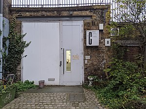
Distance: Approx. 57 meters
Latitude and longitude: 51.5325,-0.10527778
Electrowerkz is a three-floor music venue in Islington, London. In addition to mainstream club nights, it hosts the regular goth night club Slimelight and many other club, live music and events.

London Art Fair
Annual art fair in London, England
Distance: Approx. 281 meters
Latitude and longitude: 51.5355,-0.1056
The London Art Fair (LAF) is an annual contemporary art fair held at the Business Design Centre in Islington, London.

Peacock Inn, Islington
Former public house in Islington, London
Distance: Approx. 119 meters
Latitude and longitude: 51.5324,-0.1065
The Peacock Inn is a former public house at 11 Islington High Street, London, that dates from 1564.

St John the Evangelist Church, Islington
Church in Islington, England
Distance: Approx. 166 meters
Latitude and longitude: 51.534,-0.1033
St John the Evangelist Church is a Catholic Parish church in Islington, London. It was built from 1841 to 1843, seven years before the Reestablishment of the Catholic hierarchy in 1850. It was designed by Joseph John Scoles, with parts of the interior by Edward Armitage.
Weather in this IP's area
moderate rain
8 Celsius
8 Celsius
6 Celsius
9 Celsius
1012 hPa
89 %
1012 hPa
1008 hPa
10000 meters
0.89 m/s
1.34 m/s
340 degree
99 %
07:24:19
16:07:18

