Country:
Region:
City:
Latitude and Longitude:
Time Zone:
Postal Code:
IP information under different IP Channel
ip-api
Country
Region
City
ASN
Time Zone
ISP
Blacklist
Proxy
Latitude
Longitude
Postal
Route
Luminati
Country
Region
13
City
tokyo
ASN
Time Zone
Asia/Tokyo
ISP
MYTEK TRADING PTY LTD
Latitude
Longitude
Postal
IPinfo
Country
Region
City
ASN
Time Zone
ISP
Blacklist
Proxy
Latitude
Longitude
Postal
Route
db-ip
Country
Region
City
ASN
Time Zone
ISP
Blacklist
Proxy
Latitude
Longitude
Postal
Route
ipdata
Country
Region
City
ASN
Time Zone
ISP
Blacklist
Proxy
Latitude
Longitude
Postal
Route
Popular places and events near this IP address

Komae, Tokyo
City in Kantō, Japan
Distance: Approx. 1995 meters
Latitude and longitude: 35.63477778,139.57869444
Komae (狛江市, Komae-shi) is a city located in the western portion of the Tokyo Metropolis, Japan. It is one of 30 municipalities in the western portion of Tokyo known as the Tama Area. As of 1 April 2021, the city had an estimated population of 83,218, and a population density of 13,000 persons per km2.

Tama-ku, Kawasaki
Ward in Kantō, Japan
Distance: Approx. 1682 meters
Latitude and longitude: 35.61972222,139.56194444
Tama-ku (多摩区) is one of the seven wards of the city of Kawasaki in Kanagawa Prefecture, Japan. As of 2010, the ward has an estimated population of 211,221 and a population density of 10,310 persons per km2. The total area is 20.49 km2.

Nihon Minka-en
Distance: Approx. 1818 meters
Latitude and longitude: 35.609923,139.562038
Nihon Minka-en (日本民家園) is a park in the Ikuta Ryokuchi Park (生田緑地) of Tama-ku, Kawasaki, Kanagawa Prefecture, Japan. On display in the park is a collection of 20 traditional minka (民家) (farm houses) from various areas of Japan, especially thatched-roofed houses from eastern Japan. Of these, nine have received the designation of Important Cultural Assets from the national government.
Noborito Station
Railway station in Kawasaki, Kanagawa Prefecture, Japan
Distance: Approx. 1022 meters
Latitude and longitude: 35.62083333,139.57
Noborito Station (登戸駅, Noborito-eki) is an interchange passenger railway station in the Noborito neighborhood of Tama-ku, Kawasaki, Kanagawa Prefecture, Japan, operated by East Japan Railway Company (JR East) and the private railway company Odakyu Electric Railway.

Komae Station
Railway station in Komae, Tokyo, Japan
Distance: Approx. 1693 meters
Latitude and longitude: 35.6319,139.5771
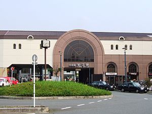
Komae Station (狛江駅, Komae-eki) is a passenger railway station located in the city of Komae, Tokyo, Japan, operated by the private railway operator Odakyu Electric Railway.

Noborito
Distance: Approx. 1022 meters
Latitude and longitude: 35.62083333,139.57
Noborito (登戸) is a neighborhood in Tama-ku, Kawasaki, Kanagawa Prefecture, Japan just across the southwestern border of Tokyo on the Tama River and about 18 minutes south of Shinjuku on the Odakyu Odawara Line Express. In 1927, Odakyu Line and Nanbu Line were constructed. Noborito Station became the interchange station.

Izumi-Tamagawa Station
Railway station in Komae, Tokyo, Japan
Distance: Approx. 1283 meters
Latitude and longitude: 35.6271,139.5736
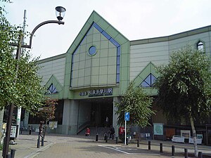
Izumi-Tamagawa Station (和泉多摩川駅, Izumi-tamagawa-eki) is a passenger railway station located in the city of Komae, Tokyo, Japan, operated by the private railway operator Odakyu Electric Railway.

Mukōgaoka-Yūen Station
Railway station in Kawasaki, Kanagawa Prefecture, Japan
Distance: Approx. 1417 meters
Latitude and longitude: 35.617195,139.56455
Mukōgaoka-Yūen Station (向ヶ丘遊園駅, Mukōgaoka-Yūen-eki) is a passenger railway station located in the Noborito neighborhood of Tama-ku, Kawasaki, Kanagawa, Japan and operated by the private railway operator Odakyu Electric Railway.

Kuji Station (Kanagawa)
Railway station in Kawasaki, Kanagawa Prefecture, Japan
Distance: Approx. 1345 meters
Latitude and longitude: 35.6105,139.5928
Kuji Station (久地駅, Kuji-eki) is a passenger railway station located in Takatsu-ku, Kawasaki, Kanagawa Prefecture, Japan, operated by the East Japan Railway Company (JR East).

Shukugawara Station (Kanagawa)
Railway station in Kawasaki, Kanagawa Prefecture, Japan
Distance: Approx. 188 meters
Latitude and longitude: 35.615333,139.579435
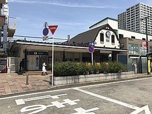
Shukugawara Station (宿河原駅, Shukugawara-eki) is a passenger railway station located in Tama-ku, Kawasaki, Kanagawa Prefecture, Japan, operated by the East Japan Railway Company (JR East).

Komae High School
High school in Tokyo, Japan
Distance: Approx. 1435 meters
Latitude and longitude: 35.6274,139.571
Tokyo Metropolitan Komae High School (東京都立狛江高等学校, Tōkyō-toritsu Komae Kōtō-gakkō) is a public high school located in Komae, Tokyo, Japan. There are over 2000 male and female students at Komae from grades 10 to 12. The school was established on April 1, 1972.
Fujiko F. Fujio Museum
Japanese museum
Distance: Approx. 984 meters
Latitude and longitude: 35.61,139.5734
The Fujiko F. Fujio Museum (藤子・F・不二雄ミュージアム), informally known as the Doraemon Museum, is a children's art museum in the suburbs of Kawasaki, Kanagawa, Japan. Fujiko F. Fujio is the pen name of the author, illustrator and creator of Doraemon.
Weather in this IP's area
few clouds
13 Celsius
12 Celsius
11 Celsius
14 Celsius
1029 hPa
62 %
1029 hPa
1026 hPa
10000 meters
4.63 m/s
30 degree
20 %
06:10:21
16:40:32
