Country:
Region:
City:
Latitude and Longitude:
Time Zone:
Postal Code:
IP information under different IP Channel
ip-api
Country
Region
City
ASN
Time Zone
ISP
Blacklist
Proxy
Latitude
Longitude
Postal
Route
Luminati
Country
Region
kn
City
kinshasa
ASN
Time Zone
Africa/Kinshasa
ISP
AFRICELL-DRC
Latitude
Longitude
Postal
IPinfo
Country
Region
City
ASN
Time Zone
ISP
Blacklist
Proxy
Latitude
Longitude
Postal
Route
db-ip
Country
Region
City
ASN
Time Zone
ISP
Blacklist
Proxy
Latitude
Longitude
Postal
Route
ipdata
Country
Region
City
ASN
Time Zone
ISP
Blacklist
Proxy
Latitude
Longitude
Postal
Route
Popular places and events near this IP address

Zaire
Country in Central Africa (1971–1997)
Distance: Approx. 2059 meters
Latitude and longitude: -4.4,15.4
Zaire, officially the Republic of Zaire, was the name of the Democratic Republic of the Congo from 1971 to 18 May 1997. Located in Central Africa, it was, by area, the third-largest country in Africa after Sudan and Algeria, and the 11th-largest country in the world from 1965 to 1997. With a population of over 23 million, Zaire was the most populous Francophone country in Africa.

N'djili Airport
Airport in Kinshasa, Democratic Republic of the Congo
Distance: Approx. 5906 meters
Latitude and longitude: -4.38575,15.44456944
N'djili Airport (IATA: FIH, ICAO: FZAA) (French: Aéroport de N'djili pronounced [a.e.ʁɔ.pɔʁ də n‿dʒi.li]), also known as N'Djili International Airport and Kinshasa International Airport, serves the city of Kinshasa and is the largest of the four international airports in the Democratic Republic of the Congo (DRC). It is named after the nearby Ndjili River.

Masina, Kinshasa
Commune in Kinshasa, DR Congo
Distance: Approx. 2323 meters
Latitude and longitude: -4.36305556,15.395
Masina is a municipality (commune) in the Tshangu District of Kinshasa, the capital city of the Democratic Republic of the Congo. It is bordered by the Pool Malebo in the north and Boulevard Lumbumba to the south. Masina shelters within it the Marché de la Liberté "M’Zee Laurent-Désiré Kabila”, one of the largest markets of Kinshasa, which was built under the presidency of Laurent-Désiré Kabila to repay the inhabitants of the district of Tshangu who had resisted the rebels in August 1998.

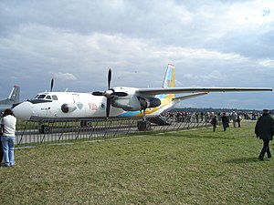
2007 Africa One Antonov An-26 crash
2007 DR Congo aircraft incident
Distance: Approx. 2755 meters
Latitude and longitude: -4.4,15.41
The 2007 Africa One Antonov An-26 crash occurred when a twin engine Antonov An-26, belonging to the Congolese air carrier Africa One, crashed and burned shortly after takeoff from N'djili Airport in Kinshasa, Democratic Republic of the Congo on 4 October 2007. The flight left N'djili at 10:43 local time bound for Tshikapa, a distance of 650 kilometres (400 mi; 350 nmi) to the east.

Republic of the Congo (Léopoldville)
1960–1965 state in Central Africa
Distance: Approx. 2059 meters
Latitude and longitude: -4.4,15.4
The Republic of the Congo (French: République du Congo) was a sovereign state in Central Africa, created with the independence of the Belgian Congo in 1960. From 1960 to 1966, the country was also known as Congo-Léopoldville (after its capital) to distinguish it from its northwestern neighbor, which is also called the Republic of the Congo, alternatively known as "Congo-Brazzaville". In 1964, the state's official name was changed to the Democratic Republic of the Congo, but the two countries continued to be distinguished by their capitals; with the renaming of Léopoldville as Kinshasa in 1966, it became also known as Congo-Kinshasa.

Ndjili, Kinshasa
Commune in Kinshasa, DR Congo
Distance: Approx. 3209 meters
Latitude and longitude: -4.40888889,15.3775
Ndjili or N'Djili is a municipality (commune) in the Tshangu district of Kinshasa, the capital city of the Democratic Republic of the Congo. It is named after the Ndjili River, which forms its western boundary.

Limete
Commune in Kinshasa, DR Congo
Distance: Approx. 5831 meters
Latitude and longitude: -4.35,15.35111111
Limete is one of the 24 communes that are the administrative divisions of Kinshasa, the capital city of the Democratic Republic of the Congo.

Matete
Commune in Kinshasa, DR Congo
Distance: Approx. 4449 meters
Latitude and longitude: -4.38888889,15.35166667
Matete is one of the 24 communes that are the administrative divisions of Kinshasa, the capital city of the Democratic Republic of the Congo.

Tshangu District
Place in Kinshasa, DR Congo
Distance: Approx. 4142 meters
Latitude and longitude: -4.420352,15.385494
Tshangu is an area of the capital city of Kinshasa, Democratic Republic of the Congo, comprising five of the city-province's twenty-four administrative divisions—the communes of Kimbanseke, Maluku, Masina, Ndjili and Nsele. It is one of the four so-called districts of Kinshasa. These were the administrative divisions of Kinshasa during much of the Mobutu years (1965-1997) and around which a number of government systems and services are still organized.

Ndjili River
River in the Democratic Republic of the Congo
Distance: Approx. 5616 meters
Latitude and longitude: -4.335499,15.376182
The Ndjili River (French: Rivière Ndjili) is a river that flows from the south through the capital city of Kinshasa in the Democratic Republic of the Congo, where it joins the Congo River. It separates the districts of Tshangu and Mont Amba. The river gives its name to the Ndjili commune and to the Ndjili International Airport.
Université Libre de Kinshasa
Private university in the DRC
Distance: Approx. 5213 meters
Latitude and longitude: -4.3667,15.3476
The Université Libre de Kinshasa (French; lit. 'Free University of Kinshasa', known as ULK) is a private university in Kinshasa, Democratic Republic of the Congo. It was established on 15 October 1988.

Limete Tower
Concrete tower in Kinshasa
Distance: Approx. 5206 meters
Latitude and longitude: -4.37438889,15.34541667
The Limete Tower (also known as French: Tour de l'Échangeur; "Interchange Tower" or French: Tour des Héros nationaux du Congo; "Tower of the National Heroes of Congo") is a tower located in the commune of Limete in Kinshasa, the capital city of the Democratic Republic of the Congo.
Weather in this IP's area
broken clouds
25 Celsius
26 Celsius
25 Celsius
25 Celsius
1012 hPa
68 %
1012 hPa
980 hPa
10000 meters
0.84 m/s
1.41 m/s
226 degree
79 %
05:33:53
17:52:54