154.66.223.98 - IP Lookup: Free IP Address Lookup, Postal Code Lookup, IP Location Lookup, IP ASN, Public IP
Country:
Region:
City:
Location:
Time Zone:
Postal Code:
ISP:
ASN:
language:
User-Agent:
Proxy IP:
Blacklist:
IP information under different IP Channel
ip-api
Country
Region
City
ASN
Time Zone
ISP
Blacklist
Proxy
Latitude
Longitude
Postal
Route
db-ip
Country
Region
City
ASN
Time Zone
ISP
Blacklist
Proxy
Latitude
Longitude
Postal
Route
IPinfo
Country
Region
City
ASN
Time Zone
ISP
Blacklist
Proxy
Latitude
Longitude
Postal
Route
IP2Location
154.66.223.98Country
Region
diffa
City
diffa
Time Zone
Africa/Niamey
ISP
Language
User-Agent
Latitude
Longitude
Postal
ipdata
Country
Region
City
ASN
Time Zone
ISP
Blacklist
Proxy
Latitude
Longitude
Postal
Route
Popular places and events near this IP address
Diffa
Urban Commune in Diffa Region, Niger
Distance: Approx. 706 meters
Latitude and longitude: 13.31472222,12.61777778
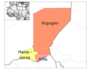
Diffa is a city and Urban Commune in the extreme southeast of Niger, near the border with Nigeria. It is the administrative seat of both Diffa Region, and the smaller Diffa Department. As of 2012, the commune had a total population of 56,437 people.

Diffa Department
Department in Diffa Region, Niger
Distance: Approx. 25 meters
Latitude and longitude: 13.31527778,12.61111111
Diffa is a department of the Diffa Region in the extreme southeast of Niger. It is bordered by Chad to the east. Its capital lies at the city of Diffa.
Diffa Airport
Airport in Diffa, Niger
Distance: Approx. 6497 meters
Latitude and longitude: 13.37222222,12.625
Diffa Airport (ICAO: DRZF) is an airport serving Diffa, a town in the extreme southeast of Niger, near the border with Nigeria. The airport is in the desert 6 kilometres (3.7 mi) north of Diffa. The runway has an additional 800 metres (2,600 ft) unpaved overrun on the east end.
Weather in this IP's area
clear sky
26 Celsius
25 Celsius
26 Celsius
26 Celsius
1012 hPa
18 %
1012 hPa
977 hPa
10000 meters
3.81 m/s
4.1 m/s
54 degree
2 %