154.46.174.40 - IP Lookup: Free IP Address Lookup, Postal Code Lookup, IP Location Lookup, IP ASN, Public IP
Country:
Region:
City:
Location:
Time Zone:
Postal Code:
ISP:
ASN:
language:
User-Agent:
Proxy IP:
Blacklist:
IP information under different IP Channel
ip-api
Country
Region
City
ASN
Time Zone
ISP
Blacklist
Proxy
Latitude
Longitude
Postal
Route
db-ip
Country
Region
City
ASN
Time Zone
ISP
Blacklist
Proxy
Latitude
Longitude
Postal
Route
IPinfo
Country
Region
City
ASN
Time Zone
ISP
Blacklist
Proxy
Latitude
Longitude
Postal
Route
IP2Location
154.46.174.40Country
Region
campania
City
manocalzati
Time Zone
Europe/Rome
ISP
Language
User-Agent
Latitude
Longitude
Postal
ipdata
Country
Region
City
ASN
Time Zone
ISP
Blacklist
Proxy
Latitude
Longitude
Postal
Route
Popular places and events near this IP address

Atripalda
Comune in Campania, Italy
Distance: Approx. 3439 meters
Latitude and longitude: 40.91666667,14.82555556
Atripalda is a town and comune in the province of Avellino, Campania, southern Italy.

Parolise
Comune in Campania, Italy
Distance: Approx. 2974 meters
Latitude and longitude: 40.93333333,14.88333333
Parolise (Irpino: Parulìsë) is a village and comune of the province of Avellino in the Campania region of southern Italy.
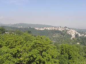
Manocalzati
Comune in Campania, Italy
Distance: Approx. 123 meters
Latitude and longitude: 40.9425,14.85055556
Manocalzati (Irpino: Manëcaozàti) is a town and comune in the province of Avellino, Campania, Southern Italy. The area produces chestnuts, nuts and grapes.
Montefalcione
Comune in Campania, Italy
Distance: Approx. 3753 meters
Latitude and longitude: 40.9625,14.88472222
Montefalcione (Irpino: Mundëfaucionë) is a town and comune of the province of Avellino in the Campania region of southern Italy. The town lies on a hill which at its summit is 523 metres (1,716 ft) above sea level. In 1861 it was the location of a revolt against the newly formed government of Italy.
Montefredane
Comune in Campania, Italy
Distance: Approx. 3937 meters
Latitude and longitude: 40.96666667,14.81666667
Montefredane is a comune in the province of Avellino, Campania, southern Italy.
Prata di Principato Ultra
Comune in Campania, Italy
Distance: Approx. 4845 meters
Latitude and longitude: 40.98333333,14.83333333
Prata di Principato Ultra is a town and comune of the province of Avellino in the Campania region of southern Italy. The town spread along a hill on the left shore of the Sabato river. The place is mentioned for the first time in a historical document in 1070.

Pratola Serra
Comune in Campania, Italy
Distance: Approx. 4646 meters
Latitude and longitude: 40.98333333,14.85
Pratola Serra is a town and comune in the province of Avellino, Campania, Italy. The area of the comune spread on the right bank of the Sabato river. The oldest part of the comune is the village of Serra di Pratola that lie on a hill overlooking the Sabato river valley.

Salza Irpina
Comune in Campania, Italy
Distance: Approx. 3963 meters
Latitude and longitude: 40.91666667,14.88333333
Salza Irpina (Campanian: Sàoza) is a town and comune in the province of Avellino, Campania, southern Italy.
San Potito Ultra
Comune in Campania, Italy
Distance: Approx. 1698 meters
Latitude and longitude: 40.93333333,14.86666667
San Potito Ultra is a town and comune in the province of Avellino, Campania, Italy.
Sorbo Serpico
Comune in Campania, Italy
Distance: Approx. 3963 meters
Latitude and longitude: 40.91666667,14.88333333
Sorbo Serpico is a town and comune in the province of Avellino, Campania, southern Italy. Three villages with the name Sorbo are Sorbo-Ocagnano on the island of Corsica, Sorbo Serpico in the region of Campania, and Sorbo San Basile in the region of Calabria.

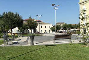
Avellino railway station
Railway station in Italy
Distance: Approx. 3333 meters
Latitude and longitude: 40.9214,14.82045
Avellino is the main railway station of the Italian city of Avellino, in the region of Campania. It is owned by the Ferrovie dello Stato, the national rail company of Italy, and is classified Silver.

Mastroberardino
Winery in Atripalda
Distance: Approx. 2648 meters
Latitude and longitude: 40.9232693,14.8296283
Mastroberardino is an Italian winery located in Atripalda, in the province of Avellino, in the Campania region of Italy. Founded in 1878, the winery is known for its production of Taurasi DOCG as well as its ampelography work in identifying and preserving ancient grape varieties like Greco and Fiano. The work of the Mastroberardino family, particularly Antonio Mastroberardino, in this field is widely respected and Antonio is often called "The Grape Archaeologist".
Weather in this IP's area
overcast clouds
12 Celsius
12 Celsius
12 Celsius
12 Celsius
1021 hPa
99 %
1021 hPa
959 hPa
10000 meters
3.36 m/s
4.7 m/s
215 degree
88 %

