154.219.212.114 - IP Lookup: Free IP Address Lookup, Postal Code Lookup, IP Location Lookup, IP ASN, Public IP
Country:
Region:
City:
Location:
Time Zone:
Postal Code:
IP information under different IP Channel
ip-api
Country
Region
City
ASN
Time Zone
ISP
Blacklist
Proxy
Latitude
Longitude
Postal
Route
Luminati
Country
Region
bcn
City
tijuana
ASN
Time Zone
America/Tijuana
ISP
Ivanov Vitaliy Sergeevich
Latitude
Longitude
Postal
IPinfo
Country
Region
City
ASN
Time Zone
ISP
Blacklist
Proxy
Latitude
Longitude
Postal
Route
IP2Location
154.219.212.114Country
Region
baja california
City
tijuana
Time Zone
America/Tijuana
ISP
Language
User-Agent
Latitude
Longitude
Postal
db-ip
Country
Region
City
ASN
Time Zone
ISP
Blacklist
Proxy
Latitude
Longitude
Postal
Route
ipdata
Country
Region
City
ASN
Time Zone
ISP
Blacklist
Proxy
Latitude
Longitude
Postal
Route
Popular places and events near this IP address

Tijuana
City in Baja California, Mexico
Distance: Approx. 1814 meters
Latitude and longitude: 32.525,-117.03333333
Tijuana is the most populous city in the state of Baja California, located on the northwestern Pacific Coast of Mexico. Tijuana is the municipal seat of the Tijuana Municipality and the hub of the Tijuana metropolitan area. It has a close proximity to the Mexico–United States border, which is part of the San Diego–Tijuana metro area.

San Diego–Tijuana
Transborder agglomeration of the Californias
Distance: Approx. 1565 meters
Latitude and longitude: 32.54218611,-117.02961944
San Diego–Tijuana is an international transborder agglomeration, straddling the border of the adjacent North American coastal cities of San Diego, California, United States, and Tijuana, Baja California, Mexico. The 2020 population of the region was 5,456,577, making it the largest bi-national conurbation shared between the United States and Mexico, and the second-largest shared between the US and another country. The conurbation consists of San Diego County, (2020 population 3,298,634) in the United States and the municipalities of Tijuana (2020 pop.

Zona Río
Neighborhood of Tijuana in Baja California, Mexico
Distance: Approx. 277 meters
Latitude and longitude: 32.530939,-117.017616
Zona Río (English: "River Zone") is an official zone, and the main modern business district, of the city of Tijuana, Mexico. Zona Río is located at a strategic point, in the north of the city, about 1 mile (1.6 km) from the U.S.-Mexico border and 9 miles (14 km) from downtown San Diego. The Río Zone is within the Delegación Centro, or Central borough, of Tijuana.

Tijuana Cultural Center
Cultural center in Tijuana, Mexico
Distance: Approx. 768 meters
Latitude and longitude: 32.53,-117.02388889
The Tijuana Cultural Center (CECUT) is a cultural center in the Zona Río district of Tijuana, Mexico. The center opened 20 October 1982, and accommodates more than a million visitors per year. Nowadays this iconic Tijuana institution has different programs for all ages, from classes for early stimulation for kids around 2 months and 2 years old, plastic arts and artisan workshops for children from 5 to 15 years old, and concerts, conferences, movies, documentaries, exhibitions, and services designed to entertain while educating different age groups at the same time.

San Ysidro Transit Center
San Diego Trolley station
Distance: Approx. 1742 meters
Latitude and longitude: 32.54443,-117.02975
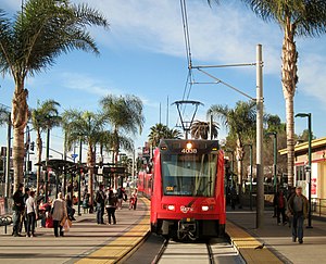
San Ysidro Transit Center is a San Diego Trolley station in the San Ysidro neighborhood of San Diego, California. The station is the southern terminus of the Blue Line and is located on a short rail spur off the San Diego and Arizona Eastern Railway main line which hosts the Blue Line to downtown San Diego. Located just north of the San Ysidro Port of Entry at the Mexico–United States border, San Ysidro serves primarily as a way to provide transportation for the thousands of international commuters and tourists who travel between San Diego County and Tijuana, Mexico.

Centro Médico Excel
Mixed-use: Medical center, Office in Zona Rio, Tijuana
Distance: Approx. 1437 meters
Latitude and longitude: 32.52111111,-117.01166667
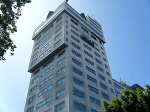
Centro Médico Excel (Excel Medical Center), or Hospital Excel (Excel Hospital) is a mixed-use skyscraper in Tijuana, Mexico. One of the prominent buildings in the city, it is the 11th tallest building in Tijuana. It is located within Zona Río, the central business district of Tijuana.

San Ysidro Port of Entry
Border crossing between Mexico and the U.S.
Distance: Approx. 1656 meters
Latitude and longitude: 32.54333333,-117.02972222
The San Ysidro Port of Entry (aka the San Ysidro Land Port of Entry or the San Ysidro LPOE) is the largest land border crossing between San Diego and Tijuana, and the fourth-busiest land border crossing in the world (second-busiest excluding the crossings between mainland China and its two special administrative regions) with 70,000 northbound vehicles and 20,000 northbound pedestrians crossing each day, in addition to southbound traffic. It connects Mexican Federal Highway 1 on the Mexican side with Interstate 5 on the American side. The San Ysidro Port of Entry is one of three ports of entry in the San Diego–Tijuana metropolitan region.

Plaza Río Tijuana
Shopping mall in Tijuana, Mexico
Distance: Approx. 621 meters
Latitude and longitude: 32.52833333,-117.01972222
Plaza Río Tijuana is an open-air shopping center in the Zona Río (new main business district) of Tijuana, Baja California, Mexico. It has a surface area of 792,000 square feet (73,579 m2). It opened in 1981 as the first large American-style mall in the city; previously downtown Tijuana was the leading shopping area.
United States Custom House (San Ysidro, California)
United States historic place
Distance: Approx. 1498 meters
Latitude and longitude: 32.5428,-117.028
The United States Custom House (also known as the Old Customs House) in San Ysidro, San Diego, California, is a 1933 Spanish Revival building located 50 feet (15 m) north of the Mexico–United States border at the San Ysidro Port of Entry. It is listed on the National Register of Historic Places with the full historic name U.S. Inspection Station/U.S. Custom House and common name U.S. Custom House.
Plaza Viva Tijuana
Open-air shopping center in Tijuana, Mexico
Distance: Approx. 1484 meters
Latitude and longitude: 32.53972222,-117.03055556
Plaza Viva Tijuana is an open-air shopping center in the Empleados Federales neighborhood of Tijuana, located immediately across Frontera Street from what was, until 2012, the entrance to Mexico for all pedestrians crossing from the U.S. side of the San Ysidro of the Mexico–United States border. It houses numerous pharmacies targeted at U.S. customers, handicraft and souvenir shops, restaurants, and one of Tijuana's largest gay nightclubs (formerly "Éxtasis" now "Club Fusion"). In 2012, the Puerta México pedestrian crossing on the west side of the southbound vehicular crossing, controversially, closed, replaced by the new Puerta México Este pedestrian entry to Mexico on the east side.
Tijuana station
Former passenger rail station and current freight rail station in Tijuana, Mexico
Distance: Approx. 1328 meters
Latitude and longitude: 32.542105,-117.026245
Tijuana station (Spanish: Estación de Tijuana) is a former passenger rail station and current freight rail station located in Tijuana, Baja California.
Tecate railway station
Railway station in Tecate, Mexico
Distance: Approx. 1328 meters
Latitude and longitude: 32.542105,-117.026245
Tecate station (Spanish: Estación de Tecate) was a train station in Tecate, Baja California. The Building has an influence on the architectural style of the first stage of American Frank Lloyd Wright. The station had a waiting room, cellar and office on the ground floor.
Weather in this IP's area
haze
11 Celsius
10 Celsius
11 Celsius
11 Celsius
1022 hPa
76 %
1022 hPa
1006 hPa
8047 meters
2.06 m/s
110 degree

