154.161.109.226 - IP Lookup: Free IP Address Lookup, Postal Code Lookup, IP Location Lookup, IP ASN, Public IP
Country:
Region:
City:
Location:
Time Zone:
Postal Code:
ISP:
ASN:
language:
User-Agent:
Proxy IP:
Blacklist:
IP information under different IP Channel
ip-api
Country
Region
City
ASN
Time Zone
ISP
Blacklist
Proxy
Latitude
Longitude
Postal
Route
db-ip
Country
Region
City
ASN
Time Zone
ISP
Blacklist
Proxy
Latitude
Longitude
Postal
Route
IPinfo
Country
Region
City
ASN
Time Zone
ISP
Blacklist
Proxy
Latitude
Longitude
Postal
Route
IP2Location
154.161.109.226Country
Region
volta
City
ho
Time Zone
Africa/Accra
ISP
Language
User-Agent
Latitude
Longitude
Postal
ipdata
Country
Region
City
ASN
Time Zone
ISP
Blacklist
Proxy
Latitude
Longitude
Postal
Route
Popular places and events near this IP address
Ho, Ghana
City in Volta Region, Ghana
Distance: Approx. 1328 meters
Latitude and longitude: 6.61138889,0.47027778
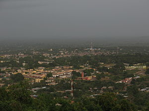
Ho is the capital of the Ho Municipal District and the Volta Region of Ghana. The city lies between Mount Adaklu and Mount Galenukui or Togo Atakora Range, and is home to the Volta Regional Museum, a cathedral, and a prison. The city is the capital of unrecognised Western Togoland.
Roman Catholic Diocese of Ho
Roman Catholic diocese in Ghana
Distance: Approx. 1342 meters
Latitude and longitude: 6.6118,0.4692
The Roman Catholic Diocese of Ho (Latin: Hoën(sis)) is a diocese located in the city of Ho in the ecclesiastical province of Accra in Ghana.

Volta Regional Museum
Ethnographic museum in Ho, Ghana
Distance: Approx. 989 meters
Latitude and longitude: 6.608611,0.468889
The Volta Regional Museum is a museum in Ho, Ghana. The museum is dedicated to the history and traditions of the Volta Region. The museum is administered by the Ghana Museums and Monuments Board.
Ho Sports Stadium
Sports venue in Ho, Ghana
Distance: Approx. 203 meters
Latitude and longitude: 6.6018,0.4664
Ho Sports Stadium is a stadium in Ho, Ghana.
Evangelical Presbyterian University College
Distance: Approx. 1135 meters
Latitude and longitude: 6.60945815,0.47053687
The Evangelical Presbyterian University College was established in 2008 by the Evangelical Presbyterian Church, Ghana.

Ho Technical University
Public technical university school in Ho, Ghana
Distance: Approx. 1066 meters
Latitude and longitude: 6.59069444,0.46897222
Ho Technical University, formerly Ho Polytechnic, is a public tertiary institution in the Volta Region of Ghana. The Polytechnic started in 1968 as a technical institute with the primary goal of providing pre-technical education. By 1972, the Institute made tremendous progress and upgraded its courses.
Ho Nurses' Training College
Distance: Approx. 1338 meters
Latitude and longitude: 6.5998,0.4788
The Ho Nurses' Training College is a public tertiary health institution in Ho in the Volta Region of Ghana. The college is in the Ho Metropolitan Assembly. The activities of the institution is supervised by the Ministry of Education.
Ho Teaching Hospital
Hospital in Volta, Ghana
Distance: Approx. 1923 meters
Latitude and longitude: 6.60126,0.48404
Ho Teaching Hospital formerly Volta Regional Hospital and popularly known as Trafalgar is the regional and teaching hospital in Ho in the Volta Region of Ghana. It was the main referral facility in the Volta Region until it was upgraded to a teaching hospital in 2019 to serve the University of Health and Allied Sciences. It was commissioned as a Teaching Hospital by the Minister of Health, Hon.

University of Health and Allied Sciences
Public university in Ho, Ghana
Distance: Approx. 1076 meters
Latitude and longitude: 6.603266,0.475854
The University of Health and Allied Sciences (UHAS) is a public university located at Ho in the Volta Region of Ghana. UHAS is one of the youngest public universities in Ghana. Its operation started in September 2012, when the first batch of 154 students were admitted.

Mawuli School
Public boarding school in Ho, Volta Region, Ghana
Distance: Approx. 1006 meters
Latitude and longitude: 6.5977,0.4755
Mawuli School is a co-educational, boarding senior high school located in Ho in the Ho Municipal district in the Volta Region of Ghana.

Ho Municipal Assembly
Municipal Assembly in Ghana
Distance: Approx. 1387 meters
Latitude and longitude: 6.61194444,0.47027778
Ho Municipal Assembly is one of the 25 administrative Districts in the Volta Region, Ghana. It is made up of total land size of 2,361 km2 and a total estimated population of 213,960 in 2017, 105,195 being males and 108,765 are females. Originally created as an ordinary district assembly on 10 March 1989 when it was known as Ho District, until the southern part of the district was split off by a decree of president John Agyekum Kufuor on 13 August 2004 to create Adaklu-Anyigbe District; thus the remaining part has been retained as Ho District.
Mawuko Girls Senior High School
Public secondary/high school in Ghana
Distance: Approx. 767 meters
Latitude and longitude: 6.5958664,0.4722528
E.P.C Mawuko Girls' High school, Ghana, is an educational institution for girls founded by the late Reverend Professor Noah Komla Dzobo of the Evangelical Presbyterian Church, Ghana.
Weather in this IP's area
clear sky
30 Celsius
29 Celsius
30 Celsius
30 Celsius
1009 hPa
37 %
1009 hPa
991 hPa
10000 meters
2.46 m/s
2.63 m/s
134 degree
7 %
