154.161.105.150 - IP Lookup: Free IP Address Lookup, Postal Code Lookup, IP Location Lookup, IP ASN, Public IP
Country:
Region:
City:
Location:
Time Zone:
Postal Code:
ISP:
ASN:
language:
User-Agent:
Proxy IP:
Blacklist:
IP information under different IP Channel
ip-api
Country
Region
City
ASN
Time Zone
ISP
Blacklist
Proxy
Latitude
Longitude
Postal
Route
db-ip
Country
Region
City
ASN
Time Zone
ISP
Blacklist
Proxy
Latitude
Longitude
Postal
Route
IPinfo
Country
Region
City
ASN
Time Zone
ISP
Blacklist
Proxy
Latitude
Longitude
Postal
Route
IP2Location
154.161.105.150Country
Region
ashanti
City
bekwai
Time Zone
Africa/Accra
ISP
Language
User-Agent
Latitude
Longitude
Postal
ipdata
Country
Region
City
ASN
Time Zone
ISP
Blacklist
Proxy
Latitude
Longitude
Postal
Route
Popular places and events near this IP address
Bekwai
Town in Ashanti Region, Ghana
Distance: Approx. 718 meters
Latitude and longitude: 6.45361111,-1.58388889
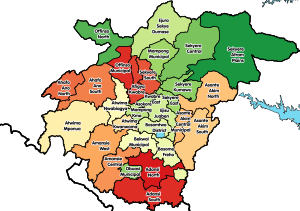
Bekwai ( ) is a town and the capital of the Bekwai Municipal, a municipality in the Ashanti Region of Ghana. Bekwai is the seventy-ninth most populous settlement in Ghana, with a population of 7,267 people as of 2013. Bekwai and Bekwai Municipal are south of Kumasi and north of Obuasi.

Bekwai Municipal Assembly
Municipal District in Ashanti, Ghana
Distance: Approx. 541 meters
Latitude and longitude: 6.44865556,-1.57635
Bekwai Municipal Assembly is one of the forty-three districts in Ashanti Region, Ghana. Originally created as an ordinary district assembly in 1988 when it was known as Amansie East District, which was created from the former Amansie District Council. Later, the western part of the district was split off by a decree of president John Agyekum Kufuor on 12 November 2003 (effectively 18 February 2004) to create Amansie Central District.

Asante Traditional Buildings
UNESCO World Heritage Site in Ghana
Distance: Approx. 7911 meters
Latitude and longitude: 6.40111111,-1.62583333
The Asante Traditional Buildings are a collection of 10 traditionally built buildings from the time of the Ashanti Empire in the area near Kumasi. These buildings served as fetish houses and shrines during the 18th and 19th centuries, during the golden age of the Ashanti Empire. When the empire fell during the British occupation of the area from 1806 to 1901, most Asante buildings of the period were destroyed during the era.
Kokofu
Town in Ashanti Region, Ghana
Distance: Approx. 7118 meters
Latitude and longitude: 6.5,-1.53333333
Kokofu is a town in the Bekwai Municipal district, a district in the Ashanti Region of Ghana.
Ahwiren
Place in Ashanti Region, Ghana
Distance: Approx. 8688 meters
Latitude and longitude: 6.46666667,-1.5
Ahwiren is a town in the Ashanti Region of Ghana. The town is known for the Saint Joseph Secondary/Technical School. The school is a second cycle institution.
Anwia-Nkwanta
Village in Ashanti Region, Ghana
Distance: Approx. 6361 meters
Latitude and longitude: 6.46666667,-1.63333333
Anwia-Nkwanta is a village in the Bekwai Municipal district, a district in the Ashanti Region of Ghana.
Weather in this IP's area
overcast clouds
38 Celsius
36 Celsius
38 Celsius
38 Celsius
1008 hPa
17 %
1008 hPa
983 hPa
10000 meters
1.46 m/s
3.23 m/s
8 degree
98 %