154.127.83.129 - IP Lookup: Free IP Address Lookup, Postal Code Lookup, IP Location Lookup, IP ASN, Public IP
Country:
Region:
City:
Location:
Time Zone:
Postal Code:
IP information under different IP Channel
ip-api
Country
Region
City
ASN
Time Zone
ISP
Blacklist
Proxy
Latitude
Longitude
Postal
Route
Luminati
Country
ASN
Time Zone
Africa/Niamey
ISP
SONITEL
Latitude
Longitude
Postal
IPinfo
Country
Region
City
ASN
Time Zone
ISP
Blacklist
Proxy
Latitude
Longitude
Postal
Route
IP2Location
154.127.83.129Country
Region
agadez
City
alaghsas
Time Zone
Africa/Niamey
ISP
Language
User-Agent
Latitude
Longitude
Postal
db-ip
Country
Region
City
ASN
Time Zone
ISP
Blacklist
Proxy
Latitude
Longitude
Postal
Route
ipdata
Country
Region
City
ASN
Time Zone
ISP
Blacklist
Proxy
Latitude
Longitude
Postal
Route
Popular places and events near this IP address

Agadez
City in Agadez Region, Niger
Distance: Approx. 5866 meters
Latitude and longitude: 16.97222222,7.99083333
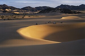
Agadez (Air Tamajeq: ⴰⴶⴰⴷⴰⵣ, Agadaz), formerly spelled Agadès, is the fifth largest city in Niger, with a population of 110,497 based on the 2012 census. The capital of the eponymous Agadez Region, the city lies in the Sahara desert, and is also the capital of Aïr, one of the traditional Tuareg–Berber federations.

Agadez Region
Region of Niger
Distance: Approx. 2744 meters
Latitude and longitude: 17,8
Agadez Region is one of the seven regions of Niger. At 667,799 square kilometres (257,839 sq mi), it covers more than half of Niger's land area, and is the largest region in the country, as well as the largest African state subdivision. The capital of the department is Agadez.

Mano Dayak International Airport
Airport in Agadez, Niger
Distance: Approx. 6130 meters
Latitude and longitude: 16.96599722,8.00011389
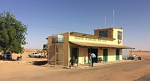
Mano Dayak International Airport (IATA: AJY, ICAO: DRZA) is an airport in Agadez in the Sahara desert in Niger. It is named after Mano Dayak, a Tuareg leader.

Agadez Mosque
Mosque in Agadez, Tchirozerine, Niger
Distance: Approx. 5807 meters
Latitude and longitude: 16.97416667,7.98838889
Agadez Mosque (French: Mosquée d'Agadez) is a prominent mosque in Agadez, Tchirozerine Department, Niger. It was made of clay and is the tallest mud-brick structure in the world. The Agadez mosque is the most prominent religious center located in the central part of the Republic of the Niger, and has been a place of worship for centuries.
Agadez and Arlit attacks
Attacks by Islamists in Niger, 2013
Distance: Approx. 6799 meters
Latitude and longitude: 16.9667,7.9833
On 23 May 2013, two coordinated attacks perpetrated by Islamist affiliates targeted the two Niger towns of Agadez and Arlit, the first being a military base the other a French-owned and operated uranium mine. In the first attack on the Niger military base, in which eight attackers participated, 23 soldiers and a civilian were confirmed dead by the next day. The second attack by two suicide bombers also claimed a worker at the mine.

Niger Air Base 201
American drone airbase near Agadez
Distance: Approx. 7623 meters
Latitude and longitude: 16.95027778,8.01388889
Niger Air Base 201 (also known in some sources as "Nigerien Air Base 201") is a Nigerien airbase near Agadez, Niger. The base is about 5 km southeast of Agadez. It is owned by the Nigerien military but was built and paid for by the United States.

Historic Centre of Agadez
Distance: Approx. 5702 meters
Latitude and longitude: 16.97361111,7.99138889
The Historic Centre of Agadez is the historic district of the city of Agadez in Niger. It was listed as a UNESCO World Heritage Site in 2013.
Weather in this IP's area
dust
27 Celsius
26 Celsius
27 Celsius
27 Celsius
1014 hPa
16 %
1014 hPa
957 hPa
4000 meters
6.69 m/s
100 degree
100 %