Country:
Region:
City:
Latitude and Longitude:
Time Zone:
Postal Code:
IP information under different IP Channel
ip-api
Country
Region
City
ASN
Time Zone
ISP
Blacklist
Proxy
Latitude
Longitude
Postal
Route
Luminati
Country
Region
fs
City
bloemfontein
ASN
Time Zone
Africa/Johannesburg
ISP
TENET-1
Latitude
Longitude
Postal
IPinfo
Country
Region
City
ASN
Time Zone
ISP
Blacklist
Proxy
Latitude
Longitude
Postal
Route
db-ip
Country
Region
City
ASN
Time Zone
ISP
Blacklist
Proxy
Latitude
Longitude
Postal
Route
ipdata
Country
Region
City
ASN
Time Zone
ISP
Blacklist
Proxy
Latitude
Longitude
Postal
Route
Popular places and events near this IP address
Saint James Church massacre
1993 mass killing by militants in Kenilworth, Cape Town, South Africa
Distance: Approx. 1421 meters
Latitude and longitude: -33.992845,18.47697
The Saint James Church massacre was a massacre perpetrated on St James Church of England in South Africa in Kenilworth, Cape Town, South Africa, on 25 July 1993 by four members of the Azanian People's Liberation Army (APLA). Eleven members of the congregation were killed and 58 wounded. In 1998 the attackers were granted amnesty for their acts by the Truth and Reconciliation Commission.
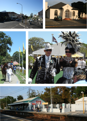
Wynberg, Cape Town
Place in Western Cape, South Africa
Distance: Approx. 258 meters
Latitude and longitude: -34.00416667,18.47027778
Wynberg ( WYNE-burg) is a southern suburb of the City of Cape Town in Western Cape, South Africa. It is situated between Plumstead and Kenilworth, and is a main transport hub for the Southern Suburbs of Cape Town.

Wynberg Boys' High School
Boys' school in Cape Town
Distance: Approx. 1111 meters
Latitude and longitude: -33.99638889,18.45888889
Wynberg Boys' High School is a public English medium boys high school situated in the suburb of Wynberg of Cape Town in the Western Cape province of South Africa. Founded in 1841, it is one of the best academic schools in Cape Town, it is believed by scholars and old boys to be the second oldest school in South Africa, however, there are several schools that were established at earlier dates as far back as 1738.
Wynberg Girls' High School
All-girls private school in Cape Town, South Africa
Distance: Approx. 363 meters
Latitude and longitude: -34.00277778,18.46388889
Wynberg Girls' High School is a public high school for girls situated in Wynberg, Cape Town in the Western Cape province of South Africa. Founded in 1886, Wynberg Girls' High School is one of the oldest all-girls schools in South Africa. The first headmistress, Miss Margaret Stewart, was supported by two teachers and catered to 27 pupils.

Kenilworth, Cape Town
Place in Western Cape, South Africa
Distance: Approx. 1047 meters
Latitude and longitude: -33.99583333,18.475
Kenilworth is a suburb in Cape Town, South Africa.

Maynardville Open-Air Theatre
Outdoor theatre in Cape Town, South Africa
Distance: Approx. 409 meters
Latitude and longitude: -34.00536,18.4643
The Maynardville Open-Air Theater is an outdoor theatre in Maynardville Park, Wynberg, Cape Town, South Africa. It seats 720 people and is known for its annual Shakespeare in the Park plays.
Wynberg Park
Park in Wynberg, Cape Town, South Africa
Distance: Approx. 1325 meters
Latitude and longitude: -34.001663,18.45355
Wynberg Park, formerly known as King Edward Park, is a park situated in the southern suburb of Wynberg, Cape Town, South Africa. The park has number of amenities including a children's playground, a duck pond, and multiple braai/barbecue areas. It was established by the Wynberg Mayor James Bisset, who obtained the land grant for it in the early 1890s.
Voortrekker High School (Cape Town)
School in Cape Town, Western Cape, South Africa
Distance: Approx. 562 meters
Latitude and longitude: -33.99933333,18.47186111
Voortrekker High School is a school in the Western Cape. The school first opened as an Afrikaans language school for white students in 1934 and was the first such school in the Southern Suburbs area of Cape Town. In 1992 the school was opened to students of all races and became a dual English and Afrikaans language school in 2003.
Wynberg Secondary School
Distance: Approx. 1512 meters
Latitude and longitude: -34.0132,18.47875
Wynberg Secondary School is a school in the Western Cape.

Michael Oak Waldorf School
School in Cape Town, Western Cape, South Africa
Distance: Approx. 923 meters
Latitude and longitude: -33.99652778,18.47388889
Michael Oak Waldorf School is a co-educational Waldorf school in Cape Town, Western Cape, South Africa. Founded in 1962, the school is divided into a pre-school, primary school and high school and offers playgroup through to Grade 12. Michael Oak Waldorf School is located in the suburb of Kenilworth and is a registered independent school.
Greenfield Girls' Primary School
School in Cape Town, Western Cape, South Africa
Distance: Approx. 1609 meters
Latitude and longitude: -33.98875,18.46986111
Greenfield Girls' Primary School is a public English medium primary school for girls in Cape Town, Western Cape, South Africa. Founded in 1956, the school was originally known as Claremont Girls’ Primary School but the name was changed later in the same year. Greenfield Girls' Primary School is located in the suburb of Kenilworth and is a quintile 5 fee paying school within the Western Cape Education Department's school system.
William Herbert Sports Ground
Cricket ground
Distance: Approx. 1519 meters
Latitude and longitude: -34.01031238,18.4817747
William Herbert Sports Ground is a cricket ground in Wynberg, Cape Town, a region of Western Cape province in South Africa. The ground was first used in 1879. It hosted two first-class matches of the Dadabhay Trophy from 1972 to 1974.
Weather in this IP's area
clear sky
17 Celsius
17 Celsius
15 Celsius
18 Celsius
1014 hPa
83 %
1014 hPa
1007 hPa
10000 meters
7.72 m/s
210 degree
05:34:07
19:27:39
