Country:
Region:
City:
Latitude and Longitude:
Time Zone:
Postal Code:
IP information under different IP Channel
ip-api
Country
Region
City
ASN
Time Zone
ISP
Blacklist
Proxy
Latitude
Longitude
Postal
Route
Luminati
Country
Region
mv
City
rockwitz
ASN
Time Zone
Europe/Berlin
ISP
e.discom Telekommunikation GmbH
Latitude
Longitude
Postal
IPinfo
Country
Region
City
ASN
Time Zone
ISP
Blacklist
Proxy
Latitude
Longitude
Postal
Route
db-ip
Country
Region
City
ASN
Time Zone
ISP
Blacklist
Proxy
Latitude
Longitude
Postal
Route
ipdata
Country
Region
City
ASN
Time Zone
ISP
Blacklist
Proxy
Latitude
Longitude
Postal
Route
Popular places and events near this IP address

Demmin (district)
District in Mecklenburg-Western Pomerania, Germany
Distance: Approx. 8254 meters
Latitude and longitude: 53.75,13
Demmin (German pronunciation: [dɛˈmiːn]) is a former Kreis (district) in Mecklenburg-Western Pomerania, Germany. It was bounded by (from the south and clockwise) the districts of Müritz, Güstrow, Nordvorpommern, Ostvorpommern and Mecklenburg-Strelitz.

Wildberg, Mecklenburg-Vorpommern
Municipality in Mecklenburg-Vorpommern, Germany
Distance: Approx. 6132 meters
Latitude and longitude: 53.65,13.11666667
Wildberg is a municipality in the Mecklenburgische Seenplatte district, in Mecklenburg-Vorpommern, Germany.

Altenhagen
Municipality in Mecklenburg-Vorpommern, Germany
Distance: Approx. 7080 meters
Latitude and longitude: 53.76666667,13.11666667
Altenhagen is a municipality in the Mecklenburgische Seenplatte district, in Mecklenburg-Vorpommern, Germany.
Gültz
Municipality in Mecklenburg-Vorpommern, Germany
Distance: Approx. 7588 meters
Latitude and longitude: 53.75,13.18333333
Gültz is a municipality in the Mecklenburgische Seenplatte district, in Mecklenburg-Vorpommern, Germany.
Knorrendorf
Municipality in Mecklenburg-Vorpommern, Germany
Distance: Approx. 8139 meters
Latitude and longitude: 53.63333333,13.06666667
Knorrendorf is a municipality in the Mecklenburgische Seenplatte district, in Mecklenburg-Vorpommern, Germany.

Kriesow
Municipality in Mecklenburg-Vorpommern, Germany
Distance: Approx. 4559 meters
Latitude and longitude: 53.73333333,13.05
Kriesow is a municipality in the Mecklenburgische Seenplatte district, in Mecklenburg-Vorpommern, Germany.

Pripsleben
German municipality in Mecklenburg-Vorpommern, Mecklenburgische Seenplatte district
Distance: Approx. 5777 meters
Latitude and longitude: 53.71666667,13.18333333
Pripsleben is a municipality in the Mecklenburgische Seenplatte district, in Mecklenburg-Vorpommern, Germany.

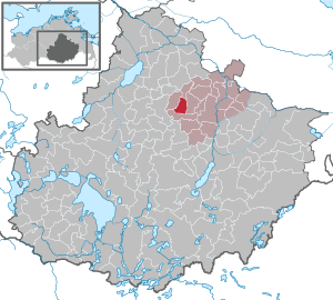
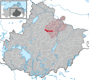
Röckwitz
Municipality in Mecklenburg-Vorpommern, Germany
Distance: Approx. 459 meters
Latitude and longitude: 53.7,13.1
Röckwitz is a municipality in the Mecklenburgische Seenplatte district, in Mecklenburg-Vorpommern, Germany.

Wolde
Municipality in Mecklenburg-Vorpommern, Germany
Distance: Approx. 2503 meters
Latitude and longitude: 53.68333333,13.08333333
Wolde is a municipality in the Mecklenburgische Seenplatte district, in Mecklenburg-Vorpommern, Germany.

Tützpatz
Municipality in Mecklenburg-Vorpommern, Germany
Distance: Approx. 4718 meters
Latitude and longitude: 53.73333333,13.15
Tützpatz is a municipality in the Mecklenburgische Seenplatte district, in Mecklenburg-Vorpommern, Germany.
Kastorfer See
Distance: Approx. 6005 meters
Latitude and longitude: 53.65027778,13.09
Kastorfer See is a lake in the Mecklenburgische Seenplatte district in Mecklenburg-Vorpommern, Germany. At an elevation of 45.3 m, its surface area is 0.64 km2.
Tüzer See
Distance: Approx. 4591 meters
Latitude and longitude: 53.72194444,13.03555556
Tüzer See is a lake in the Mecklenburgische Seenplatte district in Mecklenburg-Vorpommern, Germany. At an elevation of 51.5 m, its surface area is ca. 0.25 km2.
Weather in this IP's area
overcast clouds
5 Celsius
0 Celsius
5 Celsius
5 Celsius
1001 hPa
85 %
1001 hPa
992 hPa
10000 meters
7.09 m/s
12.78 m/s
255 degree
100 %
07:38:27
16:07:05

