Country:
Region:
City:
Latitude and Longitude:
Time Zone:
Postal Code:
IP information under different IP Channel
ip-api
Country
Region
City
ASN
Time Zone
ISP
Blacklist
Proxy
Latitude
Longitude
Postal
Route
Luminati
Country
Region
1
City
reykjavik
ASN
Time Zone
Atlantic/Reykjavik
ISP
Nova hf
Latitude
Longitude
Postal
IPinfo
Country
Region
City
ASN
Time Zone
ISP
Blacklist
Proxy
Latitude
Longitude
Postal
Route
db-ip
Country
Region
City
ASN
Time Zone
ISP
Blacklist
Proxy
Latitude
Longitude
Postal
Route
ipdata
Country
Region
City
ASN
Time Zone
ISP
Blacklist
Proxy
Latitude
Longitude
Postal
Route
Popular places and events near this IP address
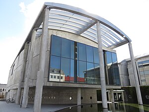
University of Iceland
Public research university in Reykjavík, Iceland
Distance: Approx. 348 meters
Latitude and longitude: 64.14055556,-21.94944444
The University of Iceland (Icelandic: Háskóli Íslands [ˈhauːˌskouːlɪ ˈistlan(t)s]) is a public research university in Reykjavík, Iceland, and the country's oldest and largest institution of higher education. Founded in 1911, it has grown steadily from a small civil servants' school to a modern comprehensive university, providing instruction for about 14,000 students in twenty-five faculties. Teaching and research is conducted in social sciences, humanities, law, medicine, natural sciences, engineering and teacher education.

Tjörnin
Lake in Reykjavík, Iceland
Distance: Approx. 202 meters
Latitude and longitude: 64.14444444,-21.9425
Tjörnin (Icelandic pronunciation: [ˈtʰjœ(r)tnɪn] ) is a small, prominent lake in central Reykjavík, the capital of Iceland. Most visitors to the city pass along its shore, as it is situated in the city centre next to the Reykjavik City Hall and several museums. Tjörnin means "the pond".
National and University Library of Iceland
National library of Iceland
Distance: Approx. 285 meters
Latitude and longitude: 64.14277778,-21.95055556
Landsbókasafn Íslands – Háskólabókasafn (Icelandic: [ˈlan(t)sˌpouːkaˌsapn ˈistlan(t)s – ˈhauːˌskouːlaˌpouːkaˌsapn̥]; English: The National and University Library of Iceland) is the national library of Iceland which also functions as the university library of the University of Iceland. The library was established on December 1, 1994, in Reykjavík, Iceland, with the merger of the former national library, Landsbókasafn Íslands (est. 1818), and the university library (formally est.

Reykjavík Town Hall
City hall for Reykjavík, Iceland
Distance: Approx. 348 meters
Latitude and longitude: 64.14583333,-21.94222222
Reykjavík's City Hall (Icelandic pronunciation: [ˈrauːðˌhuːs ˈreiːcaˌviːkʏr̥]; Icelandic: Ráðhús Reykjavíkur) is situated by the Tjörnin (City Pond) in Reykjavík. It houses the offices of the mayor of Reykjavík and a large 3D map of Iceland. The city hall is sometimes used for art exhibitions, functions or live music performances.

National Museum of Iceland
Museum in Reykjavik, Iceland
Distance: Approx. 195 meters
Latitude and longitude: 64.14194444,-21.94805556
The National Museum of Iceland (Icelandic: Þjóðminjasafn Íslands [ˈθjouðˌmɪnjaˌsapn ˈistlan(t)s]) was established on 24 February 1863, with Jón Árnason the first curator of the Icelandic collection, previously kept in Danish museums.

National Gallery of Iceland
National art museum in Reykjavík, Iceland
Distance: Approx. 297 meters
Latitude and longitude: 64.14411111,-21.93925
The National Gallery of Iceland (Icelandic: Listasafn Íslands [ˈlɪstaˌsapn ˈistlan(t)s]) is an art museum in Reykjavík which contains a collection of Icelandic art. The gallery features artwork of famous Icelandic artists and artwork that helps explain the traditional Icelandic culture.

University of Iceland Main Building
Distance: Approx. 348 meters
Latitude and longitude: 64.14055556,-21.94944444
The University of Iceland Main Building (Icelandic: Aðalbygging Háskóla Íslands [ˈaːðalˌpɪcciŋk ˈhauːˌskouːla ˈistlan(t)s]) is the central building of the University of Iceland campus on Suðurgata in Reykjavík, Iceland. It was designed by Icelandic state architect Guðjón Samúelsson and its construction was completed in 1940. Today, the building is one of the more noticeable landmarks in Reykjavík.

Gamli Garður
Distance: Approx. 197 meters
Latitude and longitude: 64.14131,-21.946504
Gamli Garður (lit. Old Dormitory) is a dormitory at Iceland's Háskóli Íslands (University of Iceland), first opened in 1934. It is Iceland's oldest residence hall and the oldest building still standing on campus.
Fríkirkjan í Reykjavík
Church in Reykjavík, Iceland
Distance: Approx. 309 meters
Latitude and longitude: 64.14431667,-21.93923056
The Fríkirkjan í Reykjavík (English: The Free Church in Reykjavik) is a Lutheran church independent from the Church of Iceland, the established church of Iceland. It lies in the centre of the Icelandic capital, by the lake Tjörnin. The Fríkirkjan í Reykjavík congregation was established in Reykjavík in the autumn of 1899.
Embassy of the United Kingdom, Reykjavík
Diplomatic mission
Distance: Approx. 364 meters
Latitude and longitude: 64.1428,-21.9372
The Embassy of the United Kingdom in Reykjavík is the chief diplomatic mission of the United Kingdom in Iceland. The embassy is located on Laufásvegur street in the Miðborg district of the city. Since the 1990s, the building has been shared with the German Embassy.
Reykjavik Women's Gymnasium
School in Reykjavík, Iceland
Distance: Approx. 298 meters
Latitude and longitude: 64.1439,-21.939
Reykjavik Women's Gymnasium (Icelandic: Kvennaskólinn í Reykjavík) was the first secondary school for women in Iceland. It was begun in 1874 by Þóra Melsteð and Páll Melsteð, as a private school. For the first four years the school was located in the home of the founders near the Parliament Building in the center of Reykjavík.
Embassy of Germany, Reykjavík
Diplomatic mission
Distance: Approx. 364 meters
Latitude and longitude: 64.1428,-21.9372
The Embassy of Germany in Reykjavík is the diplomatic mission of Germany in the Iceland. The embassy is located on Laufásvegur street in the Miðborg district of the city. Since the 1990s, the building has been shared with the British Embassy.
Weather in this IP's area
light intensity drizzle rain
10 Celsius
5 Celsius
9 Celsius
10 Celsius
1002 hPa
83 %
1002 hPa
1000 hPa
7000 meters
12.86 m/s
210 degree
100 %
09:54:22
16:30:23


